Tag: Weaving

Andean Civilizations: A Map of a Different Color
Andean Civilizations: A Map of a Different Color

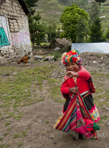
Off to the fields, Pumamarka (2011) Photo (c) Karen Abrahamson

When I think of maps I imagine back to when the first human made their first finger marks in mud to share a game trail, or a watering hole or an especially good berry bush. Surely that must have been the earliest form of map. Of course none of those primeval drawings exist, and so I’ve found myself writing a about the western development of maps over the ages and have tried to give a sense of the European tradition and the contributions of Arab and Chinese explorers and cartographers. This is the easy stuff to research and write about because the maps these cultures used were set down in a manner we are trained to see. Maps, to most of us, are a visual representation, usually on a flat medium like paper, that presents the relationship of one place to another. But other cultures have had other ways of presenting their landscapes, case in point are the great civilizations of the South American Andes.

What most of us think of as the Inca are actually a series of overlapping civilizations that rose and fell in the various livable areas of Peru, Bolivia, Ecuador, Columbia and Chile. After the very effective conquest of South American by the Spanish, not much remains of any Inca records and to date no maps (as we define them) have ever been found. But did these cultures simply not have maps or did they represent their landscapes in a different way?

Anthropologists and Cartographers say that formal mapmaking tends to occur within highly organized, bureaucratic societies as a form of discourse. The conditions necessary for mapmaking include: demands for agriculture, private property, long distance trade, militarism, and tribute relationships, amongst others, all of which are attributes of the various Andean societies.
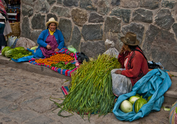
Women at Ollantaytambo market (2011) Photo (c) Karen Abrahamson

Anthropologists studying the various ancient cultures have begun to realize that westerners probably won’t recognize Andean maps until we start to see them through Andean eyes. The structure of maps aren’t only determined by geography, but also by social organization, cultural conventions and human perception. In the Inca worldview, the cosmos was built on a quartered circle, based on the way they viewed the Milky Way divide the heavens. They viewed their world that way as well, with the lands they ruled broken into four distinct quarters.

The Inca also had to map unusual terrain, from the coastal deserts and river oasis, up through the highlands to the alte-plano and Andes mountains and down again into the Amazon basin. Trade and tribute came those long distances, and north and south from Ecuador to Chile. Over those distict terrains there were distinctions of crop and animals at each of the different elevations. So, for an ancient Andean, among the things they needed to represent, were the different elevations, the different foods, and the waters that made life possible across these sometimes inhospitable terrains, as well as capturing the four quarters of the world and social relations.
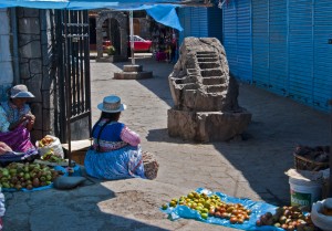
Market Scene, Chivay. Note the Inca rock that shows terracing and irrigation techniques. (2011) Photo (c) Karen Abrahamson

The resulting landscape representations convey things like ownership and elevation. Ancient weavings show the long narrow fields of produce separated by clan-assigned canals. Pottery shows spatial designs that encode critical social structures, and still other sculptures, such as Chieftain Vessels correspond to Andean landscapes with the head of the figure as the summit, the shoulders as central mountain slopes, the lower hips as the coastal plains where mountain rivers diverge on fields. Still other sculptures show realistic representations of the terraced fields and irrigation systems that make up areas of central highland valleys.

So while we might say the Inca made no maps, it doesn’t mean that they didn’t represent their landscape. The difference is that the Inca ‘maps’ were often three dimensional and layered with meaning, both in terms of the landscape, ownership and familial relationships, and the relationship of the landscape to their ancestors, the spirits and the cosmos.


Laid back in Ollantaytambo

Laid back in Ollantaytambo

Ollantaytambo sits in the Sacred Valley, northwest of Cuzco and is known for its ruins and its train station. You see this is the place most travelers to Machu Picchu go through, climbing on the train that will take them to Aguas Calientes and the bus to the famous ruins. It’s the place that the Camino Inca treks often stop for breakfast before hitting the trails into the mountains. I came here because it was (supposed to be) a quiet little town and because I am determined to go back to Machu Picchu and see the place as I didn’t see it before.

The town of Ollanta (as it is known to the locals) is apparently the best surviving example of Inca town planning available today.

Women at Ollantaytambo market (2011) Photo (c) Karen Abrahamson

Leave the Plaza de Armas and turn towards the ruins on the mountain, and the streets are narrow, cobbled and have irrigation channels running down the sides. Stone walls are crowned with cactus in a traditional alternative to barbed wire and broken glass and each house sports twin bulls on their ridgepole – the result of the Spanish saying a bull was more appropriate than the Inca symbol of the ‘puma’.

You can tell this town wasn’t built in this century by the way the traffic congests every time more than two cars get on the road together. Now picture a town converged on by tour busses, taxis, moto-taxis and the occasional semi, all trying to squeeze across a single-lane bridge and I swear entertainment in Ollanta is sitting under the lone tree in the Plaza and watching the mess reconfigure itself again and again in a kaleidoscope of vehicles.

Unfortunately I didn’t get to see as much of the town as I would have liked, because both my ankles are still crippled from the Machu Picchu hike, but I did try to get out daily and finagled my way along (between naps – hey, recovering here) as the lone tourist with a local association devoted to preserving the weaving arts in small villages up in the mountains.

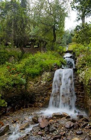
Irrigation waterfall along the mountain road, Ollantatambo, (2011) Photo (c) Karen Abrahamson

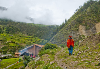
We drove out in the morning, heading up a dirt road that stretched back into the mountains. The road rose, switching back and forth across the mountain sides following a small rushing river, the Patacancha, that was joined by innumerable glacier-fed torrents that foamed down the mountainsides. Green Inca terraces, some the longest in Peru, an old stucco church with thatch roof that I was told is one of the oldest in South America. There were donkeys and pigs and sheep and trains of pack horses headed up the mountain and views of people harvesting their papa (potatoes) laboriously by hand.

Off to the fields, Pumamarka (2011) Photo (c) Karen Abrahamson

But best of all are the people. Not only are the people of Ollanta and environs friendly (they always have a smile, especially if you have one first), but this is a town where tradition has not yet been erased by globalization. Men and women both proudly wear their traditional clothing.

Nowhere was this more clear than in the small weaving town of Patacancha and the towns around it. As we drove in we could see the men in the school yard, bright orange and red clothing against the green.

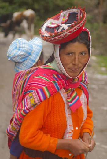
Woman near Pumamarka (2011) Photo (c) Karen Abrahamson

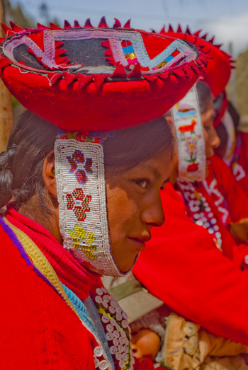
At the weaver’s cooperative, there were 36 women dressed proudly in their heavy skirts, hand-woven button-embellished jackets, and small hats held on by beaded chin straps. According to my informant, these villagers are not seeing their young men and women leave the village and that seemed the case looking at the ages of the women in the group.

So the coop bought the women’s weavings and I took photos while we sat on a hill side under thatched huts and blue skies with the sound of the wind in the eucalyptus and the river running. Taking it all in, I didn’t feel bad that I couldn’t walk much.

At the Weaving Coop (2011) Photo (c) Karen Abrahamson

Here in Ollanta, the culture and the past still lives and breathes and, if you sit quietly in the Plaza de Armas, both will pass you by – along with the traffic.

One of my new friends, waving goodbye (2011) Photo (c) Karen Abrahamson

Recent Fantasy

Available HERE,

$1.99

Available HERE,
$3.99

Available HERE $1.99


Recent Mystery


Available HERE
$4.99


Available HERE,

$4.99


Available HERE,

$4.99


Available HERE,
$4.99


Recent Romance

Available HERE, $2.99