Tag: Vancouver

Danger-Maps, Belief and New Madrid
Danger-Maps, Belief and New Madrid

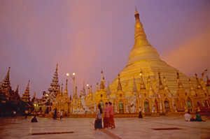
Schwedigon pagoda, Yangon, Myanmar
Schwedigon pagoda, Yangon, Myanmar (2000) Photo (c) Karen Abrahamson

Most of the maps I’ve written about over the past year have been maps setting out the geographic formations of the world—regardless of how skewed the map-maker might have made the map in order to influence the beliefs of others. But some maps are made to represent truth and to save populations from dangers, so today we’re going to look at a specific type of map—those used to convey earthquake danger. I’ve been researching this because it relates specifically to the current novel I am writing called Aftershock.

Most of us are familiar with California’s San Andreas fault, the 800 mile long fault that stretches northwest-southeast in California and that brings Los Angeles (west of the fault) two inches closer to San Francisco (east of the fault) each year. This much-talked about fault line has been the subject of disaster movies and books, and also of reams of geological research. The damage caused by the fault’s quakes led the State of California to have the San Andreas and other surface faults mapped and to require disclosure of proximity to fault lines in any residential real estate dealings in the state. The trouble is, that even though these maps are available, most people – even those who have lived in proximity to a faults line seem uninformed about the dangers and new buyers of homes are positively unaware of their proximity to faults even though they sign disclosures in their ‘offer to purchase’ agreements. Why? Because maps and the language around them can either be used to convey danger or to minimize it. In the case of the California real estate disclosures they say that the house is in the San Andreas zone, but they don’t specifically use the language ‘earthquake fault zone’.
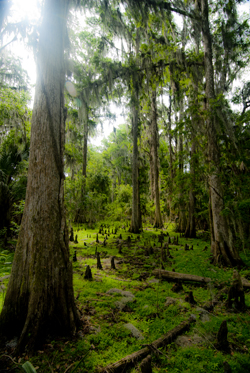
Cypress knees and trees, Orlando (2012) Photo (c) Karean Abrahamson

Another example or earthquake danger maps, and one dear to my heart (given I live on the south coast of British Columbia, Canada), are the ones that show the Ring of Fire around the Pacific Ocean basin. Nothing brings home the dangerousness of the place I live as seeing the numerous dots presenting quakes over 4.0 magnitude in recent history around the Pacific. You see, there are so many dots that a thick black line extends around virtually all of the Pacific except for the stretch bordering the Antarctic and a small section of North America – the part of the coast where I live. Okay, so there hasn’t been a moderately sized quake here in the past 20-30 years (yes, Seattle has had one, but not here, so far). In fact there hasn’t been a really big one here in a heck of a lot longer than that. But historical evidence and that ring of dots around the ocean says that there’s a very good chance one will happen one of these days. Around here we grow up being told to be earthquake prepared. Are we? Given the number of schools that haven’t been seismically upgraded, I’d say ‘no’, even though the maps are there to show us the danger.

So why do we refuse to listen to the maps? A likely answer lays in another part of America. Right in the heartland of the U.S., where Missouri, Tennessee, Arkansas and Kentucky meet, in 1811/12 near the small community of New Madrid, a series of massive earthquakes (magnitude 7.5 and 8) wiped out entire fledgling towns, sent sand and water geysering into the air and lifted huge chunks of the landscape. The only thing that stopped huge loss of life was the fact that few people lived there.

Research into the quake says this type of quake will happen again. The trouble is the quake zone isn’t at the edge of a tectonic plate and there isn’t something like really a visible fault line to show where the quake will occur because these quakes occur far underground—that’s also why they are so devastating—and so life in the Midwest has mostly been focused on the danger of tornadoes, rather than the lurking danger right underfoot.
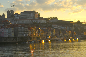
Sunrise over Porto, Portugal. (2005) Photo (c) Karen Abrahamson.

The trouble with this type of deep earthquake is that shockwaves travel farther and wreak more damage. In fact, geologists predict that such a quake today would be felt from Colorado to Washington D.C. and could wipe out most of the country’s central infrastructure.

As a result when, in 1990 a prominent inventor named Iben Browning predicted a major quake would occur in the New Madrid fault zone between December 1 and 5th of that year, the media promulgation of maps showing concentric areas of damage seriously impacting cities like St. Louis, Nashville, Birmingham, Little Rock, Jackson and Chicago started to get people taking the danger seriously. Children were kept home from school during the danger days. T.V. crews descended on the area like flies on road kill and everyone held their breath.

When nothing happened, of course finally people began to listen to the scientists who had previously laid out why the big one wasn’t likely to happen at that exact place and time. But the maps had done their damage. They’d laid out a ‘cartography of danger’ that hadn’t arisen. As a result, even though the states of Kentucky, Missouri, Arkansas and Tennessee try to prepare people for earthquakes because the risk of the big one still exists, they have an even more uphill battle than they do in California or here in the Pacific Northwest. You see, seeing a fault line on a map may not bring home the importance of believing, but when what you believe the danger presented on the map and then nothing happens, you’re less likely to believe in future danger.

So when the big one does hit, it will be Aftershock, indeed.
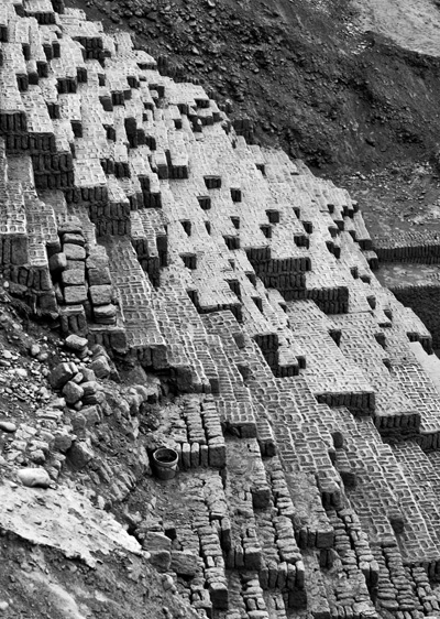
A pile of bricks is all that remains in earthquake-prone Peru. The ruins of Huaca Pucllana, Miraflores, Peru. (2011) Photo (c) Karen Abrahamson.


The Past, the Future and Map Wars

The Past, the Future and Map Wars

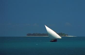
Dhow off Zanzibar Island (1994) Photo (c) Karen Abrahamson

I’ve written about how maps created belief systems in the people of old. In ancient days, stories and maps of Prestor John led people to Asia and Africa in search of his kingdom. Mariners believed that the Indian Ocean was a huge inland sea surrounded by Africa that swept down and around to join with Asia. When North America was discovered, maps of the mythical Northwest Passage, led explorers to seek the real passage. But maps do more than that. Maps are sources of propaganda and maps are sources of conflict. You see maps, their systems, omissions and scale (as examples) are often used to take forward propaganda or a dominant world view. They have been used this way close to home in Canada.

For example, for many years maps of Lake Superior were left largely blank, because people believed the lake was very deep. But the truth was that fishermen didn’t want their secret ‘fishing shoals’ mapped for others to find. It was only after military vessels went missing (not to mention the Edmund Fitzgerald) that in 1930 that the Canadian Hydrological survey confirmed that there is a mountain rising in the middle of Lake Superior creating a large shoal. This shoal had been known to American fishermen, but no one had ‘told’ because the area was a magnet for fish.

Recent visitors. (2012) Photo (c) Karen Abrahamson

Maps as propaganda were used extensively in the settling of Canada. The Dominion of Canada turned surveyors maps of soil and rivers into grid maps that were then artistically enhanced with pastoral images of farms and young golden-haired women clad in white dresses. Atlases of Canada were created and sent to Europe and America in hopes of encouraging immigration. The art was focused on meeting the pastoral desires of the Europeans and in particular the British. Slightly different art work was used for maps sent to America. It didn’t matter that the images didn’t reflect the prairie landscape (The images were more of Ontario). It was the dream of the pastoral lifestyle that drew the immigrants that Canada needed.

These same maps with their grid lines were sources of conflict because they established expectations about how people would inhabit the landscape. The grids were set out in sections six miles by six miles, based on latitude and longitude, regardless of the lakes or waterways they crossed. As I mentioned in a previous blog (here) the Metis found the grid pattern foreign because they settled land based on long strips of land that swept back from water courses and that allowed everyone access to water. But immigrant groups from Eastern Europe also had challenges with the grid pattern. They were familiar with more communal, village styles of land allotment, where the land was marked off from the village in a manner more appropriate to communal living. As a result these groups (the Mennonite, Doukhobors, and Hutterites) subverted the grid style by purchasing the land, but then subdividing it according to what worked for them.

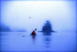
Kayaking the coast of British Columbia (1996) Photo (c) Karen Abrahamson

Maps were also used as propaganda by commercial entities such as the railroads. Canada’s two railways, Canadian Northern (CN) and Canadian Pacific Railway (CPR) battled for ridership through their maps. Maps were developed that left out or diminished the competitor’s railway. For example, CN created a triangle route map between Edmonton, Jasper National Park and Vancouver that played with scale. In this map CN’s journey through scenic Jasper was presented in large scale so that the route through Jasper leaves little room for any other details, while the rest of British Columbia was presented in small scale that didn’t allow CPR’s rail lines to even exist—according to the map. The interesting thing about this map is that no one then, or even today, notices the scale issues with the map—we accept what the map presents as reality.

So while maps are supposed to be presentations of reality, the big question the map reader has to ask themselves is whose reality (or wishful thinking) are they reading. Sometimes it is helpful to step back from the map and ask what does this map tell up about the people who developed (or paid for) it? Or what was going on at the time it was made? Or Why was this map even made? I think of my local community developers who, like the Dominion of Canada with their maps, are presenting the paved-over reality they would like to have made. The question is whether this is the map of the future we want, or whether, like the Mennonites, Hutterites and Doukhobors, we can  subvert it to a better reality.

Book 2 of the Terra Trilogy is now available!

Book 2 of the Terra Trilogy is now available!

I’m thrilled to announce that book two of the Terra Trilogy is now available in e-book and the print publication will be available in May.

In the years after the ‘Big One’ destroyed most of human civilization, a lone city perches precariously on the Pacific Northwest coast of North America.

When nomadic marauders attack the Independent city of Couver, seventeen-year-old Terra Vargas must choose: use her Cartos powers to protect her city, or rescue her mother from the marauders’ camp. But as her control over the earth power erodes, so does her ability to choose wisely.

Stay or go?

Either way, there will be a horrible price to pay.

Available on Amazon and at Smashwords and other fine e-tailers.


Spy Lands –Who really discovered the coasts of America

Spy Lands –Who really discovered the coasts of America

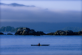
Kayaking the west coast of Vancouver Island, Photo (c) Karen Abrahamson

I mentioned last week about spies and maps and government subterfuge as aspects of maps that we rarely think about. Municipal governments still fool residents with streets on maps that are planned, but haven’t been built. Map makers take liberties with place names and add imaginary towns and streets that reflect their biases for and against university football teams. But in the past spies were frequently involved in cartographic subterfuge.

For instance, most of us were schooled that Captain Cook was the first European to lay eyes on the north western coast of North America. However there is mounting evidence that the English privateer (government sanctioned pirate) Sir Francis Drake, not Cook, first saw the coast of Oregon, Washington and British Columbia between 1577 and 1580 – 160 years before Cook’s journey.

Why isn’t this known?

First of all because some historians are hard pressed to let go of old ideas, but second of all because Drake’s journey was likely suppressed and evidence of it hidden, because of disputes with the Spanish that were, later, going to erupt into war. Drake is confirmed to have travelled as far north as Mendocino, California, the farthest north the Spanish had been, but a 412 year old map commemorating Drakes circumnavigation of the globe shows details of the coast of British Columbia that no one could have known unless they had been there. Additionally, archeological evidence – 1571 British coins and equipment – have been found in Oregon and Victoria, B.C. gardens, so that Drake is believed to have travelled as far north as Prince of Wales Island in Alaska. Finally, Drake’s cousin confessed under torture to the Spanish, that a fabled North Pacific island, Nova Albion, had been discovered by Drake and claimed for England 29 years before Samuel Champlain founded Quebec and before there was a Virginia on any map. This is believed to have been Vancouver Island, kept secret.

A further example of cartographic spies, deals with those icons, Christopher Columbus and John Cabot. Columbus, we’re taught, discovered the Americas while looking for China. Cabot’s fame is due to his first North American landfall by a European. Or at least that’s what we’re taught. But in a 1498 letter that was penned just months after Cabot’s historic return from Newfoundland, a spy in England wrote to Columbus and talked about earlier voyages by men from Bristol to the same place Cabot had been and that these earlier voyages had been to an “Island of Brasil” and that Cabot’s landfall “is believed to be the mainland that the men from Bristol found”. The spy’s letter also mentions that these voyages from Bristol were well known to Columbus – something that is further supported because Columbus had spent time in Bristol and Iceland in the 1470s – almost 20 years before he managed to convince the Spanish monarchy to fund his explorations. Did Columbus use this knowledge to convince Isabella? Did he use it to calm his crew on his long crossing?

We may never know, and even if we do, will it matter? For Columbus IS an icon that history won’t forget, but what this shows is how secrets and spies permeate the European history of maps, so that who really ‘discovered’ the coasts of America may never be known. Of course, just talk to a First Nations/Native American person and they’ll tell you we’ve got it all wrong anyway. North America had been ‘discovered’ long before any European left home.

Free Fiction — and apologies

Free Fiction — and apologies

I want to apologize for missing last week’s posting  of new chapters in Jaymee and David’s story, but a family emergency kept me away from the right material on my computer, I hope this week’s installment keeps you reading. Click here to read chapter 17 and 18.

Recent Fantasy

Available HERE,

$1.99

Available HERE,
$3.99

Available HERE $1.99


Recent Mystery


Available HERE
$4.99


Available HERE,

$4.99


Available HERE,

$4.99


Available HERE,
$4.99


Recent Romance

Available HERE, $2.99