Tag: road less travelled

Bhutan: How Gross National Happiness Made Me Cry

Bhutan: How Gross National Happiness Made Me Cry

Prayer flags at Gangtey. Photo copyright Karen Abrahamson.

Sometimes… sometimes this world can be so darned hard to be in—like reading about the death of the last male northern white rhino, or that 18 of the Tigers ‘rescued’ from a Thai temple ended up dying. And then there’s the whole darn political situation where nobody seems to speak the whole truth.

But other times the world can be such a giving place that it overwhelms. That was my experience in Bhutan.

As I mentioned in a prior post, Bhutan is a Buddhist country. It isn’t a big country. It isn’t particularly modern in the way places like London, New York, or even Bangkok might be, but it’s a country that seems to understand the concept of ‘enough’. It might not be a wealthy country (up until this year it’s biggest source of revenue was tourism), but the government has decided not to rate the well-being of the country not on gross domestic product (in other words, how much does the country produce or earn each year), but instead they assess the country on Gross Domestic Happiness.
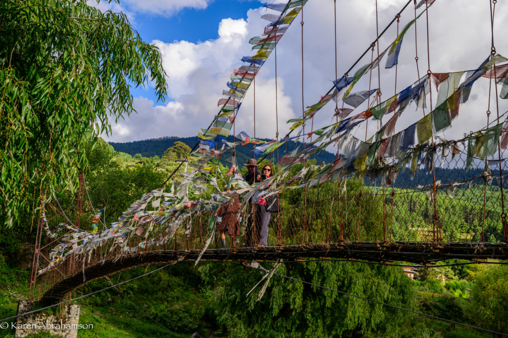
A local suspension bridge adorned with flags and a couple of photographers in the Tang Valley. Photo copyright Karen Abrahamson.

I’m not quite sure how they measure this apparently quite ‘ephemeral’ concept, but I have to say that the country seems to be doing quite well. Some of it seems to be the personal realizations of the citizens that they can have ‘enough’—maybe not from driving for the ‘high life’, but from something else. For instance, the country has put a lot of energy into education and has a well-educated middle class. This has lead to many young people leaving their traditional country villages for the city leading to pressure on Thimpu and Paro (the two main cities) and some concern for the farming tradition of the country. What did the country do? It offered sizeable subsidies for the well-educated young people to return to farming—and its working!
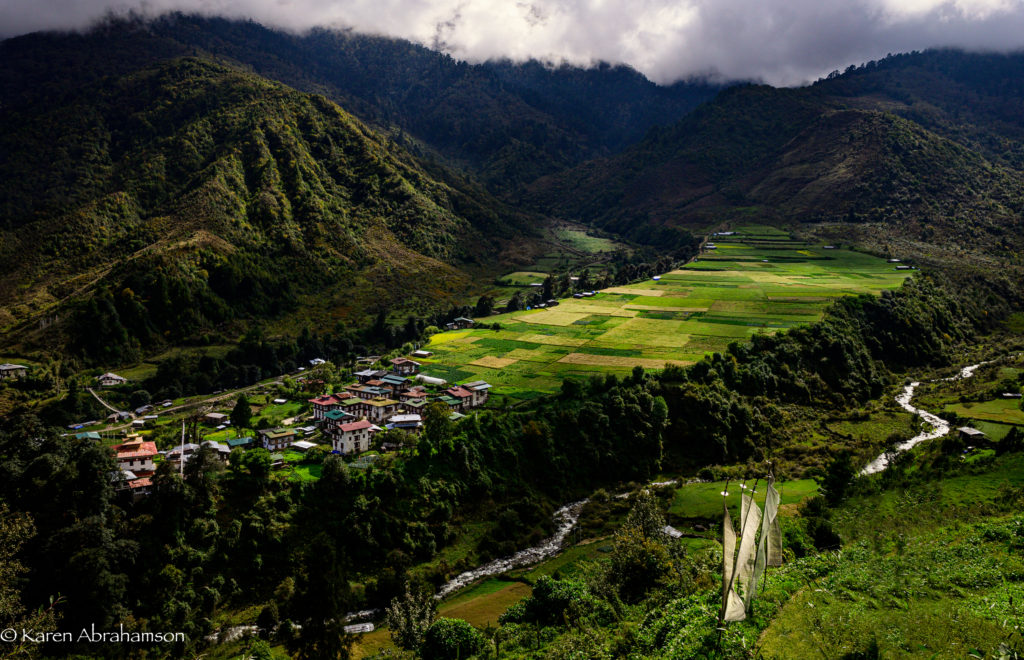
Prayer flags above one of the many mountain towns. Photo copyright Karen Abrahamson.

Bhutan is also a country that is trying hard to balance growth with protection of the environment. Compared to most countries around the world, Bhutan has actually seen an increase in the its national forest cover and it does things like set aside an entire fertile valley floor in order to preserve the habitat of the rare black-necked crane. Pretty progressive.

At the same time, tradition is everywhere. Come to a bridge, a river confluence, or mountain pass, and you find yourself amongst the fluttering host of red, yellow, green, blue or white prayer flags. Tradition says that with every gust of wind, the prayers connected to the flags are sent skyward to the benefit of the prayer flag’s patron. You become a patron by deciding to put up the flags but you’ll also see clusters of white prayer flags on poles that are raised in remembrance of the newly dead.

While I was in Thimpu, the capital, I had the chance to visit a Bhutanese astrologer who informed me that:

  1. I was a Fire Monkey (they use the Chinese astrological calendar)
  2. That I was going through a couple of bad years, and
  3. That there were flags that I could hang to help me get through this tough patch.

Given the astrologer was exactly right about the couple of bad years, I took the prayer flags he recommended and thought that I would hang some in Bhutan and some when I returned home. My kind and oh-so-knowledgeable guide, Kuenzang Norbu, researched dates that were bad to hang flags, and our wonderful driver, Tenzin Norbu (no relation) actually asked his father to research my best and worst days of the week.
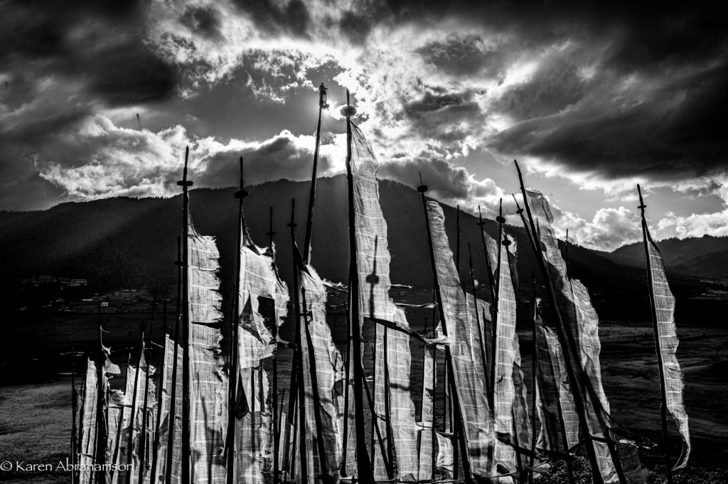
Prayer flags against the sun. Photo copyright Karen Abrahamson.

Not long afterward, we were traveling over one of Bhutan’s many high passes where the wind rarely ceases. The peaks of the pass were a mass of poles bearing crowds of fluttering flags and I knew immediately that this was where I had to hang my flags. Wonderful Tenzin helped me sort through them and then our entire group climbed the hill with me and helped hang my flags.

Whether it was for my benefit or whether it was because we all received the benefit of hanging those flags in the wind, the giving nature of everyone involved (foreign photographers and Bhutanese hosts alike) left me quite astounded.

So, I stood in amongst all those windswept prayers and cried.
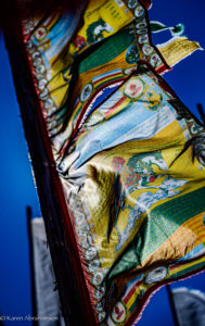
Colourful flags on a mountain pass. Photo copyright Karen Abrahamson.
Back to Burma (Myanmar)

Back to Burma (Myanmar)

I traveled to Myanmar (Burma) in 1997 while I was living and working in Thailand. At the time, the country was still mostly closed to foreigners. Only select parts of the country were open. During my month ‘in-country’ (the maximum the visa allowed) I conducted research on the Burmese puppet troupes and stayed at small guesthouses for a better chance of meeting local people. Unfailingly, everyone I met was giving of their time, knowledge and their kindness.

That began my love affair with Burma. (You can read more about my travels here.)

Since then I’ve written a number of novels set in Burma, including the modern, paranormal romance Shades of Moonlight.

In April 2017 Guardbridge Books published Death By Effigy, the first in my historical Aung and Yamin Fantasy Mystery series, in which an aging puppet singer and a mischievous puppet, must solve the murder of the king of the puppets or risk the destruction of the entire troupe.

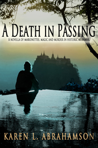
I’m pleased to announce that the second in the series, A Death In Passing, has just been released, continuing the trials and tribulations of Aung, the puppet singer, with his troublesome assistant, Yamin, as they try to solve the murder of Burma’s most powerful spirit dancer.

In all of these books I’ve attempted to be true to the country’s culture and to accurately present the wonderful nature-magic systems (with a few embellishments). Burma seems to be in my blood and I envision more novels set in this wonderful and varied country. Whether historical or modern novels, I hope to capture the country’s magic for readers.

If you’ve traveled in Burma, I’d love to hear how I did.

“A Good Traveler (or writer) has no Fixed Plans…”

“A Good Traveler (or writer) has no Fixed Plans…”

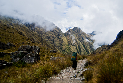
Porter on the Camino Inca. (2011) Photo (c) Karen Abrahamson

I purchased a lovely journal the other day. Though it’s not specifically a travel journal it certainly could be, because all of the quotes in the book relate to travelling, but when I read the complete quote by Lao-Tzu, all I could think of was its applicability to writing. The quote goes thus:

‘A good traveler has no fixed plans and is not intent on arriving.’

As someone who loves to travel, this quote provides a cautionary tale, because it warns that if you focus always on the destination you miss a lot along the way. Personally, I prefer to meander from place to place because you never know when you are going to find some better place to go than the place you intended. If you are always focused on heading somewhere, you have a much greater chance of missing where you are. As the Buddhists suggest, mindfulness of where we are, rather than worrying about the future  (or where we are going) brings much more happiness than the rush, rush, rush of hurried travel. It’s for that reason that I don’t take bus tours. The tours point out what they think you want to know, not what you can really learn just by being there.

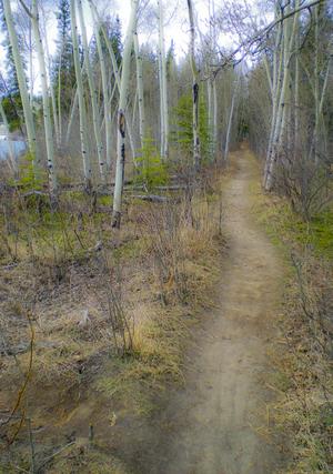
Yukon path, (2008) Photo (c) Karen Abrahamson

But Lao-Tzu’s quote applies equally to writing. The writer who spends all his/her time solely focused on completing a project isn’t really giving themselves the opportunity to enjoy the project. I’m not saying that you should fool around and never finish, I’m suggesting that you should enjoy the process, no matter how difficult it is, and—just like the traveler who takes the time to meander you don’t need to be so end-driven that you can’t enjoy the little sidepaths that your muse sends you down.

I guess what I’m talking about is allowing the story to carry you along, just like the road can. You don’t have to know where you are going exactly, though you may have a vague idea that you would like things to end in a certain way. Some of my best days of writing are when I have allowed the story to carry me away from the story I had intended—those are the mornings I get up and rush to get writing again because I want to know what happens next. The funny thing is that if you allow the little digressions and flashes of insight to lead you, often the ending will turn out to be some place better than what you envisioned. Believe me, if the ending surprises you, it’s going to surprise and charm your reader, too.

So as a recovering ‘plotter’ of novels I think all novelist should allow themselves the freedom to step off the path they are following to explore the new world they’ve created. They might just find it’s bigger and better than they ever imagined.

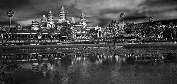
Angkor Wat reflections. (2009) Photo (c) Karen Abrahamson
Maps, Dreams and a Road Trip to Port Townsend

Maps, Dreams and a Road Trip to Port Townsend

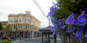
One of the lovely old buildings along Water Street, Port Townsend. (2012) Photo (c) Karen Abrahamson

This past week a good friend and I embarked on one of those memorable institutions of Americana (or Canadiana—we are both Canucks)—the road trip. Not that it was one of those great ventures across the continent like so many novelists have captured. No this was a small road trip—actually more of a mini or micro-mini road trip all the way from Vancouver, Canada, to Port Townsend, Washington. Why did we go? Just like any other road trip, we went because it was there and because it was a point on a map that we hadn’t visited before.

Road trips seem like an important part of our North American culture. Maybe it’s our love of the automobile or maybe it’s the distances, but I know people who think nothing of hopping in their car and driving for days on end just to visit a friend, or to be able to stand on a point of land and look out at the Pacific Ocean. Yes, they might have been able to fly to the location quicker and more conveniently, but the road trip makes the process of getting there just as important as the arrival.

Boat pulled onto dock at Coupeville, Whidbey Island. (2012) Photo (c) Karen Abrahamson

My first road trips were in the back of my parents’ black Ford sedan, travelling across the continent not once, not twice, but at least five or six times because my dad was posted at a military base on one side of the continent and ‘home’ was always on the other side. Dad would drive and mom would ride shot gun and play navigator with the road map. For summer holidays we took road trips from the Pacific Northwest to Utah and California or Montana. Those were memorable trips and brought home at a young age, just how huge the continent was and the diversity of all the places there were to visit and all the different people you could meet along the way. We’d play games of spotting license plates from other places, and I’d count the horses I saw in the fields.

My first independent road trip was right out of high school when, with two friends, we drove to Mexico and back in a Ford van affectionately known as the Dorf. At eighteen it was adventure and an announcement of independence to the world. It took all three of us to places we’d never been before, following the map down the coast and back up I5. We got lost travelling at night playing leapfrog with the long haul truckers and then turning off when exhaustion made us look for a place to sleep in the Van. We got chased off by locals and scared by someone prowling around us and ended up taking turns and travelling right straight through from central California to home in one sitting following the long straight road laid out on the map for us.

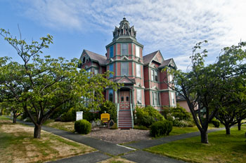
Lovely old Heritage house, cum B and B, Port Townsend. (2012) Photo (c) Karen Abrahamson

What is it about the road trip that draws most of us to such a trip at some point in our lives? Is it simply the love for the automobile and the feel of power that wheels us away from the moorings of our life, or is the call to adventure that dreamers dream of and writers write about? Or is it the vestigial need to explore that remains like a tailbone in our psyche?

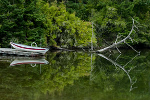
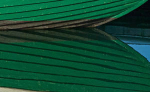
Wooden boat hull reflections. Port Townsend has a long history of wooden boat building. (2012) Photo (c) Karen Abrahamson

Either way, my friend and I explored the heritage byways and backwaters of Whidbey Island before climbing on a ferry and crossing to Port Townsend. We followed the city map of heritage houses and explored the town before heading on our way again looking for opportunities to fall of the map before climbing back on again to eventually find our way home. At one point our trusty map failed us and it took a kind trucker and his GPS to put us straight again, but that’s the nice thing about road trips: you meet nice people most of the time. When we got home my friend and I were both ready for another, longer trip. We’re already scanning the maps for new places we haven’t seen. Any recommendations?

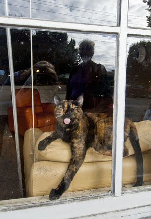
A Port Townsend cat makes us welcome by licking the window. (2012) Photo (C0 Karen Abrahamson
Mapmakers, Spies and the Alaska Highway

Mapmakers, Spies and the Alaska Highway

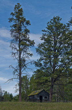
Cabin on the Kane Lake Road, B.C. (2011) Photo (c) Karen Abrahamson

Last week I wrote about characters in the Canadian Cartographic past. I thought I’d continue that theme this week with an illustration of how mapping is not the objective scientific pursuit we all think it to be. Instead, mapping is an exercise influenced by politics, exploitation of resources, culture and religion. Hubris comes into play in there somewhere, too. Mapmakers influence perception through their use of scale, their level of detail and even just by what they choose to put on the map. Determining which maps are actually made is perhaps the penultimate influence on public perception.

One of the most memorable Canadian mapping ‘junkets’ involved an American millionaire by the name of Charles C. Bedaux.

In 1934 Beadaux, then living in France, initiated the Bedaux Sub-Arctic Expedition, that planned to use specially built tractors and horses to traverse, map and cut a road from Edmonton, Alberta, through northern British Columbia to the Pacific Ocean. The 1,800 kilometer route was to go through Fort St. John, Redfern Lake, Sifton Pass and Telegraph Creek. While the media reported that Bedaux claimed the expedition was purely scientific, there were other rumors abounding.

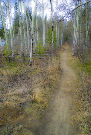
Woodland trail, Yukon, Canada (2009) Photo (c) Karen Abrahamson

In any event, this strange expedition left Edmonton with a crew of 43 people including Bedaux’s wife, her Spanish maid, and an Italian Countess to tend to Bedaux, along with the usual accoutrements of pate de fois gras, champagne and a gamekeeper. Oh yes, and a movie cameraman to record the adventure. This was not your usual surveying venture, but along with this cavalcade of oddities, were a topnotch group of scientists and surveyors. Poor sods.

Immediately after leaving Edmonton they were caught in rainstorms that slowed their progress and caught them in muskeg, even though Bedaux’s vehicles had extra wheels that were to lift them over the worst obstacles. Bedaux had brought everything with him from French cook pans, lock and tackle to lift the tractors over vertical terrain, and claw-foot bathtubs. All the equipment literally weighed  ton.

As the expedition progressed, the situation worsened. The tractors’s problems didn’t get any better and had they to be pulled out by some of the expedition’s 100 pack horses. When even this didn’t help them make better progress, he determined to start divesting himself of equipment. Not the bathtubs and champagne of course, but scientific equipment like the surveyor’s theodolite. The situation became more bizarre as Bedaux railroaded the surveyor’s assistant into becoming his houseboy, and demanded the other scientists become actors in staged moviemaking involving forest fires and staged stampedes of the horses.

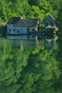
Old water mill in the countryside near Besoncon, France (2004) Photo (c) Karen Abrahamson

Finally, after 14,00 kilometers, Bedaux abandoned the expedition over 400 kilometers from Telegraph Creek. Bedaux returned to France, but the meticulous maps and drawings prepared by the surveyor of the venture, one Frank Swannell, went on eight years later, to lead to the building of the Alaska Highway which followed Bedaux’s route north from Fort St. John.

And Bedaux, well his fate wasn’t quite so memorable. You see one of the rumors about Bedaux was that his venture was really a testing ground for German military transport trucks in alpine conditions. During World War II Bedaux hitched his star to the Third Reich and acted as go-between between the Germans and the Vichy French. It is suggested that he passed information to the Germans, and in 1943 he was captured in North Africa by the Americans. He was brought back to America and charged with trading with the enemy, but in 1944 he overdosed on barbiturates and died.

Thus ended another bit of Canadian cartographic history. But one wonders. Maybe we have the Germans to thank for the Alaska Highway.


Maps, Mergers, Detours and the Other Direction

Maps, Mergers, Detours and the Other Direction

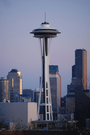
I just got back from Seattle (my OTHER favorite city), from a whirlwind trip to a Clarion party to see my old writing instructor Connie Willis (she teaches a mean reversal and wonderful lessons on plot). I travelled with another of my Clarion classmates (Class of 2001) and we were struck by a few things that got me thinking about maps and directions and foreign countries.

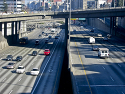
You see, there we were following the directions provided by Google maps (I prefer maps over GPS any day)and we were trying to get from I5 to the Queen Anne area when we discovered that there apparently is different English used for American directions than for Canadian. The American directions told us to merge when to Canadians it was clearly a left hand turn. ( A merge being something you do from an onramp onto a freeway.) In other spots we were told to turn left or right, when clearly to our Canadian eyes it was a merge. Needless to say, while we didn’t get lost, there were times I was seriously glad I wasn’t a driver behind us. I mean what were these crazy foreigners doing?

Of course our trip home wasn’t any easier. Not only did we have to navigate the many one way streets, that area of Seattle seems perennially under construction so we had to deal with detours. The main Lake Washington Bridge was closed which meant we couldn’t easily take a side visit to Redmond, and the downtown was also chewed up by construction so that we had to follow detour signs to get to I5 again. The interesting thing was, if we hadn’t been going to visit friends in Redmond we would have been seriously in trouble, because the detour signs just got us to the highway – headed south instead of back to Vancouver. Later, as we attempted to find our turn off, we had to deal with signs that said X Exit merge left and then, a quarter mile later, X Exit merge right.  Again I was glad of my foreigner license plates that at least gives me some license to be a little confused as I madly slalomed across the highway.

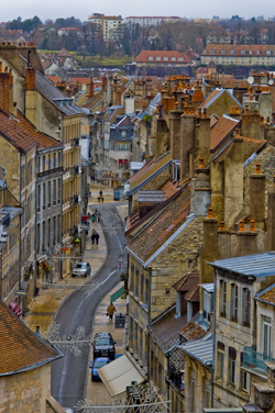
Christmas Street, Besconson, France (2005) Photo (c) Karen Abrahamson

All of this put me in mind of my travels in other countries where charming street signs have tickled my fancy. My favorite continues to be crossroad signs in France:  Paris with an arrow pointing in a certain direction, to Pontarlier, with an arrow pointing in a second direction, and a third sign with an arrow saying Les Autre Direction (the other directions). Maybe it’s just that North Americans have more need for specificity, but these signs always made me snort with laughter. I mean, of course the sign pointed in another direction, the question (for me) was what direction was it? Although I drove many places with my friends I don’t recall ever driving in that direction. So today as I wended my way home through the deceiving streets of greater Seattle I think I may have found myself unknowingly travelling Les Autre Directions. The surprising thing is I got to where I wanted, whether the signs led me there or not.


Maps, Magical Thinking and the Magic Kingdom

Maps, Magical Thinking and the Magic Kingdom

So I’m here at Disney World with my sister and nieces. Yesterday we visited the Magic Kingdom and of course had to orienteer our way around the park with the small maps that they provide. Actually the small map was pretty good and we made our way around the park pretty well, taking in the sights the girls wanted to see. Getting to the park was another thing altogether.

Leaving our resort we thought we had it figured out, except I thought one way and my sister thought another. Given she has been here a whopping four hours longer than me, we went by her directions and soon weren’t sure just where we were going. Glory of glories, she said let’s stop and ask for directions, which we did.

It put me in mind of a wee episode I had in Portugal with my beau of that time. There we were in eastern Portugal with a specific destination in mind (I can’t recall what). We followed the route our map showed and ended up travelling a huge loop that did not take us where we wanted to go and we ended right back at our starting point. At which time I suggested we stop for directions. My beau would not.

So we drove that same loop again. And again. With my beau getting madder – not so much because we were lost, but because I kept suggesting we ask for directions. Such repetitious action—travelling the same route again and again, but expecting different results is a lot like something problem gambling Counselors call magical thinking. People with gambling issues play a game of chance again and again believing that the odds of them winning increase with the number of times they play and don’t win BECAUSE THEY HAVE TO WIN SOMETIME. What they don’t realize is that they are wrong. They have exactly the same odds of winning a gambling game each time they play and the house has stacked the odds against them. Just like taking the same hopeless route again and again doesn’t improve our odds of not getting lost.

So stopping for directions was an auspicious beginning to this trip. Aside from the comedienne gas station clerk (who informed me that if I wanted Disneyland (not Disney World) I’d taken a wrong turn for the east coast somewhere) I got straightforward directions that took us direct to the Magic Kingdom. Here are some photos to prove we were there.

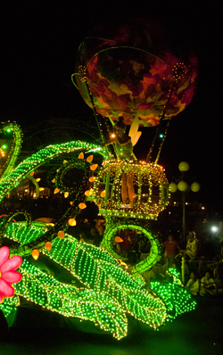
Tinkerbell at the Parade of Lights (2012) Photo (c) Karen Abrahamson
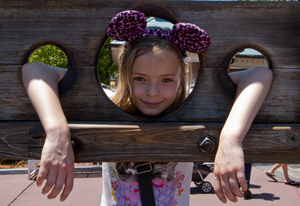
In the Frontierland Stocks (2012) Photo (c) Karen Abrahamson
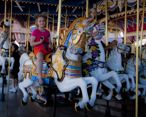
Jo on the Fantasyland Carousel (2012) Photo (c) Karen L. Abrahamson
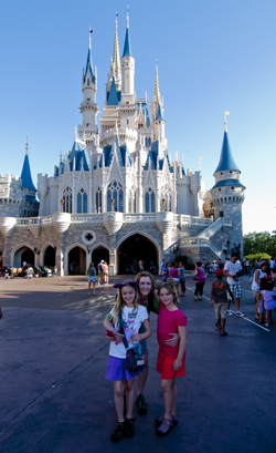
The girls at the Magic Castle (2012) Photo (c) Karen Abrahamson
Free Fiction

Free Fiction

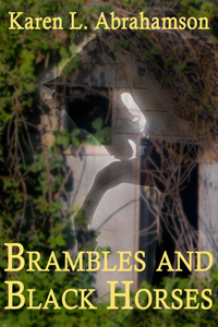
Brambles and Black Horses

By Karen L. Abrahamson

Gayle lost everything in the long ago accident that killed her family’s champion race horse and left her a ruined wreck of flesh and broken bones. Now, as bulldozers destroy the old farm where her love of racing was born, the appearance of a strange barefoot boy threatens to bring ruin upon her again.


To read the story, click here.

Maps and Spies

Maps and Spies

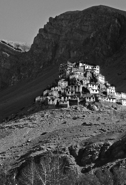
Himalaya Monastery outpost (2000) Photo (c) Karen Abrahamson

In one of my last posts (here) I wrote about how Sir Francis Drake may have been the real first discoverer of the Pacific Northwest coast, and how this fact was likely kept under wraps by the British government because of the potential for Spanish spies. Maps and spies have gone hand-in-hand for years and are still important in modern battles. I recently picked up the book Swan Song and the opening scene is the President looking at spy satellite images (maps) of Russian Territory. Spies and maps. That’s what this post is about.

Of course spy satellites weren’t always around, but spies were, and they have played an important role in the Great Game of Asia (the name given to the period between 1813 and 1907 when the Brits and Russians duked it out over influence and ownership over Central Asia). Being able to map an area and to gain control over important vantage points, rivers, towns and countries was all part of ‘the game’. The Survey of India I mentioned here, was all part of the British Raj’s need to know about and control their holdings.

But they ran up against a barrier – the physical boundary of the Himalayan Mountains and the geopolitical border with Tibet that had been closed by order of the Chinese Emperor. Although Europeans had sighted the heights of K2 and had scaled peaks only slightly less tall than Mount Everest, they hadn’t been able to map Tibet because of the Chinese border that specifically excluded Europeans. As a result, a captain of the Indian Survey, Thomas G. Montgomerie, decided to train and send disguised native agents into the mountains. Only two men passed the rigorous training: cousins Nain and Mani Singh.

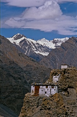
Himalayan Monastery along the Spiti Valley India (2000) Photo (c) Karen Abrahamson

In 1865 they went on their first mission through Nepal and into Tibet to try to reach Lhasa. The two became separated on their journey. Mani made it into western Tibet and returned with some mapping information, but it was Nain who managed to make it to Lhasa. Along the way he was robbed, but managed to retain his survey instruments. Trained to take even paces as his means of measuring distance and using a 100-bead rosary to keep track of his pace-count, he eventually entered the fabled city disguised as devout pilgrim. There he chanced public beheading by taking night-time measurements of altitude and latitude using mercury he poured into his begging bowl.

When he thought people were becoming suspicious of him, he left the city with a Ladakh caravan and headed west along the great Tibetan river, the Tsangpo. Along the way he mapped the river’s course and kept up his careful measures before finally escaping one night to make his way back across the Nepali border. He’d travelled 2,000 miles and mapped it all and returned with descriptions of Lhasa and the first reasonable placement of it on the map.

Nain’s accomplishment was followed by similar mapping parties, not all of which ended well. One agent travelled into northern Afghanistan and was murdered in his sleep. Another returned to Lhasa and back to India with data on almost 48,000 square kilometers of previously unmapped territory. A nephew of Nain’s continued the work and travelled for nearly six years in the mountains. He’d mapped a caravan route to China as well as the headwaters of the Mekon, the Salween and Irrawaddy rivers.

More impressive still, is the adventure of Kinthup, another native trained to survey the mountains. In 1880, he and another man were sent into the mountains to answer the question of whether the Tsangpo River became the Brahamputra. He braved the mountains and escaped after being sold as a slave by his ‘partner’ on the venture, but still managed to complete his mission in a feat that became legendary to Survey of India.

But it was only in 1911, after the Great Game was over, that the mapping of the Himalayas was completed, when the British joined their surveys with those of the Russians they had so long fought against. But it was brave native spies like Nain Singh and Kinthup who did the work for us and brought Lhasa and the Himalayas into the known world.

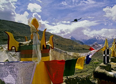
Himalayas and Crow (2000) Photo (c) Karen Abrahamson
The Place That Wasn’t There

The Place That Wasn’t There

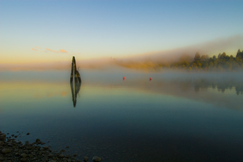
Mist on the Fraser River (2009) Photo (c) Karen Abrahamson

I fell off the map this week – at least that was what it felt like when I learned that I’d been removed from the intercom list at my townhouse complex. It doesn’t sound like much – a simple omission when they were doing the complex list – but think about it. To the outside world I no longer existed in this location. I inhabited an invisible place outside of the normal world that happened to be located between the house number below me and the one above – much like the safe house in Harry Potter but without the overt magic. I was gone, and so was my home and all the mementos I’ve collected from across the world. And of course my cats.

I’ve experienced something similar before, when I worked in the interior of British Columbia in a small town that was a long ways away from anywhere. When my agency’s reporting relationship shifted from one region to another, all the paperwork connections seemed to disappear and no one contacted us – it was actually quite a nice change. But it was also like we inhabited some huge fog bank that filled a space in the center of the province that no one knew existed. Our own personal twilight zone.

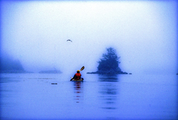
Kayaking the Broken Islands (1996) Photo (c) Karen Abrahamson

Such phenomena isn’t only in my imagination. Cartographers have been erasing or omitting bits of the landscape from their maps since before Prince Henry, when choice harbors and trade routes were secrets worth killing for. In order to gain a truer picture of the world, it became common practice for Kings to confiscate the log books and charts of each ship that came to harbor in order to copy them down before the sailors took ship again.

During the time of the early Portuguese spice trade, the location of, the Moluccas, the five tiny islands that were the sole source of nutmeg, mace and cloves, were closely guarded secrets. True maps of the eastern Indian Ocean were treated as highly classified documents (and few exist today) due to the possibility that the Portuguese were violating a Papal bull which gave the Spanish sovereignty over all lands west of a longitudinal line running 100 leagues west of the Cape Verde Islands (in the Atlantic).

During the age of exploration and when Spain, France and England were vying for the Americas and the Northwest Passage, maps were made that purposely misrepresented the landscape in case they fell into (and sometimes purposely intended for) the enemies’ hands. Such maps were intended to deter exploration by competitor nations because the harbor, the river, the inhabitable, productive land wasn’t there.

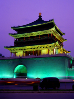
Xi'an tower (1998) Photo (c) Karen Abrahamson

Even today we see maps shift reality so that places exist differently than what you would find ‘if you were on the ground’. Road maps often include streets that are planned, but have never been built, or don’t describe that the street crossing that looks so direct on the map, can’t be made. A recent internet report showed that Chinese government maps of cities often change the position of major streets. Why? For military purposes. The government has apparently fallen back on the ancient practice of redrawing reality to stop potential invasion or intelligence gathering.

Happily, I’ve been replaced on the list of existing residents of my complex and so my home and I have been returned to reality. There is no longer a fog where my house once stood and my cats and I are all okay.

Recent Fantasy

Available HERE,

$1.99

Available HERE,
$3.99

Available HERE $1.99


Recent Mystery


Available HERE
$4.99


Available HERE,

$4.99


Available HERE,

$4.99


Available HERE,
$4.99


Recent Romance

Available HERE, $2.99