Tag: research

Danger-Maps, Belief and New Madrid
Danger-Maps, Belief and New Madrid

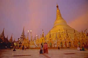
Schwedigon pagoda, Yangon, Myanmar
Schwedigon pagoda, Yangon, Myanmar (2000) Photo (c) Karen Abrahamson

Most of the maps I’ve written about over the past year have been maps setting out the geographic formations of the world—regardless of how skewed the map-maker might have made the map in order to influence the beliefs of others. But some maps are made to represent truth and to save populations from dangers, so today we’re going to look at a specific type of map—those used to convey earthquake danger. I’ve been researching this because it relates specifically to the current novel I am writing called Aftershock.

Most of us are familiar with California’s San Andreas fault, the 800 mile long fault that stretches northwest-southeast in California and that brings Los Angeles (west of the fault) two inches closer to San Francisco (east of the fault) each year. This much-talked about fault line has been the subject of disaster movies and books, and also of reams of geological research. The damage caused by the fault’s quakes led the State of California to have the San Andreas and other surface faults mapped and to require disclosure of proximity to fault lines in any residential real estate dealings in the state. The trouble is, that even though these maps are available, most people – even those who have lived in proximity to a faults line seem uninformed about the dangers and new buyers of homes are positively unaware of their proximity to faults even though they sign disclosures in their ‘offer to purchase’ agreements. Why? Because maps and the language around them can either be used to convey danger or to minimize it. In the case of the California real estate disclosures they say that the house is in the San Andreas zone, but they don’t specifically use the language ‘earthquake fault zone’.
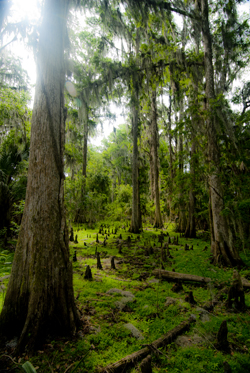
Cypress knees and trees, Orlando (2012) Photo (c) Karean Abrahamson

Another example or earthquake danger maps, and one dear to my heart (given I live on the south coast of British Columbia, Canada), are the ones that show the Ring of Fire around the Pacific Ocean basin. Nothing brings home the dangerousness of the place I live as seeing the numerous dots presenting quakes over 4.0 magnitude in recent history around the Pacific. You see, there are so many dots that a thick black line extends around virtually all of the Pacific except for the stretch bordering the Antarctic and a small section of North America – the part of the coast where I live. Okay, so there hasn’t been a moderately sized quake here in the past 20-30 years (yes, Seattle has had one, but not here, so far). In fact there hasn’t been a really big one here in a heck of a lot longer than that. But historical evidence and that ring of dots around the ocean says that there’s a very good chance one will happen one of these days. Around here we grow up being told to be earthquake prepared. Are we? Given the number of schools that haven’t been seismically upgraded, I’d say ‘no’, even though the maps are there to show us the danger.

So why do we refuse to listen to the maps? A likely answer lays in another part of America. Right in the heartland of the U.S., where Missouri, Tennessee, Arkansas and Kentucky meet, in 1811/12 near the small community of New Madrid, a series of massive earthquakes (magnitude 7.5 and 8) wiped out entire fledgling towns, sent sand and water geysering into the air and lifted huge chunks of the landscape. The only thing that stopped huge loss of life was the fact that few people lived there.

Research into the quake says this type of quake will happen again. The trouble is the quake zone isn’t at the edge of a tectonic plate and there isn’t something like really a visible fault line to show where the quake will occur because these quakes occur far underground—that’s also why they are so devastating—and so life in the Midwest has mostly been focused on the danger of tornadoes, rather than the lurking danger right underfoot.
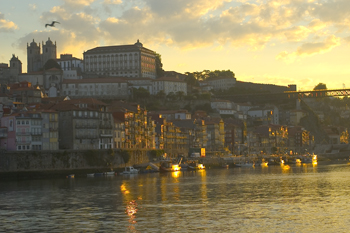
Sunrise over Porto, Portugal. (2005) Photo (c) Karen Abrahamson.

The trouble with this type of deep earthquake is that shockwaves travel farther and wreak more damage. In fact, geologists predict that such a quake today would be felt from Colorado to Washington D.C. and could wipe out most of the country’s central infrastructure.

As a result when, in 1990 a prominent inventor named Iben Browning predicted a major quake would occur in the New Madrid fault zone between December 1 and 5th of that year, the media promulgation of maps showing concentric areas of damage seriously impacting cities like St. Louis, Nashville, Birmingham, Little Rock, Jackson and Chicago started to get people taking the danger seriously. Children were kept home from school during the danger days. T.V. crews descended on the area like flies on road kill and everyone held their breath.

When nothing happened, of course finally people began to listen to the scientists who had previously laid out why the big one wasn’t likely to happen at that exact place and time. But the maps had done their damage. They’d laid out a ‘cartography of danger’ that hadn’t arisen. As a result, even though the states of Kentucky, Missouri, Arkansas and Tennessee try to prepare people for earthquakes because the risk of the big one still exists, they have an even more uphill battle than they do in California or here in the Pacific Northwest. You see, seeing a fault line on a map may not bring home the importance of believing, but when what you believe the danger presented on the map and then nothing happens, you’re less likely to believe in future danger.

So when the big one does hit, it will be Aftershock, indeed.
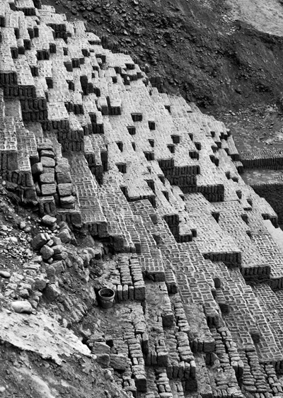
A pile of bricks is all that remains in earthquake-prone Peru. The ruins of Huaca Pucllana, Miraflores, Peru. (2011) Photo (c) Karen Abrahamson.


Ray Bradbury and Rewriting the Map of Canada

Ray Bradbury and Rewriting the Map of Canada

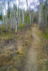
Woodland trail, Yukon, Canada (2009) Photo (c) Karen Abrahamson

Ray Bradbury died this week and as a science fiction and fantasy writer, his was some of the writing that most inspired me. I will forever be haunted by his horrific short story “All Summer in a Day,” but some of Bradbury’s best work were his cautionary tales like Fahrenheit 451, a terrifying look at the death of freedom and the burning of books in a fictional future. You might wonder what this has to do with the map of Canada, but bear with me.

This post will probably be as close to getting political as I will ever get, but events here in Canada have pushed me to the place where I finally have been forced out of the silent majority. You see the map of Canada is about to change. Not the physical map, perhaps, but the environmental map and the map of our hearts and our place in the world, and our children’s future is under attack so badly that I have to speak out. It feels very strange for a business person and writer who has always focused on fiction. For those of you who don’t live in Canada, here’s what’s at issue.

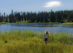
Small fishing lake in the B.C. Interior. (2011) Photo (c) Karen Abrahamson.

1. Our federal government is currently introducing legislation, Bill C 38, that will abolish most of our environmental protection legislation. They claim that they are trying to clean up the legislation in order to make it ‘make sense’ for municipalities and farmers, but in reality, while they might cut some red tape, they are getting rid of any legislation that might block the immediate implementation of major corporate initiatives, like the Enbridge Pipeline that will cross some of the most rugged and pristine landscape in Canada, from Alberta to the Pacific Ocean. This pipeline will cross hundreds of miles of wilderness and thousands of salmon-spawning streams to bring the dirtiest type of oil to the Pacific Ocean. Once there, this same legislation erases much of the laws in place to protect the pristine waters of British Columbia. It will allow oil tankers to ply the delicate environmental areas of the inland passage to take this dirty oil to China—one of the worst polluting countries in the world. Think Exxon Valdez. The legislation also removes the safeguards in place for many endangered species, because, the new legislation says, these species aren’t really important.

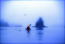
Kayaking the coast of British Columbia (1996) Photo (c) Karen Abrahamson

2. At the same time this government is systematically silencing any opposition. Along with this salvo against the environment which shortens any environmental assessments and limits who can even participate in the discussions, the government has also launched an attack against non-profit societies and charities, by imposing restrictions that stop these charities from any sort of advocacy against government actions. This attack has specifically been leveled at environmental organizations because they receive donations from other countries and this government is threatened by the groundswell of reaction from around the world about what they plan to do. They are changing the rules to hamstring any opposition against the huge oil corporations.

At the same time, they either stop funding scientific research, or they place gag orders on all remaining government scientists who might provide a voice of reason or evidence that government actions are wrong. But then I shouldn’t be surprised. This government doesn’t believe in science.

Even Members of Parliament who try to express what their constituents want are silenced. And when members of the United Nations commented recently on the impoverished state of our First Nations population, this government told them to go away and focus on third world countries. It seems Canada, in this government’s eyes, is beyond criticism.

All of this paints a picture that should terrify anyone concerned for our future. For someone who has always been a proud Canadian these actions are only the tip of a blood-chilling iceberg. It leaves me to think that, instead of the great white north that has stood proudly for freedom, integrity and honour both here and abroad for 145 years, we are being transformed into a country I only read about as in Ray Bradbury’s writing.

Welcome to totalitarian Canada – next comes the book burning.


The Satisfaction of Maps

The Satisfaction of Maps

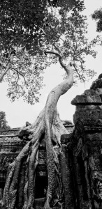
A wonderful fromage tree at Angkor ruins (2008) Photo (c) Karen Abrahamson

As I said way back when I started blogging about maps, some of my favorite early memories are of looking at maps with my family as we started out on some adventure, or as I fantasized about places around the world that I wanted to see. I guess that experience made me a map fan. In reaction to my blog about whether maps should be in books, a few blog readers reminded me that they also like to read maps and in particular find satisfaction in maps contained in books because those maps offer the opportunity to better understand the relationship and distances between places written about in the book. The readers enjoyed following along with the characters as they moved across the landscape.

This enjoyment with following voyages isn’t limited to readers. I recently lost an afternoon playing with the Facebook Cities I’ve Visited app. I think Facebook and Tripadvisor are on to something there – the need to record and understand just where we’ve been in relation to where we are right now.

I mentioned previously that I always carry a map when I travel and mark my journey down for my future enjoyment. As a writer, taken in conjunction with my journals, these maps always help me remember the places I’ve been or travelled through and provide a cartographic representation of terrain that my aging brain cells might have forgotten. But maps aren’t just used by me during my journeys. My family always hauls out the atlas and follows along as I wander. On my last trip, to Peru, a network of writer friends around North America followed along as I did sent in my blogs like an itinerant reporter. I suppose the satisfaction for them, was not only that they could follow along, but that they could also get a sense of the relationship of where I was to their location.

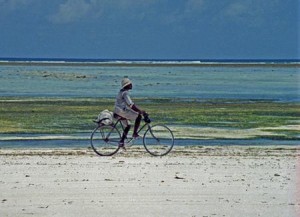
Shell seller on the west coast of Zanzibar (1994) Photo (c) Karen Abrahamson

Because although maps represent a greater world, they are also are very egocentric creations. By this I mean that maps are drawn by the creator not necessarily to draw reality, but to draw their reality. Case in point is a lovely 1886 Imperial Federation Map if the World Showing the Extent of the British Empire which shows Britain at the centre of the map (much as the medieval T/O maps showed Jerusalem at the centre of the known world). The wonderful map uses the Meracator projection which nicely enlarges landmasses in the northern hemisphere (including Britain) and also includes mythic Atlas holding aloft the world which is straddled by lithesome Britannia who is surrounded and adored by the lesser ‘races’ (read colonies), all peering up at Britannia’s greatness. Not simply a map it seems, but also a satisfying cartographic representation of the way Brits at that time wanted to view the world and themselves.

To some degree I think the Cities I’ve Visited acts something like the 1886 map: although we aren’t placing ourselves above the world, it gives us comfort with our place in the world. We create our representation of the places we’ve touched and maybe that gives them more reality for us. Perhaps that satisfaction also includes a little reassurance of our place in the world?

So when I was done with Cities I’ve Visited, I was very satisfied that I’d trod so many places in the world, but also fairly embarrassed. I felt almost like I was competing with some cyber-other to show that my vision of the world was broader because I’d been more places. Was it really a competition? The App said the average person has visited 17 cities. I was at 247 and I stopped when I started to feel really stupid (not to mention that I’d wasted a good chunk of the afternoon).

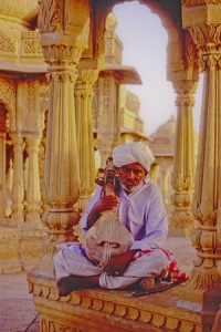
Muscian at tombs above Jaisalmer, India (2000) Photo (c) Karen Abrahamson

The whole experience reminded me of too many tourists I’ve laughed over who arrive at a place, leap out of the tour bus, take a photo and then leave to drive like mad to the next place and the next photo. That phenomena always put me in mind of a mission to collect places like notches on a belt – or like a dog leaving photographic spoor like doggie–do reminders of where they’ve been.

It makes me wonder if our egocentric need for maps is something like our need to collect, buy and own – as a means to quell our unquenchable need for satisfaction.


Maps and Spies

Maps and Spies

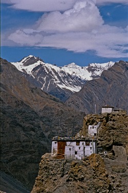
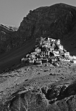
Himalaya Monastery outpost (2000) Photo (c) Karen Abrahamson

In one of my last posts (here) I wrote about how Sir Francis Drake may have been the real first discoverer of the Pacific Northwest coast, and how this fact was likely kept under wraps by the British government because of the potential for Spanish spies. Maps and spies have gone hand-in-hand for years and are still important in modern battles. I recently picked up the book Swan Song and the opening scene is the President looking at spy satellite images (maps) of Russian Territory. Spies and maps. That’s what this post is about.

Of course spy satellites weren’t always around, but spies were, and they have played an important role in the Great Game of Asia (the name given to the period between 1813 and 1907 when the Brits and Russians duked it out over influence and ownership over Central Asia). Being able to map an area and to gain control over important vantage points, rivers, towns and countries was all part of ‘the game’. The Survey of India I mentioned here, was all part of the British Raj’s need to know about and control their holdings.

But they ran up against a barrier – the physical boundary of the Himalayan Mountains and the geopolitical border with Tibet that had been closed by order of the Chinese Emperor. Although Europeans had sighted the heights of K2 and had scaled peaks only slightly less tall than Mount Everest, they hadn’t been able to map Tibet because of the Chinese border that specifically excluded Europeans. As a result, a captain of the Indian Survey, Thomas G. Montgomerie, decided to train and send disguised native agents into the mountains. Only two men passed the rigorous training: cousins Nain and Mani Singh.

Himalayan Monastery along the Spiti Valley India (2000) Photo (c) Karen Abrahamson

In 1865 they went on their first mission through Nepal and into Tibet to try to reach Lhasa. The two became separated on their journey. Mani made it into western Tibet and returned with some mapping information, but it was Nain who managed to make it to Lhasa. Along the way he was robbed, but managed to retain his survey instruments. Trained to take even paces as his means of measuring distance and using a 100-bead rosary to keep track of his pace-count, he eventually entered the fabled city disguised as devout pilgrim. There he chanced public beheading by taking night-time measurements of altitude and latitude using mercury he poured into his begging bowl.

When he thought people were becoming suspicious of him, he left the city with a Ladakh caravan and headed west along the great Tibetan river, the Tsangpo. Along the way he mapped the river’s course and kept up his careful measures before finally escaping one night to make his way back across the Nepali border. He’d travelled 2,000 miles and mapped it all and returned with descriptions of Lhasa and the first reasonable placement of it on the map.

Nain’s accomplishment was followed by similar mapping parties, not all of which ended well. One agent travelled into northern Afghanistan and was murdered in his sleep. Another returned to Lhasa and back to India with data on almost 48,000 square kilometers of previously unmapped territory. A nephew of Nain’s continued the work and travelled for nearly six years in the mountains. He’d mapped a caravan route to China as well as the headwaters of the Mekon, the Salween and Irrawaddy rivers.

More impressive still, is the adventure of Kinthup, another native trained to survey the mountains. In 1880, he and another man were sent into the mountains to answer the question of whether the Tsangpo River became the Brahamputra. He braved the mountains and escaped after being sold as a slave by his ‘partner’ on the venture, but still managed to complete his mission in a feat that became legendary to Survey of India.

But it was only in 1911, after the Great Game was over, that the mapping of the Himalayas was completed, when the British joined their surveys with those of the Russians they had so long fought against. But it was brave native spies like Nain Singh and Kinthup who did the work for us and brought Lhasa and the Himalayas into the known world.

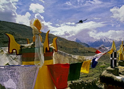
Himalayas and Crow (2000) Photo (c) Karen Abrahamson
A Prince, a Prophecy and a Legend

A Prince, a Prophecy and a Legend

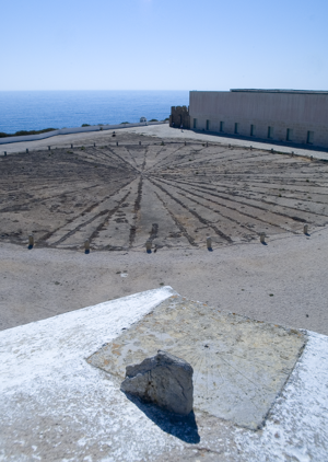
In southern Portugal, at a place called Sagre, I stood on red cliffs, high above an azure ocean and inhaled ocean wind and dust that had blown all the way from Africa. There, in an ancient fortress, laid out amid the scrub grass and rocky ground and seabird guano, laid a thirty foot, circular, roped off area that contained an old wind rose – a collection of ray lines that spread out to all points of a compass. This was the legendary home of Prince Henry the Navigator.

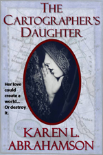
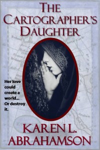
This was a few years back, when I had the good fortune to spend a month traveling around Portugal researching a prince for a book I was writing (The Cartographer’s Daughter). The prince I researched was none other than Prince Henry about whom the entire Portuguese psyche seems to revolve – or else he’s just a key tourist draw. You see everywhere you go in Portugal there are memorials to the old boy’s doings. In Porto there’s a museum that celebrates his birthplace. In Lisbon grand statues stand over the harbor and paintings of him fill the maritime museum. In Lagos another museum waits and elsewhere there are plaques and other statues. Why, you might ask? What did this man very few North Americans have heard of, do to deserve this kind of canonization?

I suppose the answer can be found in the wind rose.

Sagre windrose
The Sagre windrose has led to legends of a cartographer's school at Sagre. (2005) Photo (c) Karen Abrahamson

No, Henry didn’t invent the wind rose. Simply put, this foppish, spendthrift prince could be called the father of the Age of Exploration. Yes, there were many people that contributed to the dawn of new age of Europe, but good Prince Henry had something to prove and the full might of the Knights of Christ, the inheritors of the Knights Templar after they were disbanded, to help him do it. But I run ahead of myself. So who was Prince Henry?

The middle son of the Portuguese king, Henry was born under stars that astrologers proclaimed would devote Henry to ‘great and noble conquests and to uncovering secrets previously unknown to men’. Imbued with this sense of destiny, how could he help but be more than a middle son?

Henry grew up to be an ardent Christian and to become the head of the Knights of Christ. Along with that, came a driving hatred of the Moors and a determination to rid the European continent of them (they still held Granada). It also led to a dream of taking the Crusades across Gibraltar to Tangiers. His drive and his influence over his father led to one of the last European crusades—this one against the Moroccan trade city of Ceuta. The Portuguese won and held the city, but later, when they tried to advance they ended up routed from Tangiers and having to trade Henry’s younger brother for their freedom. This horrible blow some historians lay at Henry’s doorstep, but the loss of his brother was fuel to Henry’s fervor and he spent much of his life trying to revive the crusading fever amongst his cronies. It never came to be, but in the meantime Henry influenced a nation because he began to focus on maritime issues.

As a patron he began sending men on exploration along the African coast. Yes, he may have also been seeking a road to Christian Kings who could help him against the Moors, but his push and his financing, led to Gil Eannes becoming the first man to round Cape Bojador, which previously had been described as the end of the earth due to its difficult currents. With that passage, and with the improved sails and hull structures Henry’s money fostered, he ripped down a psychological barrier and the length and breadth of Africa beckoned. This led to a series of explorations sponsored by Prince Henry. He also fostered the collection of maps and sailors’portolan charts so that navigational information was shared and developed, before they became guarded national secrets.

The old Church at Sagre, (2005) Photograph (c) Karen L. Abrahamson

The interesting thing about Henry is that though we know so much about him, he still remains a man of mystery and legend. Records seem to show that he was an austere man who was deeply religious and sometimes given to mysticism at the same time as he liked to dress in foppish clothes and lavishly over spend the wealth of his estate holdings. He was also a man of learning who funded universities and financed astrologers and physicists and cartographers. But as I stood in Sagre by that wind rose I was struck by the rugged beauty that must have inspired him – that is until I went into the site’s visitor’s centre and they advised me that this fortress in Sagre was never a cartography school, though he did make his home here.

And the wind rose?

Henry’s involvement is just the stuff of legend.

Being In the Moment

Being In the Moment

I recently had a spate of medical tests that involved injected dyes and C.T. scans. There I was, laying on this human-sized platter waiting to get dragged through this donut-shaped machine with multiple monitors and IV tubes and straps etc. hanging from spider-like ceiling beams to snake into my arms. It was all a new experience for me and not one I particularly liked, but the newness shocked me into taking heed of all the sensations and what was going on. It reminded me of the importance of being in the moment for writers.

I’ve always been taught that being in the moment involves being ‘present’. That means that you are fully aware of what is happening to and around you, including all of your bodily sensations. It is not allowing all the thoughts about where you want to be and how to get there, or the thoughts of where you were and your various regrets, to get in the way of attending to where you are.

Flying high in the moment.

Sounds like a simple concept, but it’s harder than you know. Try going for a walk and just attending to the feelings in your body and your surroundings. Don’t be surprised when you come-to thinking about what to cook for dinner tonight, or your job, or the blog you need to write for next week. It’s a lot like suddenly becoming aware you’ve almost arrived at your destination and for the life of you, you can’t recall the driving. You’ve totally zoned out and as a result you’ve missed the scenery along the drive, or the birds in the trees, or the scent of an unusual flower. Or life, for that matter.

All of us do this. We’re so incredibly busy running from issue to issue and task to task in our lives that we feel we HAVE to double and triple multitask in order to get everything done. Heck, I do this knowingly every time I go for a walk and try to work through a plot problem.

As a writer we need to be aware of this tendency and to work on being in the moment. If we do so we can find the marvelous little details, or the glimpses of the human condition that can make our writing richer. From my time on the human platter I’m going to remember the burn of the dyes as it moved through my blood stream and the taste of hot copper taste on the back of my tongue. They’ll appear somewhere in my writing, because being in the moment, I noticed them.

That Research Thing

That Research Thing

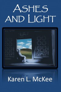
Ashes and Light - coverReaders of my books set in Afghanistan or Portugal and Burma often ask me how I got the details right. Of course the answer is research, and in all truth I can’t say that I got all the details right, but for me to write I have to have a sense that I have enough knowledge of the place and the culture to write it correctly, or as close to correctly, as I know how. Same goes for a particular time period or a specific piece of technical knowledge. This blog is about how I go about building the knowledge so that when I sit down to write it flows out of my hands.

1. Reading: I read about what I want to write about. I read fiction that gives me a flavor of how other people write about a location. I read non-fiction accounts, memoirs, biographies and histories. These both allow me to pick up the nuggets these writers gleaned about the place or culture. I’ll pick up cheap coffee table books from remainder tables at book stores just so I can look at the photos. This often fuels my sense of place. I haunt the history and geography sections of used book stores like Powell’s to find relevant writing about the place or timeframe, like for 1400’s Portugal for my upcoming book, The Cartographer’s Daughter. I’ll read the coffee table book if something captures my imagination. For example, I was living in Thailand and saw a small coffee-table book about Burmese Puppets. I picked it up and what I read spurred me to want to write a story about the puppets – I know, it’s a ridiculously esoteric subject – but I read that book from cover to cover and used it as a jumping off place to identify other information I needed to know.

2. Maps: I’m a huge fan of maps. Maps give a me a sense of location and perspective. I recall traipsing around Venice, and it was the maps with the bird’s eye view that I first looked at when I arrived, that stopped me from ever getting totally lost in the maze of streets, canals and alleys. The same map put into perspective where Marco Polo’s house was and how that location within Venice might impact his view of the world. Maps let you identify potentialities in the location and they also show specific locations for events in your stories. Maps, I find, are an inspiration.

This is especially the case in writing historical stories, because maps not only show you the landscape back then, but they also tell you a lot about the culture, belief system and world view of the people. I’ll talk more about maps in a later blog.

Similar to historical fiction, when the story is a fantasy set in a fantasy landscape, I make maps up. Knowing where things are located and having place names in your head, allows you to build histories around those landscapes which are so important to making fantastical places real. It also forces you to think how long it would take to get from point A to B and about how the landscape would impact the characters who live or travel there.

3. Talking to people: Talking to people who are experts in their fields can help to get the details right. It can also be a source of inspiration with those odd facts that are so obvious to the experts, but no one else is aware of. These are jewels for writers, because they let readers in on the secret language of whatever this specialty is.

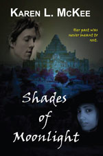
When I was writing about the Burmese puppets I had the good fortune to travel in Burma(Myanmar) and made a point of going to every puppet show in every town I travelled through. I made arrangements to interview the owner of one of the shows in Mandalay who spoke moderately good English and he referred me on to another man who made the puppets. It turned out this kind man was an ex-surgeon and spoke excellent English. He had been instrumental in providing information to anthropologists doing research on the puppets and kindly showed me how they were made, demonstrated some of them for me and even gave me a precious manuscript he had received from the anthropologists so that I could photocopy it for myself. You have to understand that at the time Burma was almost a closed country and that he was taking a risk even talking to me, a writer. Those items I treasure to this day and those unbound pages still have a place of honor on my bookshelves. They were also critical to a couple of fantasies and Karen L. McKee’s Paranormal Romance, Shades of Moonlight.

If you can’t talk to the people, you might be able to get in touch via e-mail. When I was writing my Afghan novel I was in touch with past foreign correspondents, and members of the military that friends helped me locate.

Writing about other cultures, it’s also important to talk to people of that culture. For my Afghanistan book I spent a number of coffee and lunches interviewing a lovely Afghani woman who was brave and interested enough to talk to me about woman in her culture, about her faith and about what was happening in her country, as well attitudes amongst her people towards the foreigners ‘liberating’ her country. These attitudes shaped my characters. She also provided me with small phrases and legends that are common in her country. These are also gold because they allow you to build in the real words and beliefs of the people.

4. Old Newspapers: If you are writing about a historical period where there were newspapers, or you are writing about another part of the world and can get newspapers in a language you can read from that time period, this can be an invaluable way to get a sense of the background events that were occurring in the location at the time you are writing about. Nowadays many major newspapers have their archives available on line. Reading the old papers can also spur inspiration regarding events that are reported and how your characters might have been involved or touched by the event, and can also give you a sense of fashion and language used ‘back in the day’. For example, a story about how bats had taken over the old Regina City library back in the 1920s led to an opening chapter of the first adult novel I ever wrote.

5. Library and Internet research: Having a local librarian as an ally can be a boon, because a librarian can suggest you try looking at books in areas you might not have even thought of. University libraries are also superb resources. When I was writing about Burma I wanted a specific book about the magic systems and the animistic spirit worship. There’s been very little written on the subject at the time, but there was one fairly comprehensive anthropological study. I found the book (a very old, falling apart version) and ended up photocopying the whole thing so I could have it available as a resource.

The internet can be helpful in finding old journals and photos of locations taken by other travelers. Blogs can be a wonderful source of information, both about the place and about the traveler’s reactions to it. I used old articles in The Economist and old travel journals about a very rough ride through northern Afghanistan to bring realism to my novel set in that country.

6. Travel: I try to travel every few years and I don’t go to resorts and I don’t do tours. I go to places I think I might want to write about and I spend my time poking around the back streets and absorbing the feel of the place. I spend time talking to people to get a sense of people’s attitudes. I’ll sit in a park and let people come to me. I talk to waiters and taxi drivers and vendors on the street – often with very limited communication skills because we speak different languages, but enough to get a sense of small bits of their realities—like the

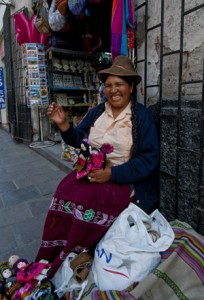
Carmelita of Puno, Arequipa (2011) Photo (c) Karen Abrahamson
Carmelita of Puno, on the Arequipa streets (2011) Photo (c) Karen Abrahamson

woman who worked in one city in Peru, but who had left her children behind in another city because there was better money to be earned where she was – a hard economic choice the country’s situation had forced on her.

Before I travel I think about where I want to go and what I want to see and a plan a general itinerary around that, but I also let fate take me where it will. There have been times when a chance meeting, or a wander off the beaten path, has allowed me to find something wonderful that takes the potential writing in a whole new direction.

So research for writing isn’t so much simply gathering facts and then writing about them, it’s about immersing yourself in a location or situation (even if you’ve never been there), so that when you sit down to write the place itself inspires what you are writing. I recall my Afghan book as one of the most difficult books I have ever written. Why? Because I had so many false starts on the book. I would start and get a chapter in and realize I wasn’t ready to write that story yet because I wasn’t filled with the sense of place and the culture. So I kept on researching and wrote other books and then one day I sat down and the book poured out wiht all the wonderful details in just the right places. And yes, there are probably errors in the book, because in a war-torn country there are places so remote that you just can’t get the information. So you know what? There are things in that book that arose purely from my imagination.

Because it’s fiction, folks. Remember that. Fiction.

Going Places You Never Thought You Could

Going Places You Never Thought You Could

The title sounds like it’s one of my travel blogs, but in this case it’s not. Although it could be. I certainly have gone places I didn’t think I could.

But anyway, the inspiration for this blog came this morning as I was stepping out of the shower. So there I am, all naked and dripping wet and there is big Ben, waiting for me—standing on top of the door. Nicely balanced, if I do say so myself. He was actually able to turn around and give me a pained look when I asked him what he thought he was doing. When he leapt halfway across the room to the floor, it was with a cat-shrug as if it was something he has done every day. And maybe he has. Cats make difficult, naughty things look easy.

On a few other occasions I’ve found him busy knocking shells I’ve gathered from around the world off an ornamental shelf I have hung above my towel rack. You know—one of those shelves of mock wood that you hang from the wall. He has to get to this shelf by balancing on my towel rack. Thank goodness I’ve got both rack and shelf screwed into the wall.

Trouble- Shiva and Ben at 6 months Photo (c) Karen Abrahamson

But Ben’s absolute fearlessness, and his determination to get wherever it is he sets his mind to, reminds me of the permission we need to give ourselves as writers. When I was working on Ashes and Light, the romantic suspense set in Afghanistan, I had a dickens of a time getting started.

Each time I did, I stopped within the first 20 pages, because I just couldn’t get my head around where I was writing about. I felt if I didn’t know a place firsthand—hadn’t inhaled the spices, felt the grit on my skin, and almost broke an ankle on the uneven pavement—there was no way I could start. This begged the question: Could I only write about places I’d been? Could all those literary fiction pundits be correct when they said that I couldn’t write about a culture other than my own?

That’s a perspective that has slapped me upside the head a few times, and with which I heartily disagree, because if we can only write our own culture, then by extension, how can I write about anyone but me? (A fine idea for those narcissists among us, but….) So if I could reject the second hypothesis, then surely I could reject the first. The only thing getting in my way was my own ability to grasp the greatest truism of novel writing:

It’s Fiction!!

Yes, I had to do research. Yes, I had to recall my travels to parts of the world where Turkic people live, and to the mountains so like those around Badakshan in Northern Afghanistan. I had to find photo books and travel books and contact the Canadian military for information about the landscape. I befriended a local Afghani woman and picked her brain for hours about life as a woman in Afghanistan, attitudes towards woman, and folk stories and sayings.

After all that work and about 450 manuscript pages I still found myself hung up. There I was with my characters crossing a pass in the snow-bound Hindu Kush mountains and they and I were stuck. I couldn’t find anying describing the pass. I knew it was high. I knew it was rough. And Google Earth wasn’t exactly helping with accessing details of the militarily sensitive landscape.

That was when I had the epiphany.

It’s fiction.

It’s fiction and how many people are going to go to that tiny speck of earth to check whether my details are 100% true to life? Besides, in the Hindu Kush mountains, the landscape changes. There are earthquakes.

So knowing it was fiction, I wrote a fictional scene, in a fiction book, and you know, it worked.

I got down out of that imaginary landscape just as slick as Ben got off that door edge.

Recent Fantasy

Available HERE,

$1.99

Available HERE,
$3.99

Available HERE $1.99


Recent Mystery


Available HERE
$4.99


Available HERE,

$4.99


Available HERE,

$4.99


Available HERE,
$4.99


Recent Romance

Available HERE, $2.99