Tag: planning

What to consider when considering a tour:
What to consider when considering a tour:

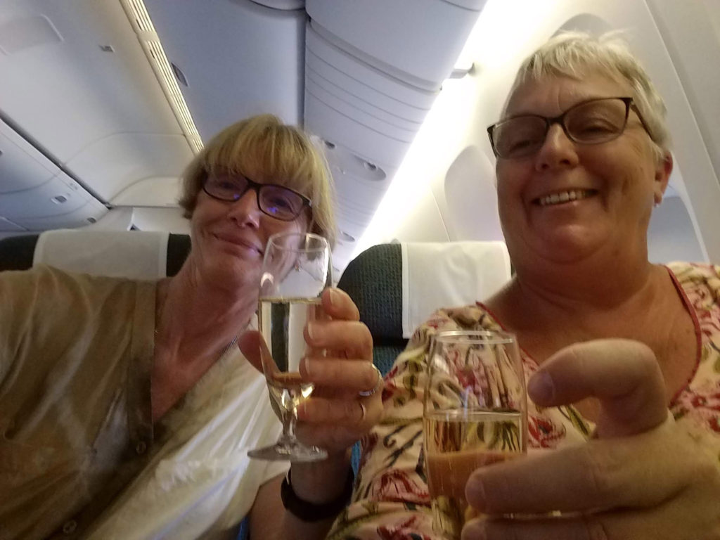
Recently a friend and I took a tour in India. Now first of all, a disclaimer from me: I am not a tour kind of person. I prefer to travel on my own in most situations, however I have done tours in the past that were some of my most memorable travels for all the right reasons.

The India trip left me and my travel companion thinking that there was more that we should have done to do due diligence before booking the tour. The following list of questions/considerations is intended to help travelers to gather complete information before booking a tour so that you aren’t surprised along the way. These questions are in no particular order.

  1. Is this a tour provided by a large company or a small one-person operation or something in between? Large tour operators are more likely to have many resources on the ground in your destination, but are less likely to have the flexibility to shift itineraries to meet your preferences. Small operators offer flexibility, but also may not have the network and knowledgeable guides that you want.
  2. How many times has the guide led this tour? Is he/she from the country in question? What are the guide’s credentials (e.g. do they have training in the culture/history/natural history and geography of where you are going? In other words can you ask them the name of a local tree is and get an answer instead of a shrug.)
  3. Ask whether the guide usually caters to a particular clientele, such as seniors, women, men, LGBTQ? Consider whether the guide’s experience could conflict with what you expect on a tour. For example, if the tour guide has mainly dealt with Seniors, but you enjoy high levels of physical activity. Be clear about your expectations and make that clear to your guide before the trip.
  4. Does the guide/operator use local guides at certain destinations? When was the last time they were in touch with the local guides? Do they have a backup should the intended local guide not be available? Are the local guides affiliated with an established local company that can be easily contacted?
  5. If you can speak to the tour guide, ask them to tell you about the culture that you’ll be traveling in. Get a sense of whether the guide respects or even likes the local people.
  6. If you can speak to the guide, ask them about visiting a historical site. How will this be handled? Will they:
    • shepherd you through like a flock of sheep,
    • go in with you and be available for questions and to ensure that you see everything, or
    • will they send you in and  stay outside to do the newspaper crossword puzzle?

Consider what you want from your guide.

  1. Ask what types of restaurants you will eat in and what meal times will be kept. Will there be three meals a day at regular times, or will it be catch as catch can between breakfast and dinner? Consider your meal requirements and discuss with the tour operator/guide whether they can be accommodated.
  2. What types of transportation will be used? Consider that in less developed countries overnight trains, even in first class sleeper cars, may not provide comfortable sleeping accommodation. If these are very long trips, how will meals be accommodated while on the train?
  3. What types of hotels will you stay in? Will they be in areas where you will feel comfortable going out walking? If not, will the hotel be such that you will be comfortable staying in the hotel? E.g. is there a pool or something else to do and are the rooms clean and large enough to feel comfortable rather than cell-like. Be clear about what you need, because if you expect 5 star and only get 2 or 3 star (or expect 3 star and get one star or no star) accommodation, you won’t be happy. Ask whether the guide has stayed in these hotels before.
  4. Ask what will be done if you arrive at accommodation and it is clearly unacceptable (e.g. the room has bugs.)
  5. Consider how many days are spent in travel versus in individual locations. Is there enough time to see the location and to settle in a hotel, or are you forever going to have bed-head from sleeping on railway cars or buses?
  6. If something falls through – e.g. a location is closed – does the tour have a backup plan for activities?
  7. Before the tour, ask whether there is openness to adjustments to the itinerary. Is the guide willing to research possible changes and present choices to the client? For example, are there alternative ways to accomplish transportation? Do you have to do a round-trip boating trip, that then requires a driver to take you to the next destination, or could the boat actually take you to the next destination instead of returning to its point of origin?
  8. Are there any identified or potential extra costs? For example, would the boat trip to the new destination cost extra? If there is an extra guide for the trip, is there any additional cost for that additional guide? Clarify that all costs are included in the price agreed to at the start of the trip other than the tips for the workers and guide(s).
  9. If the guide is going to make recommendations regarding shops or products, what knowledge does the guide have of that type of shop or product? For example, if recommending a tailor shop, does the guide know enough about sewing to judge whether a bespoke item is well made or even sufficiently finished (e.g. no raw edges inside, not so poorly measured and cut that they have pieced together portions of the garment and tried to hide it?)
  10. Consider past reviews of the guide or contact past users to ask about appropriateness of guide language and conduct such as inappropriate sexual comments, respect for country’s culture, consumption of clients’ alcohol, consuming illegal substances, respect for restaurant/hotel workers, drivers etc.
  11. Ask whether there will be consultation with all clients about changes in itinerary.
  12. Ask for guidance about appropriate tips for the variety of people who will help you along the way, including drivers, hotel staff and subsidiary guides. Gain a sense of whether there will be any suggestion/expectation of patronage (e.g. special support like immigration assistance or money) for guides/workers along the way and whether this is condoned by the company.
  13. Recognize that you will not see everything or do everything that you want to during a tour. There is never enough time.
  14. Be prepared to be exhausted at the end of a tour. A tour excels at cramming a lot into a short time. Don’t expect to be rested, but do expect to your head to be filled with a tremendous number of adventures.
Mapping the Mind: Birds, the Inuit and Urban Development

Mapping the Mind: Birds, the Inuit and Urban Development

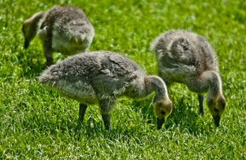
Canada geese goslings. (2012) Photo (c) Karen Abrahamson

Last week I wrote about some of the maps that helped create a country. This week I want to write about maps and development here in my little bit of Canada. You see, recently I attended a City planning meeting about the planned development of said city over the next thirty years. The city planner was there to gain input to the plan, so like I am wont to do, I opened my mouth. I asked whether there were plans included for city parks that were more than playing fields. In particular I asked about retention of trees.

You see the city plan targeted three areas of the city for development. This meant that the areas that currently hold some of the last large acreages with the last stands of mature trees would be logged off and cut up into micro-lots of high-density houses and townhouses. If the development practices I see in other areas of this city are any indication, the landscape will be reduced to a wasteland of ticky-tacky houses and spindly trees planted so they don’t block resident’s views. The aim is to build the highest number of houses on the smallest lot, which doesn’t leave a lot of room for trees. Land costs too much.

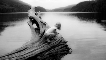
Jo at Buntzen. Children need the opportunity to be close to nature. (2011) Photo (c) Karen Abrahamson

I know, I know. People have to live somewhere, but the prospect of this loss left me so angry I felt poisoned inside. I’ve been trying to figure out how my perspectives have wandered so far into ‘radical’ territory from what now seems to be mainstream. You see, I worry about the other creatures we share this earth with. I worry about the air-cleaning capacity of the trees we’re cutting down. I worry about the birds and the squirrels and the other creatures we’ve displaced with our houses.

The worst part of the episode was that few people in the meeting seemed to share my concern.

A recent survey of birds in Canada, showed a decline of 40% plus across most species. Here in B.C. the decline is 35%, but with every development permit, you can bet the bird population is a little bit less. Over the last ten years that I’ve lived here, the flocks of swallows have decreased so I see less than ten on a morning walk. In my own townhouse complex, the council is continually cutting down lovely mature trees that provide homes to song birds and safety from predatory crows and starlings, in order to improve the view of some homeowner.

So what does this have to do with maps, you’re wondering. Well I recalled reading about Inuit maps and how they are ephemeral things. Each member of an Inuit tribe builds cognitive maps that remember and recognize different things. Shamans remember where malevolent spirits dwell. Hunters carry knowledge on moving over the landscape and the sea, while the women recognized the safest campsites and the sources of berries and seaweed. When asked to draw maps of particular areas, Inuit elders drew proportions skewed with places of greater importance presented larger, and those of lesser importance, drawn smaller. Place names, unlike our western tendency to name places after historical people, are based on a location’s physical, biological or ecological significance. Their names evoke images like ‘the place where the rocks are warm from the bodies of walrus’, or convey not only that a place is flat, but also that in winter the land and sea look continuous. For the Inuit, a map is not just a representation of the world. It becomes a lens that layers meaning on a place and that meaning is carried in place names.

Right now, with the inroads of western culture on the north, the place names that made up these northern cognitive maps are being lost, and placing at risk the understanding of the relationship of the Inuit to the land they inhabit. This seems to be what has happened in this city. People have forgotten the importance of having nature around them, and thus it is being eroded away. The loss of a word, the felling of a woodlot. It happens so gradually and then the knowledge is lost and the trees and birds are gone.

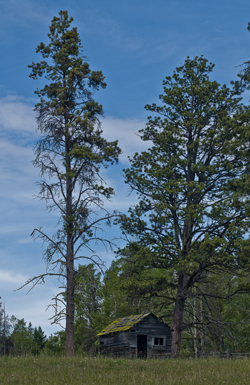
Cabin on the Kane Lake Road, B.C. (2011) Photo (c) Karen Abrahamson

I’ve come to view myself as one of the old ones that carries an old fashioned cognitive map of what my city should look like. Unfortunately no city planner understands what I’m talking about and hat no one but maybe an anthropologist or someone of my generation might understand my anger.

I wonder if the Inuit language contains a name for a silent landscape where no bird sings and all the houses look the same.


Knowing Where We Are in the World – and in Story

Knowing Where We Are in the World – and in Story

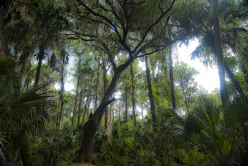
Cypress tree, Northern Everglades (2012) Photo (C) Karen Abrahamson

I’m currently working on two pieces of writing. One is the third novel in the Terra Trilogy and the other is the third installment of the Ice Dragon Series of short stories. Working on these two projects has made me question how I know where I’m going and how do I know where I am in relation to everything else in both these stories. It brings to mind the question of how we know, in our real life, where we are in relation to the rest of the world.

In this day of GPS and mapquest etc. this might seem like a very easy question to answer, but it wasn’t always this way, just like I wasn’t always able to have a sense of where I am in a story. Yes, surveyors took it upon themselves to survey the world. Countries (and scientists) agreed on the prime meridian that impacts all our time zones. But the 20th century has primarily been concerned with improving the precision of mapping and in particular with ensuring the pinpointing of places on the map in relationship to the rest of the world. The US Geological Survey was involved in this through most of the 20th century.

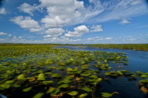
Waterlilies, Northern Everglades (2012) Photo (c) Karen Abrahamson

Why is this important? Well, think about it. Without standard understanding of how everything relates to everything else, weird things happen, like bridges getting built from each shore that don’t meet in the middle, or highways that have weird jogs in them because the measurements allowed the two ends to miss each other. It might not be important to you, but the cost overruns of such mistakes make having a common context for measuring everything important because it stops these types of things from happening.

In North America, the result of the surveying is those nice little brass discs (known as monuments) set in concrete or rock dotting the landscape . Each of these little brass discs serves as a known point for all subsequent surveying in the area. How did they know the individual location of these monuments? They took meticulous measures of distance through triangulation surveys and also measured the azimuth—the direction of Polaris—to set each monument’s position.

Throughout America, broad swaths of land were surveyed independently to create grids of known locations. They measured locations not only horizontally across the landscape, but also vertically, in relation to sea level, but the challenge was knowing that all these grids fit together. The result was the selection of a single monument at a ranch in central Kansas, Meades Ranch, as point zero for all grids across the country. Meades was chosen because it sat centrally in the US and it lay close to the crossing of two major survey lines across the US – one from Canada to Mexico and the other from the Atlantic to Pacific Ocean. Interestingly, today Meades Ranch has been superseded by global positioning that uses the center of the earth as the central point of reference.

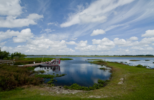
Airboat docked in the Northern Everglades. (2012) Photo (c) Karen Abrahamson

The use of that central point for mapping draws me back to my thoughts on plotting a novel or story. I once heard the wonderful writer, Nancy Kress, talk about plotting. Now I don’t know how you feel about plotting—some people are all for detailed plotting of everything in a novel, while others prefer to fly by the seat of their pants (Pansters) and write into the mist of their imagination. Nancy Kress seemed to offer a third alternative that didn’t hold a writer’s imagination down, but also gave some structure to writers so that all that lovely mist didn’t turn into a dense blinding fog. Ms. Kress suggested that writers need to write down what they think is going to happen in the novel. Just brainstorm them out. Ask yourself what is the beginning (the inciting event) and what is the midpoint (quiet often a reversal of some sort), and how do you think the story will end (the climax)? Once you have those key points identified, you can easily place them on a plot line and them locate all your other plot ideas on either side of the midpoint—a lot like being able to measure your location from Meades Ranch.


Rhumb Lines, Novel Writing and How to get from point A to Point B

Rhumb Lines, Novel Writing and How to get from point A to Point B

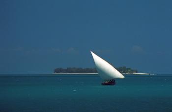
Dhow in coastal waters off Zanzibar Island (1994) Photo (c) Karen Abrahamson

As I mentioned in a previous post, I’m in the midst of a year of writing sequels. Actually it may take two or three years to get through all the sequels needed for my current novels. As I have already mentioned on this blog I’ve found writing my first sequel a bit of a challenge even though I knew where I was going. It seemed that I kept straying off course.

This puts me in mind of the challenges mariners had back before Gerard Mercator created his famous projection in 1569. A projection is a way of taking three dimensional landforms off of a globe and placing them onto a flat surface (a map) while retaining relative conformity of shape and relation between the landforms. What Mercator did was take meridians of latitude and longitude and make them all aim straight north-south or east-west creating 90 degree angles at each intersection. Sure it expanded the landforms closer to the poles, but it also gave mariners a means of plotting courses over long distances.

Picture this overlaid on top of a typical world map with latitude and longitude laid out.

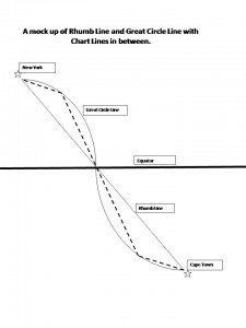
You see, prior to Mercator, mariners shared two fears – bad weather and getting lost. (Actually I share their fears, the latter most particularly when I’m writing.) In the years before Mercator’s projection, mariners had generally confined their sailing to the Mediterranean and coastal waters. The transatlantic voyages to America were done by the stars, but there were no helpful portolano (mariners maps using compass roses to show sailing routes) of the great oceans. Mercator’s grid made sailing the open ocean as easy as sailing the coasts because it gave sailors a means to chart a straight line (a rhumb line) from Point A to Point B across the ocean. From this they could plan their headings and make their voyages.

Of course sailing the distance from Cape Town to New York is about as huge an endeavor as writing a novel (or a sequel) from page one to the end and neither route actually takes a straight line. Sailors travelling that distance recognized that they didn’t travel a flat earth, they travelled a globe and so they added to their calculations, the curve of a great circle that was the largest circle they could draw through a sphere and this route showed the actual shortest distance between two points. Sailors then chose their routes by drawing straight chart lines between the great circle and rhumb line that allowed them to approximate the great circle along the route.

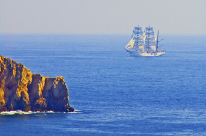
Tall ship off Portuguese coast (2006) Photo (c) Karen Abrahamson

This seems a lot like the process I use when I’m writing. I know where I start and I know where I want to finish (most of the time). The writing process then becomes one of deciding how far to travel from the rhumb line (the plot or the backbone) of the story, for it seems to me that novels have great circles, too. These are the themes you are writing about and you don’t want to allow your plots to take over, so that your story is nothing but plot, but neither do you want your subplots to take you so far out of your way that the story no longer fits within its themes. And that’s where sailing and writing diverge in their process. Sailors use the great circles and rhumb lines to plot their course and they follow it from Point A to Point B. A writer, on the other hand, will use them to plan their novel or their series of novels, but also to look behind and check whether they have wandered too far off course to get to their final destination. This is the challenge in sequels: viewing the second or third book as just one of the charted lines between the rhumb and the great circle, building its way to the ultimate end of the voyage.


In Search of a World Map

In Search of a World Map

This week I finished the second draft of book two in my post apocalyptic fantasy, Terra Incognita, series. It wasn’t easy because it required a fairly major rewrite of much of my major character’s attitudes and motivations because I hadn’t mapped my character out from book one to book three. As I get started on Book Three, I’m thinking about how the importance of a consistent road map across a series of books is just as important as a consistent map of the world.

My last post spoke of the work done to standardize measures in mapmaking that led to the creation of the scientific metric measuring system. But the creation of the metric system was only the start in a venture to create of a consistent set of maps of the world. This might not seem sexy, but think about traveling to a different locale and finding the maps you are using don’t use consistent measurements and contradict each other. You end doing a mass of translations to make the maps work or you might end up throwing the maps out because they are so inconsistent it’s easier to simply start from scratch. That was the situation for many explorers because the maps they had might have used a consistent measurement scale (but not always), but were also based on measurements started from different starting points. In other words the Prime Meridian had never been agreed upon.

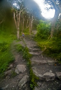
The trail turns upwards (2011) Photo (c) Karen Abrahamson

After the agreement about the metric system, there were still disagreements in the cartographic world. One of the major ones was the position on the earth from which meridians (the imaginary lines drawn on the earth from pole to pole that connect all spots along the longitude) should be referenced – in other words where was the zero point on the globe from which all other distances would be measured. To this point in time, where measurements began depended upon the nationality of the scientist conducting the measurement.

The need for a Prime Meridian had existed for all Cartographers. Ptolemy had chosen the Fortunate Islands – at his time the westernmost extent of the world. But the age of politics had national sentiment taking precedent with the French recommending the zero point’s location in Paris, the Spanish recommending either Toledo or Cadiz, the Italian Pisa or Rome, and Americans wanting Washington or Philadelphia etc. It took the International Meridian Conference in 1884 to settle on Greenwich as the Prime Meridian which gave us our zero longitude, and also set our clocks and time zones with Greenwich Mean Time.

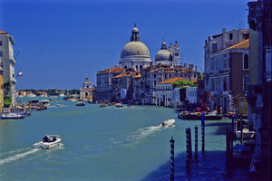
Venice's Grand Canal (2004) Photo (c) Karen Abrahamson

A later conference of the International Geographic Congress realized the mapping issues I mentioned above meant that there was a need to revise the world’s maps to create a consistent map of the world. It led to a proposal for an International Map of the World that would all be drawn to a single scale – 1:1,000,000 (1 centimeter =10 kilometers or 1 inch equals 15.78 miles) – leading to the name of the project being the Millionth Map. It would also be drawn using standardized symbols and colors. The project was debated for a period, but after examples of the maps were produced, in 1913 an agreement was reached. Maps were to be created for each 4 degrees of latitude and 6 degrees of longitude, not paying attention to national boundaries. All place names had to use the Roman alphabet.

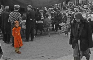
Little Uigher girl, Sunday Market, Kashgar, Western China (1997) Photo (c) Karen Abrahamson

It was a slow process. Between 1913 and the start of the First World War only eight maps were produced out of a total of 2,500 required to map the world. Between 1921 and 1946, the American Geological Survey produced the 107 maps that comprised the map of Hispanic American (North and South America). By the 1930s 405 maps had been produced in total, but the central repository of the maps (in Paris) was largely destroyed during the Second World War. In 1953, the United Nations assumed responsibility for oversight of the project, but by the 1980s only 800-1000 maps had been completed and many were not completed using exactly the same standards. Since then the U.N. has stopped even reporting on the project, so after all this work the Millionth Map languishes and who knows when you’ll fall right off its edges when you visit another country and have to work with maps that don’t mesh.

This suggests that I had better get busy and piece together the latitudes and longitudes of book three in my series, so that all of the books provide a complete and consistent picture of Terra’s world.


Living like a Writer: Guilt, and How I Spent My Summer Vacation

Living like a Writer: Guilt, and How I Spent My Summer Vacation

This past summer I had the ‘interesting’ experience of living like a writer. My day-job contracted work dried up and I basically had no work for July and August – except my writing. Nothing to do except sit in the sun, walk my cats (yes, on a leash), and the business of writing. Sounds like a lovely dream, doesn’t it? Yes, it was, but it also involved a heck of a lot more discipline and work than most people would have thought. And that’s why I’m writing this post because living like a writer isn’t just sitting staring out a window and typing when inspiration strikes, the business of being an independent writer requires deadlines and non-writing work and most of all, an awful lot of self talk. So what did my writing summer entail?

1. Setting Goals – I knew in June that my contract work was going on hiatus, so I spent some time planning. I also (thankfully) spent a wonderful few days at the Think Like a Publisher workshop put on by Dean Wesley Smith and William Scott Carter where I developed an even more detailed set of goals for my summer. The thing that was interesting for me, is that the plan wasn’t rocket science and yet I’d had a heck of a time setting as detailed a plan for myself. Critical to the goals was making sure there was time for both writing and the business of writing. Setting this plan was as simple as creating two columns on a piece of paper, one with the writing goals and one column for the business of writing goals. The writing goals came first, but just having all the goals written down gave me a sense of clarity and I could plan my months ahead easily.

2. Setting up a schedule- I’m used to this, because being self employed, if I don’t set up a schedule things like my writing will never get done. My summer writing schedule involved getting up every morning and writing for at least two hours and possibly more depending on what I was working on, or where I was in the project. The schedule also built in reading time, exercise, social time and the BUSINESS.

3. Learning the Technology – As I’ve ventured down the self-publishing road, I realized I needed to understand a lot more than how to structure a novel. I needed to know better how to format and publish books both in e- formats and also for print on demand. That meant learning how to use not only electronic publishing formats, but also how to use programs like InDesign and Photoshop with more ease.

4. Learning the Business – This involved delving into a number of different areas, from how to blog more effectively (still working on that), to how to connect with others on social media (yes, I finally started to use Twitter though I still don’t fully understand it), and marketing.

So now that September is here, it’s time to review how I did and what I learned:

I accomplished my writing goals for the summer which were to complete a novel started I started in June, as well as two novellas. (Unfortunately one of the novellas wants to grow up to become a novel, so back to the drawing board on that one.) What did I learn? That my proclivity to write long still haunts me, but I can still maintain a schedule of writing even when I’m also involved with the business. This was a revelation for me, as I have spent the last few years struggling to maintain my creativity while also keeping up with the soul-sucking process of traditional marketing.

I accomplished my business goals as well: I had three novels that I wanted to have e-published as well as three short stories. All of these have been published. As well I wanted to have one novel published in print on demand. I actually achieved more than this and managed to have three novels approved and available for POD.

I updated my websites and found better ways to display my books. I established direct sales bookstores for my print publications and went through the hassle of obtaining ISBNs from the Canadian Government for my print books. I arranged for the development of a specialty website to fit with a series of fantasy books I write.

All of this filled my days so that aside from an hour or so exercise every day, I really wasn’t laying around in the sun. Better for my skin anyway, I suppose.

But perhaps the biggest accomplishment this summer was learning what it takes to be a writer, both financially and mentally. Financially, it meant that my spending had to cut right back, because I didn’t want to dig too deep into my savings. Mentally it meant that I had to recognize the legitimacy of what I was doing. I was writing. I was in business. But you know what? Even knowing that I was working at something all day at least five days a week (and usually seven) I still experienced a strange phenomenon: Guilt.

Guilt that I could be doing something I loved so much, while everyone else still had to go to work. And I wasn’t on vacation! Now that it’s September and my contract work is back in full swing, I really would love to go back to dealing with that guilt again. Now to set goals for the winter (and hope my contract work dries up again next summer).

Free Fiction

Free Fiction

This week’s story is a  humorous mystery called The African Queen.

A first date, a crime and a geeky video store clerk who channels Humphrey Bogart. Welcome to the jungle Casey Bigelow. Click Here.

Puno: Leaving Things Unfinished

Puno: Leaving Things Unfinished

I wasn’t sure what I was going to write this blog about because I saw so little of the Lake Titicaca area, but perhaps that’s the point. Sometimes things get in the way of best intentions and we either can’t or just don’t get the job finished for whatever reason. This certainly happens in writing, when health or other life issues get in the way. So I guess this is my turn. Just in case anyone was worried, I seem to be fine. The high blood pressure meds seem to have done the trick and I am going to get checked out before the Machu Picchu climb. But that’s all fodder for a next post.

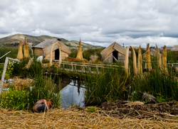
A village of the Isla Uros, Puno, Peru (2011) Photo (c) Karen Abrahamson

Let me tell you about Puno.

Puno sits on the shore of Lake Titicaca, running up the sides of a number of hills that roll down to the great northwestern bay of the lake. My bus arrived in the night, so we crammed three of us (from the bus) into a shared taxi to get to our various hotels. All well and good, until we left the bus terminal and headed into the streets. Think narrow enough two cars can’t pass. Think congested with cars, trucks, motorcycle-taxis that they call ‘chilos’, as well as bicycle rickshaws. And pedestrians. Don’t forget the pedestrians. Masses of them, blithely passing between the vehicles. In the night everything smelled like car exhaust , and the air was glossy with mist off the lake. And pollution. OK, I thought: this seems rather Dante-esque, but it was night and I was tired and so I let it pass, because I’d seen worse in other countries.

The next day, the day I finally saw the doctor, I went out for a walk. Grotty was about the best I could describe it. Now maybe it was me – I was unstable enough on my feet I actually got lost twice – and I rarely get lost, but the city seemed in a perpetual state of being unfinished. Everywhere you looked there were brick buildings with iron poles sticking out of the roof awaiting the next story. Even my guest house, which was up-scale on the scale of guest houses I’ve been staying in, had its courtyard dug up and the front entrance perpetually stuck in a heap of dirt-cum-mud.

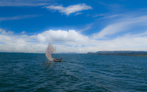
FishingSailboat on Lake Titicaca, (2011) Photo (c) Karen Abrahamson

Not impressive, to say the least. Not a place you’d want to spend any more time than you had to, even though the streets were filled with delightful ladies in traditional bowler hats and absolutely everyone I had contact with was wonderful. My plans for Puno had been to use it as a base to do research farther afield. I had planned to go out to one of the islands in the lake and live there a few days, but given how I was feeling it seemed like a particularly stupid idea to put myself that far from a doctor.

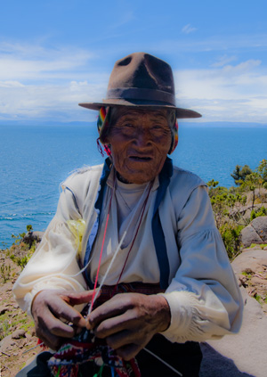
One of the knitting old men of Isla Tranquile, Lake Titicaca, Peru (2011) Photo (c) Karen Abrahamson

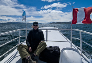
So instead I did what I never do: I booked into a – dare I say it – a tour. A one day tour out to Isla Tranquile. I figured there was no way they were going to stress me out, and I could at least see something of the lake.

Of course I was wrong.

A wonderful day – brisk wind, blue skies and the scent of wet mud you get from a marsh as we first visited the floating islands of Lake Titicaca. These are islands built of a layer of matted root and then heaped on top with reeds. Whole towns exist on these islands. And if you don’t like your neighbor, you just pull up your ten anchors and float away to Bolivia. Think about how easy ending a marriage would be!

From there we headed to Tranquile. I’m picturing a landing, a light walk and lunch. The real picture relates to the fact that Tranquile is basically a mountain. So we land, and I’m looking at an uphill climb. Way uphill. We have to reach the top for our lunch. And of course I’m carrying about 35 pounds of camera equipment that I will not leave unchaperoned on the boat.

Looking back own the flank of Isla Tanquile (2011) Photo (c) Karen Abrahamson

At 14,000 feet this was not an easy hike, but the panting was worth it. Isla Tranquile sits in glacier-blue waters, its steep sides terraced with green, and laced with gold flowers. The sounds of birds and the call of children fill the air. The old men sit knitting (Tranquile is a UNESCO site for its fine fabric weaving and knitting) and its women constantly spin a weaving bobbin. You see them everywhere and they produce absolutely beautiful knit wear. The island is also famous for its gender roles. Men gain their worth by having a wife gift them with many handmade purses. The women cut their hair and weave it into a belt for their future husband. They also cut their hair to produce long falls that the men wear in ancient, Andean ceremonies. When you look at these faces, they have the same high cheek bones and hawk nose of the Incans and some say that Lake Titicaca is where The Inca – the first Inca – came from.

Which brings me back to Puno. I felt bad to leave the city without exploring it better. I climbed on the bus this morning feeling something of a failure, because I don’t like to leave things unfinished. Which is perhaps why Puno’s appearance that the whole place was under construction or reconstruction left me so unsettled.

But I learned from the guide on the bus that my perception was correct. Apparently the government of this department (state) only requires citizens to pay taxes on a finished house….

So I’m holding to that: Like the homeowners of Puno, sometimes in writing and travel it pays to leave things undone.

On the rooftop on the way to Isla Tanquile (2011)
Security and Travel –It’s not just the dangers of the road

Security and Travel –It’s not just the dangers of the road

Sorting through the last few things I need to do for Peru, I’ve realized the numbers of actions I take to ensure security of myself and my belongings during travel and I thought they might be of value to others.

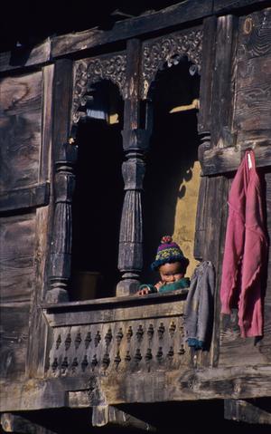
Child at a window in Kalpa, Northern India (2000) Photo (c) Karen Abrahamson

Thinking about security begins at home, because bad things can happen there while you are gone. Thieves work here as well as they do in a foreign country and if there is any chance they can learn you will be away (and there usually is) then you need to ensure your home is protected. Sure, you can cancel the newspaper and put in timers for lights, but the very fact you cancel your paper, or put a hold on our mail means that you’re sending a message into the universe that you’re not home.

In my situation, I took care of part of the concerns by having someone live in, but that isn’t always possible. My parents have had to deal with this a number of times when they have gone on extended trips. Often home owner’s insurance doesn’t cover you for extended absences. You need someone either in the home or checking the home frequently. This is especially the case in the cold weather months when a winter storm could mean a power loss and frozen pipes and flooding. Not what you want to come home to, especially if insurance won’t cover you because you haven’t had a house sitter while away.

The other consideration, especially when you have someone coming into your home, is to make sure your valuables are safe. For example, though I trust my cat sitter with their wellbeing, I know of others who have had house sitters and have found changes at home like computers reconfigured, and items missing. Worst of all are the creepy stories of someone rifling through your underwear and other private stuff.

To deal with this there are a few things I do. First, I always ask trusted neighbors to keep an eye on the place. Second, I remove everything of significant value like jewelry and either leave it with trusted friends, or place it in a safety deposit box. Along with the jewelry go my external hard drives for both my business and my writing computers in the hopes that even if the ‘Big One’ happens something will survive. Beyond my house and home, I also ask a neighbor to check my car and to start it a couple of times for me while I’m away. In the best of all worlds they would also take the car for a drive because it’s hard on the tires to be in stationary for a month. Last of all, I only give the house-sitter the minimum necessary keys and make sure I get them back immediately when I get home.

Okay. Home is safe. I hope. And the cats will be taken care of because I have left a long list of instructions and also have other people checking in on them.

That leaves me in another country, or in transit. With a backpack I used to always padlock the pack closed, but since 911 this doesn’t work. You are likely to find the lock cut off your pack and you in a foreign country with no solid lock. As a result I don’t lock the pack for the flight, but I do place it inside another bag, thus making it more trouble to break into. What I have is a large lightweight bag that can be broken down easily and stuffed into the bottom of my pack. This bag protects my bag from casual pilferage during flights into dodgy airports and also protects the backpack straps from getting caught in conveyor belt machinery.

When I’m traveling on foreign ground, I have a padlock for the pack’s top opening and also a bicycle chain so that the pack can be chained to something in my hotel room or to my bunk or seat on a train. I also carry electrician’s tape in case someone knifes the pack. The tape can fix just about anything.

For myself, I usually carry most of my traveler’s checks and cash in a money belt or pouch. Depending on the trip I might take both so that not everything is in one place. I also often wear a cross-shoulder purse which could be a target for thieves, but I wear a mesh photographer’s vest over the purse strap, so it isn’t exposed to knives. Finally, perhaps the best protection of all is confidence. Read your maps ahead of time and look confident and like you know where you are going when you are on the street. When you climb in a taxi on a dark night in a new city, make sure you have a map out and visible to the driver and act like you know where you are going, even if you don’t. This makes the driver less likely to drive you around to bump up the cost, or to drive you to places you don’t want to go. If you are arriving late at night, like I am, often you can arrange for the guest house or hostel to even pick you up at the airport. 

Dhamayagyi Phato, the Pagan plains (1997) Photo (c) Karen Abrahamson

So there I am. I’m not pretty, but I’m as secure as I can be and I’m as ready to travel as I’m going to get.

I’ll be in touch next from Lima.

Money: Or horses are like tomatoes (and cats are, too)

Money: Or horses are like tomatoes (and cats are, too)

This blog is about money. It may be very short. Or long.

You see, money and I have a long and troubled relationship. Yes, I’m doing okay at the moment, but it hasn’t always been so good. I can recall winters of eating mostly potato soup, or venison the neighbors donated to me and my spouse. I still remember the night our ‘house’ almost burned down when the wood heater (we couldn’t afford a furnace) overheated. The house? A converted garage cum chicken coop (not kidding). So I’ve seen some good times and some bad and right now things are less bad than others so I’m doing the not-too-smart thing and running off travelling. I guess my mom didn’t teach me so good.

So what does this have to do with travel and writing? Because I’m planning out the money for my Peru trip a number of money rules have started reverberating in my mind. I thought I’d share some that relate to travel and writing.

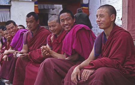
Tibetan monks after ceremony, Labrang, China (1998) Photo (c) Karen Abrahamson

My writing mentors, Dean Wesley Smith and Kristine Kathryn Rusch have some wonderful blogs about writers and money. One of their major rules that all writers should remember is that ALL MONEY FLOWS TO THE WRITER. What this means is that writers should not be paying faux publishing companies or shady agents to edit and revise the writer’s manuscript. True enough. Those scam artists who offer to publish your book if you only send them cash, are preying on new writers who don’t know that rule. But in this day of digital self-publishing a variation on the rule is, Money flows to the writer unless you are paying someone to edit your manuscript for self-publishing to ensure that you are publishing the highest quality possible. It might also mean that the writer who doesn’t want to learn how to make book covers, spends some money to have a creditable cover made for the book.  Any writer prepared to do this needs to consider how long it is going to take to recoup the dollars spent, but also consider whether their time is better spent doing what they do best – namely writing.

All well and good, but unfortunately the rule with travel is that ALL MONEY FLOWS FROM THE TRAVELER. First there was the cost of the jacket I wrote about. Then there are new hiking boots (mine just died), and then there are the things like camera memory cards etc. Those are all the sundry costs before you go.

And then there is the cost of travel. As a relatively seasoned traveler, I like to plan for costs before I leave, because I don’t like depending on plastic when I’m overseas. First of all there’s the fact plastic runs up debt. Then there’s the fact that overseas use of credit and bank cards is more prone to problems. Picture this: In Delhi I went to my bank (an international that has branches almost everywhere) and plugged my bank card into their bank machine. Said machine eats card. On a Sunday. In the afternoon. Monday I call said bank and am told that said card had been reported stolen. I ended up spending almost 24 hours phoning my branch back home to get things sorted out.

Nope, cards are great backups, and cash may be good to get the best rate in exchange, but give me a good old traveler’s check any day. American Express or Thomas Cook are my best friends when I travel and are less tempting to thieves, as well.

But budgeting for travel can be a problem. I always plan for my expected costs and then double the amount , but even that has left me high and dry a couple of times. For instance in Cambodia, two years ago we budgeted about $2,000.00 for a bit over a month. I suppose that would have been fine, except inflation had hit Cambodia and everyone wanted everything paid in American dollars. Cash. I was never so happy to get back to Thailand where the costs seemed more manageable and we could use plastic because the time in Cambodia had eaten up the money faster than I’d figured. So rule three and four: ALWAYS EXPECT TO BE OVER BUDGET and ALWAYS HAVE A CONTINGENCY.

In the same vein, expect there to be times when travelling cheap is just too painful. I recall sitting in a grotty hotel room in a town in central China after a nightmare journey down the Yangtze River. My traveling companion and I were both close to tears and the thing that held us together was the fact that the next morning we knew we had the cash to lug our backpacks down the street to the nicest hotel in town (even with a swimming pool). When you travel YOU MUST BUDGET ENOUGH MONEY TO ALLOW YOURSELF TO RECOVER. Travel is hard. Backpacker travelling is even harder and if you don’t build in a comfort buffer you will find yourself hating your trip and travel. That’s not what it’s all about.

My last rule comes to me from a previous spouse who might have never travelled but he was wise in common sense and the way of horses. He was an old cowboy and superb horseman and he told me that horses are like tomatoes: they are just as perishable and just as easily ruined. Hard to believe, I know, but a 1,500 lb equine is so darned prone to injury and illness that they can go from magnificent dressage horse to fox feed in next to no time. Illustration: A very good hunter jumper mare cast herself upside down in a ditch on my property. We got her out, but the poor thing was exhausted. Did she just stay down until she regained strength? Oh no. She fought to get to her feet – so hard she broke her leg. So I learned the hard way to insure my horses and now, believe it or not, I have medical insurance for my cats, too. It has paid off,  because Big Ben has already had far too many misadventures like shattering a toe in his carry cage.

Humans are no different. So the last thing a traveler wants to do is be caught somewhere having to shell out big bucks to cover medical costs. My parents had a lovely trip to Palm Springs end on an unfortunate note when my mom had heart troubles and ended up hospitalized. On my trip along the Silk Road an acquaintance on the bus behind ours had his arm shattered when his bus went off the road. Thus my last rule of travel is ALWAYS TRAVEL WITH MEDICAL INSURANCE. Let me leave you with my litany of past injuries and illnesses as illustration:

• Tropical ulcers in East Africa that required medical attention and frequent debriding (something you do not want to go through) and antibiotic shots for months.

• Food poisoning in West Africa that required my hotel staff to bundle me up and get me on a plane out.

• Food poisoning in Burma that (thankfully) required nothing (except a very rapid-fire rejection of the food).

• Two sprained ankles in China that made the next month and a half a nightmare ride.

• Walking pneumonia in India.

I hate to think what it would have cost if I something REALLY bad had occurred.

I guess I’d better be careful hiking the Peruvian mountains.

Recent Fantasy

Available HERE,

$1.99

Available HERE,
$3.99

Available HERE $1.99


Recent Mystery


Available HERE
$4.99


Available HERE,

$4.99


Available HERE,

$4.99


Available HERE,
$4.99


Recent Romance

Available HERE, $2.99