Tag: Northern Gateway Pipeline

Maps, Klondike Gold and Northern Pipelines
Maps, Klondike Gold and Northern Pipelines

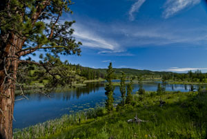
One of the Kane Lakes, Central British Columbia (2012) Photo (c) Karen Abrahamson

I’ve mentioned previously how maps are actually an argument on paper to convey, or propagate, a specific belief system. A good example of this was seen in the late 1800s during the famed Klondike Gold Rush that lured many a man (and woman) north to what was then viewed as the last frontier on the continent.

In the early 1880s little was known of the geography and geological wealth of the north but, extrapolating from gold strikes in places like Cassiar, British Columbia, there were rumors abounding of what might be found. As a result of the lack of real information, the Geological Survey of Canada sent surveyors north and by 1887 a report, with maps, had been completed that outlined the territory’s geological features and mining prospects as well as its geographical features. The report went so far as to predict gold finds in the Yukon and in 1896 that came true, with the discovery of placer gold on Rabbit Creek.

The resulting gold rush led to a demand for maps of the area. When the Geological Survey ran out of official maps, private companies and cities and towns took over. All of them wanted their piece of the Klondike pie, so many cities and private operators developed maps of the Klondike that presented their city, or their route as the best-easiest-most direct (you choose which) way to get to the north. They couldn’t all be right, so of course, they lied or at least doctored the truth to be in their favor.
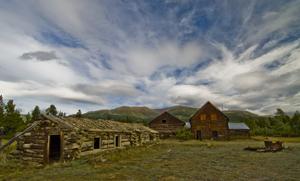
Old farmstead, Yukon (2009) Photo (c) Karen Abrahamson

Case in point were maps that gave the impression it was only two or three days from Edmonton to the Klondike, because the prospector just had to navigate two waterways and they would arrive at their destination. Other maps skewed the projection of the earth (a projection is used to take the landforms of a round earth and place them on a flat map. Every projection skews the land formations to some degree, but different projections can be used to make different part of the land look larger or smaller). These new maps emphasized the huge distances of some routes and made others look shorter. Of course they also failed to mention things like mountain barriers or the high costs associated with steamer passage across lakes that blocked the short way to the promised land.

Which brings me back once more to the Northern Gateway Pipeline. While Enbridge and the Canadian Government show maps of the pipeline route and claim that it will be built to withstand the rigors of northern British Columbia and will pose limited risk to the landscape, the fact is that they haven’t even allowed a full environmental assessment of the area the pipeline proposes to cross. The trouble is, we’re unlikely to ever have such an assessment, because the Canadian Government has failed to provide its scientists with the resources (time, staff, funding) to complete such an assessment within the time the Government’s process now allots.

As a result the rhetoric on safety and responsibility we’re hearing from the Canadian Government sounds an awful lot like the maps to the Klondike from Edmonton. A road trip of two to three days of easy travel.

Right. And we’re supposed to believe it.

The government seems to be hoping that, just like gold on the Klondike did to prospectors, black gold to be sold to China will inflame our imaginations and distort our knowledge of geography – and make us believe anything.

Not going to happen, Mr. Prime Minister.
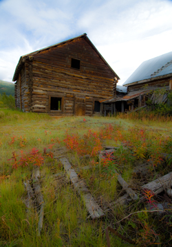
Old homestead, Yukon (2009) Photo (c) Karen Abrahamson


Mystical Dunvegan and the Northern Gateway Pipeline

Mystical Dunvegan and the Northern Gateway Pipeline

Along Kane Lake Road, British Columbia (2012) Photo (c) Karen Abrahamson

The furor in British Columbia about the proposed Northern Gateway Pipeline got a little bit more interesting this past week. First of all we had Enbridge providing the public with maps of the coastal route to be used by oil tankers. Those maps conveniently left out all the islands and difficult narrow ocean channels those same tankers would have to navigate. Then we had the announcement by a B.C. newspaper mogul that he was exploring the potential for building an oil refinery on the Northwest coast of BC. His rationale was that with so many people concerned about oil tankers travelling the treacherous and pristine British Columbia waterways, why not process the oil in BC, create new jobs, and only ship processed gas and diesel. This would alleviate some of the concerns over a potential oil spill as both gasoline and diesel are easier to clean up and don’t pollute like oil does. Of course the reaction has been mixed. Even the oil companies aren’t sure they like his alternative, but Enbridge’s maps and the newspaper mogul’s vision put me in mind of the ‘town’ of Dunvegan.

Abandoned Yukon Homestead (2009) Photo (c) Karen Abrahamson

I say ‘town’ with parentheses because Dunvegan was never actually built, but in the saga of Canadian maps it has a place of ignominy. You see, as the Dominion of Canada was busily surveying and dividing the country to encourage development it led to a boom in land speculation. These high stakes games were trying to anticipate where the next great land boom was going to take place. Dunvegan seemed like a likely place.

Located six hundred and fifty kilometers north of Edmonton, Alberta, Dunvegan was a convergence point for a number of native trails and a regular route for explorers and map makers. Indians camped there. Two creeks met there. A fort was built at the location and provided a jumping off point and point of safety for missionaries, explorers and homesteaders. Dunvegan became one of those mystical places on the map like Finisterre was to the pilgrims on the Camino de Santiago in Spain and France.

So much did Dunvegan enter the public consciousness of the day that it was included in the name of the first railroad to the Peace River in British Columbia, the Edmonton-Dunvegan and British Columbia Railroad. The trouble was, the railway never actually ran to Dunvegan. This was never mentioned in all the real estate material selling land to Englishmen and Easterners. Nope, the material and the maps showed the rail running to the town. Along with the railway the maps showed wharves along the waterways and development. But that wasn’t the only problem with Dunvegan. The many maps of the town being used to sell the land to the unwary, showed quarter sections of land without bothering to mention the topography. Think vertical cliffs and steep drops. Though the land was sold to many, not one lot was built upon because of the many difficulties.

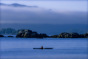
Kayaking Clayoquot Sound, British Columbia (1996) Photo Karen Abrahamson

Which brings me back to the proposal for a pipeline and a world class oil refinery on the north coast of British Columbia. Sure, you could build the refinery, or you can talk about it, but such a refinery is dependent upon a pipeline across the same type of terrain that turned back the land investors in Dunvegan. I like to think that unlike the unsuspecting purchasers of land in Dunvegan, the British Columbia public won’t be taken in by maps and rhetoric that enhance non-existent amenities and that minimize the dangers that do.


Maps, Highways, and Their Imprint on The World

Maps, Highways, and Their Imprint on The World

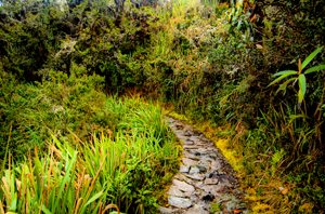
Path through the rain forest on the Camino Inca, Peru (2011) Photo (c) Karen Abrahamson

The ancient T.O. maps didn’t represent reality, but they did map the reality of the Christian spirit at the time. Portolan Charts gave a realistic representation of coastlines and the work of the Indian spy/cartographers, placed rivers on the maps well before aerial mapping existed.

One of the last bastions of ‘unmapped’ territory was the Amazon basin of Brazil. In 1799 Alexander von Humboldt, the son of a Prussian baron, spent five years travelling from Venezuela’s Orinoco river through the Amazon, collecting specimens and surveying. Afterwards he produced 33 volumes of maps and illustrations. That was the last mapping for over a hundred and fifty years except for the occasional scientific or rubber company exploration.

Until 1970.

That’s when the Brazilian government got the idea to construct a highway from the Atlantic Coast, across 5,000 kilometers (about 3,400 miles) of rainforest to the Peruvian border. The construction was a nightmare due to a dearth of maps. The rainforest had too many clouds and—gee, rain in a rainforest?—for aerial mapping to work. The result was construction following ground-based surveyors who were barely ahead of the bulldozers and this led to the construction having to cross the same river multiple times leading to enormous unforeseen costs.

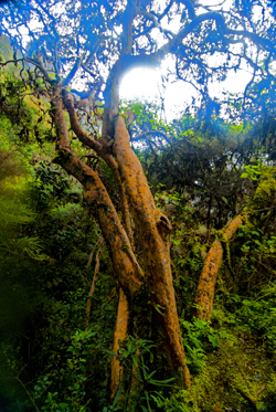
Cloud Forest tree along Camino Inca, Peru (2011) Photo (c) Karen Abrahamson

Enter the cartographers. In this case it was cartographers and the invention of side-looking radar (SLAR). SLAR is an improvement on the radar that helped safe Great Britain during the Battle of Britain. It’s the invention that allows radar to be shot out the side of an aircraft to take long horizontal pictures of the landscape. This technology can ‘see’ through clouds and trees to the landforms. With the help of computers, SLAR can provide accurate pictures of the rise and fall of the landscape.

The survey team with their aircraft arrived in Brazil on the summer of 1971. In just under a year SLAR mapped the Amazon in 32-kilometer-wide swaths which lead to the first detailed maps of the Amazon and an understanding that this huge territory wasn’t the previously-thought Amazon “basin”. Instead they found that only about 20% of the area was lowlands, with most of the landscape being hilly and mountainous.

This ‘sped up’ the construction of the highway which was completed in 2011 except for a single bridge in the Peruvian part of the road. But what has this meant for the area? For some, it replaces weeks of travel on dirt roads to a relatively short drive. For others it promises income from a potential huge influx of tourists. But what it also means is environmental degradation.

Brazil has a long history of environmental issues springing directly from road-building into this relatively delicate biosphere. Previous road building shows that almost 90% of deforestation lies within 50 kilometers of a road (about 23miles). Timber and mineral extraction are followed by hydroelectric dam development and the destruction this causes.

What’s disturbing is that the Amazon is truly the lungs of the world and cartography has provided the data needed to seriously damage those lungs. It places a different perspective on maps; one that undermines the beauty of what I’ve always thought and suggests the need for ethical standards that stand up to the push of corporate greed.

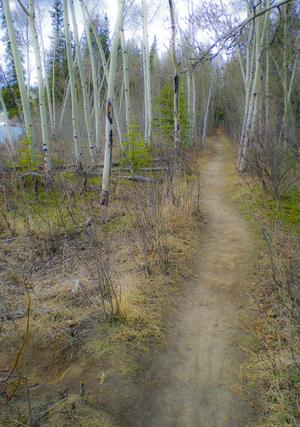
Path along the Yukon River. The quiet places like this are the ones lost in rampant development. (2010) Photo (c) Karen Abrahamson

There are means to ameliorate the potential destructiveness of developments like the Transoceanic Highway or the construction of pipelines like the proposed Northern Gateway pipeline through British Columbia, but it requires people like cartographers, citizens, and government officials to demand agreements that protect the environment BEFORE, planning starts. Otherwise ‘progress’ can just as easily lead to widespread destruction like what is happening in the Amazon.

The new maps of the Amazon not only map progress, but also the destruction of a reality. Unlike the T.O. maps of the Christians that cemented the Christian spirit firmly in Jerusalem, these maps not only mark destruction of biodiversity, but they record the destruction of the spirit of the indigenous people.


Recent Fantasy

Available HERE,

$1.99

Available HERE,
$3.99

Available HERE $1.99


Recent Mystery


Available HERE
$4.99


Available HERE,

$4.99


Available HERE,

$4.99


Available HERE,
$4.99


Recent Romance

Available HERE, $2.99