Tag: Japan

Maps, Shakespeare and Melville- One Year Later

Maps, Shakespeare and Melville- One Year Later

Rajasthani girls with Mendhi on their hands. (2000) Photo (c) Karen Abrahamson

Exactly one year ago I wrote my first blog about maps and decided that I would write a series on that topic– maps, their history, the people who made them, and how maps have been used by people. I did this because maps are integral to the series of books I write in the Cartographer Universe and I wanted to understand more deeply what maps have meant to humankind.

What I’ve come to understand is that maps can be a truth, a lie and a metaphor. They can present the ‘reality’ of the physical world—the mountains and rivers and roads and cities and can inspire men to superhuman acts just to complete a map. Just as often, though they represent lies or half-truths—the imaginary island of Brasilia, the shifting landscape of Prestor John’s Kingdom or, more overtly, contorted landscapes intended to lure the unwary into towns, gold fields and department stores. And that’s a problem, because we tend to think of maps as representing the truth and we don’t  approach maps with a ‘use at your own risk’ mentality or with the realization that any map may only represent the reality that the map’s maker wishes to represent. They’ve been used this way for centuries, so that the modern-day Chinese maps which change the location of major city thoroughfares to stymie the advance of any potential invasion are only an extension of the same tradition that caused British mapmakers to make erroneous maps of the West Coast of Canada (presumably to stymie the work of Spanish spies), and the Portuguese and Dutch Kings who kept secret their routes to the spice islands.
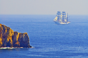
Ship off the Portuguese Algarve, (2005) Photo (c) Karen Abrahamson

But maps are much more than simply tools to convey or obscure information. Maps are a part of our psyche so deeply engrained that the map metaphor has seeped deep into our culture. Cervantes wrote ‘Journey all over the universe in a map, without the expense and fatigue of travelling, without suffering the inconveniences of heat, cold, hunger, and thirst.’ Shakespeare wrote “In thy face I see the map of honor, truth and loyalty.”
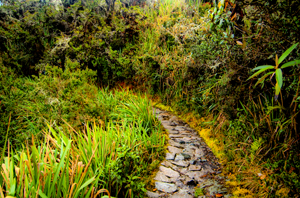
The Camino Inca Trail to the sacred city of Machu Picchu. (2011) Photo (c) Karen Abrahamson

But maps themselves are not truth, but metaphors. Once, in Fra Mauro’s time, they represented the mythical extent of man’s imagination and potential. Once, they represented the adventure, the spirit of mankind in the terra incognita of the empty sections of the map. Nowadays they represent the world as governments want it to be when they represent contested borders (think the current battle over islands between Japan and China, or the oil-rich islands in the South China Sea that three countries claim). Maps are used to represent presidential aspirations, shifts in battlefields, oil pipeline routes, and enemy and friendly countries—not that these presentations are the truth, but they are one truth—the truth that the mapmaker wants us to believe.

In this day and age when maps are no longer produced by a person hunched over vellum and ink, we must remember that many things influence the mapmaker’s pen. Everything from politics, funding sources and the publishing company’s allegiances represent what is filtered onto the page. Which brings me to my final conclusion about maps and the truth. They have always been creatures of the imagination and not of the truth, no matter that they grew out of scientific endeavors, but now that purpose of inciting the imagination is being used with more strategic purpose than ever before. Can we trust maps? No.

As Herman Melville stated so well:

It is not down on any map; true places never are.

Porto boats at dawn , Porto, Portugal. (2005) Photo (c) Karen L. Abrahamson
Books and Geology: Mapping Beneath the Surface

Books and Geology: Mapping Beneath the Surface

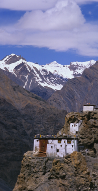
Cliff-side Monastery, Spiti Valley, India (2000)
Cliff-side Monastery, Spiti Valley, India (2000)(photo (c) Karen Abrahamson)

Recently I was reflecting on the difference between plot and story, with plot being the events that happen to keep the story moving, and ‘story’ being what the book is about and the changes that occur to the characters along the way. Frodo starts out as a happy young hobbit, and returns as someone who understands the price that must be paid for the safety of places like the Shire. Bella starts out as this infatuated, clumsy girl who constantly has to be rescued, and turns out to hold the secret abilities to save everyone.

This got me thinking about mapping beneath the surface. In a book, if you are a plotter, you map out where the actions occur, but also the impact the scene has on the character. I started out writing this way, and used wonderful planning sheets like these. This has allowed me to layer stories with the emotional changes that make a story much richer to read.

A similar process has occurred in mapping the world. Once the surface mapping was well under way, people began to wonder how to map the landscape under the layer of dirt and forests we see. Why? To gain a better sense of the layering of the landscape and the connections between places. For example, the discovery of similar strata layers in both France and England demonstrated that once they were a single land mass.

The process of mapping the underside of the earth began around 1750 when a Frenchman named Jean Etienne Guettard asked just such a question about England and France. Though he posed the question, the first person taken seriously for geological mapping was an Englishman named William Smith who spent a quarter of a century mapping England and Wales beneath the ground. Smith had been a surveyor’s helper and a keen observer who noticed and recorded things like strata exposed in hillsides and in mine shafts. Smith was the first person to have the insight that different strata held different fossils from different time periods, which provided a means to date the strata. He also noted that similar fossils were found in similar strata, even though they were separated by long distances. In 1815, the result of his study was a many-colored map of England and Wales that set out the different geological formations.

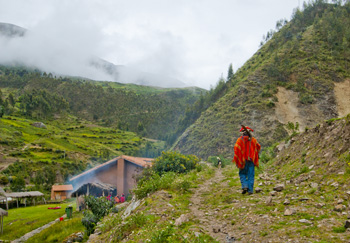
Off to the fields, Pumamarka (2011) Photo (c) Karen Abrahamson

Such a map can set out the distribution of various geological units such as glacial debris (if it was near the surface) or deeper formations like igneous, metamorphic or sedimentary rock that underlie the topsoil. Of course, having a general picture of the structure of the earth wasn’t enough for a civilization with an increasing thirst for oil and minerals, so processes were developed that measured gravitational attraction from which geologists could deduce the nature of the subsurface geology. Other processes drew on the ancient Nordic use of magnets to locate ore bodies. A more modern magnetometer was developed in the 1930s and mounted on aircraft to gather readings. The Seismic method was developed after 1875 when an English geologist in earthquake-prone Japan, thought to use a seisomograph to determine where the quakes arose from. A similar process was used in 1909 to discover the boundary between the Earth’s crust and its mantle.

Using sonic sounds or thumpers or vibrators to create sound, the sonic process then uses geophones (or hydrophones for underwater exploration) to read echoes from underground formations that tell the scientists what lies underneath.

This has led to the ability to measure the crust of the earth (which measures from about 6.5 kilometers thick under the ocean to 50-75 kilometers thick under high mountains), the mantle which extends from the crust to about half way to the centre, and the dense, partly molten core. Seismology has led to the ability to map oil deposits and layers of water and natural gas that wait in the earth’s crust. But they have also allowed scientists to reach much deeper.

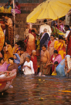
Main Ghat, Varanasi
Main Ghat, Varanasi (2000) Photo (c) Karen Abrahamson

Geologists are now able to measure and map the underside of the earth’s crust (I alluded to this here). Which is a lot like understanding the underside of a novel, because, like the geothermal power of the earth that may save us from global warming,  it’s really the hot emotional underbelly of a novel that brings out the best of any novelist’s writing.


When Maps Were Born

When Maps Were Born

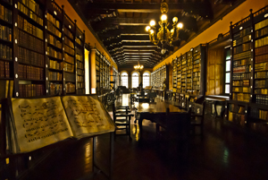
Monastery library, Lima, Peru. (2011) Photo (c) Karen Abrahamson

Writing this series of posts about maps and map makers has brought home that people have been making maps or pictures of places for a very long time, but it has also brought home that what people were making and the reasons they were making them has changed dramatically over the centuries. This change in purpose has led academics to wonder whether maps really were as ubiquitous across human history and they suggest that maps as we know them today really only came into existence in the 15th or 16th century.

What do they base this upon?

First of all it’s the paucity of maps that have remained in existence from earlier times. Sure, time would have destroyed many maps, but surely more than the few we have would have survived, just as art and sculpture and manuscripts survived. Secondly, those ‘maps’ that have survived from earliest times, had purposes that were different than maps today. Some represented a way of seeing the world , for example, the T-O maps I wrote about here, were intended to show Jerusalem as the holy centre of the world. Another example are Mesoamerican maps that didn’t focus on spatial mapping, but instead presented ‘community maps’ that represented history and territory, something like a pictorial genealogy. Native American maps present something similar. Other early maps were diagrams of a monasteries and manors, and still others served as religious icons, mandalas, construction drawings, itineraries and so on. Different maps, different purposes, and definitely not the purpose we put maps to, today.

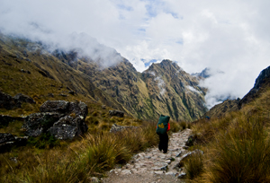
Porter on the Camino Inca, Peru (2011) Photo (c) Karen Abrahamson

The proponents of the idea that maps as we know them began in the latter half of the second millennium, also point to how the current purpose of maps – namely representing space or relationships, or showing ownership, or pointing out how to get from point A to point B were purposes that had previously been accomplished using means other than maps for as long as there has been history. If people wanted to represent a place, there were paintings and art work. For relationships, there was genealogy. If they wanted to convey ownership, there was text to use, or numbers. And if they wanted to show how to get from point A to point B, well there was word of mouth or text. These had sufficed for centuries. Why did people need these things called maps?

The answer apparently came with the rise of the nation state in the 15th and 16th Century (and possibly as early as the 12th Century in China). As nations expanded, as military ventures demanded, the need for maps became more evident. Rulers such as Henry IV of France were advised that maps could convey an idea of his holdings better than words could. Other rulers such as the Hapsburg emperor Charles V lost vital battles for wont of a map of a strategic area. And this wasn’t just a European experience. In places like Japan there is little evidence of widespread use of national maps until 1591 when suddenly maps were commanded for all geopolitical areas, leading to a national map in the 1630s. And Japan isn’t alone: at the same time that Japanese and European mapmaking blossomed, similar mapmaking flourished in China, Thailand, Russia, Malaysia, Vietnam and the North American Colonies.

Yes, some of this flourishing may have been due to importation of mapmaking from one culture to another as international trade broadened, but academics suggest that the ease of the adoption of these skills speaks to the existence of similar map-making traditions that had sprung up independently across cultures at the same time. Why?

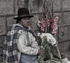
Flower seller, Cusco, Peru (2011) Photo (c) Karen Abrahamson

Map making appears to have proliferated in the new nation-states where it would otherwise be difficult for a central government to ‘know’ the length and breadth of their nation, suggesting maps brought local knowledge from the hinterlands into the center of government, where that knowledge could be used to the service of the central state. So modern maps themselves, just like the lines we draw on them, were an act of control – not just setting boundaries on the landscape, but also establishing boundaries around the people who dwelt there.


Recent Fantasy

Available HERE,

$1.99

Available HERE,
$3.99

Available HERE $1.99


Recent Mystery


Available HERE
$4.99


Available HERE,

$4.99


Available HERE,

$4.99


Available HERE,
$4.99


Recent Romance

Available HERE, $2.99