Tag: GPS

Maps, Mergers, Detours and the Other Direction
Maps, Mergers, Detours and the Other Direction

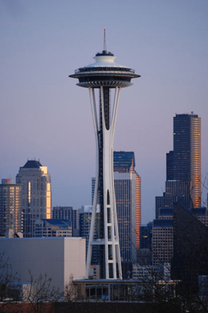
I just got back from Seattle (my OTHER favorite city), from a whirlwind trip to a Clarion party to see my old writing instructor Connie Willis (she teaches a mean reversal and wonderful lessons on plot). I travelled with another of my Clarion classmates (Class of 2001) and we were struck by a few things that got me thinking about maps and directions and foreign countries.

You see, there we were following the directions provided by Google maps (I prefer maps over GPS any day)and we were trying to get from I5 to the Queen Anne area when we discovered that there apparently is different English used for American directions than for Canadian. The American directions told us to merge when to Canadians it was clearly a left hand turn. ( A merge being something you do from an onramp onto a freeway.) In other spots we were told to turn left or right, when clearly to our Canadian eyes it was a merge. Needless to say, while we didn’t get lost, there were times I was seriously glad I wasn’t a driver behind us. I mean what were these crazy foreigners doing?
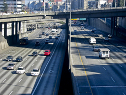
Of course our trip home wasn’t any easier. Not only did we have to navigate the many one way streets, that area of Seattle seems perennially under construction so we had to deal with detours. The main Lake Washington Bridge was closed which meant we couldn’t easily take a side visit to Redmond, and the downtown was also chewed up by construction so that we had to follow detour signs to get to I5 again. The interesting thing was, if we hadn’t been going to visit friends in Redmond we would have been seriously in trouble, because the detour signs just got us to the highway – headed south instead of back to Vancouver. Later, as we attempted to find our turn off, we had to deal with signs that said X Exit merge left and then, a quarter mile later, X Exit merge right.  Again I was glad of my foreigner license plates that at least gives me some license to be a little confused as I madly slalomed across the highway.
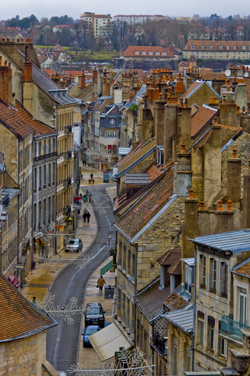
Christmas Street, Besconson, France (2005) Photo (c) Karen Abrahamson

All of this put me in mind of my travels in other countries where charming street signs have tickled my fancy. My favorite continues to be crossroad signs in France:  Paris with an arrow pointing in a certain direction, to Pontarlier, with an arrow pointing in a second direction, and a third sign with an arrow saying Les Autre Direction (the other directions). Maybe it’s just that North Americans have more need for specificity, but these signs always made me snort with laughter. I mean, of course the sign pointed in another direction, the question (for me) was what direction was it? Although I drove many places with my friends I don’t recall ever driving in that direction. So today as I wended my way home through the deceiving streets of greater Seattle I think I may have found myself unknowingly travelling Les Autre Directions. The surprising thing is I got to where I wanted, whether the signs led me there or not.
 

Knowing Where We Are in the World – and in Story

Knowing Where We Are in the World – and in Story

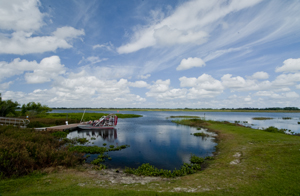
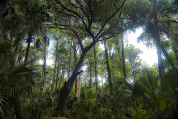
Cypress tree, Northern Everglades (2012) Photo (C) Karen Abrahamson

I’m currently working on two pieces of writing. One is the third novel in the Terra Trilogy and the other is the third installment of the Ice Dragon Series of short stories. Working on these two projects has made me question how I know where I’m going and how do I know where I am in relation to everything else in both these stories. It brings to mind the question of how we know, in our real life, where we are in relation to the rest of the world.

In this day of GPS and mapquest etc. this might seem like a very easy question to answer, but it wasn’t always this way, just like I wasn’t always able to have a sense of where I am in a story. Yes, surveyors took it upon themselves to survey the world. Countries (and scientists) agreed on the prime meridian that impacts all our time zones. But the 20th century has primarily been concerned with improving the precision of mapping and in particular with ensuring the pinpointing of places on the map in relationship to the rest of the world. The US Geological Survey was involved in this through most of the 20th century.

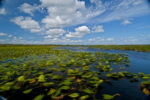
Waterlilies, Northern Everglades (2012) Photo (c) Karen Abrahamson

Why is this important? Well, think about it. Without standard understanding of how everything relates to everything else, weird things happen, like bridges getting built from each shore that don’t meet in the middle, or highways that have weird jogs in them because the measurements allowed the two ends to miss each other. It might not be important to you, but the cost overruns of such mistakes make having a common context for measuring everything important because it stops these types of things from happening.

In North America, the result of the surveying is those nice little brass discs (known as monuments) set in concrete or rock dotting the landscape . Each of these little brass discs serves as a known point for all subsequent surveying in the area. How did they know the individual location of these monuments? They took meticulous measures of distance through triangulation surveys and also measured the azimuth—the direction of Polaris—to set each monument’s position.

Throughout America, broad swaths of land were surveyed independently to create grids of known locations. They measured locations not only horizontally across the landscape, but also vertically, in relation to sea level, but the challenge was knowing that all these grids fit together. The result was the selection of a single monument at a ranch in central Kansas, Meades Ranch, as point zero for all grids across the country. Meades was chosen because it sat centrally in the US and it lay close to the crossing of two major survey lines across the US – one from Canada to Mexico and the other from the Atlantic to Pacific Ocean. Interestingly, today Meades Ranch has been superseded by global positioning that uses the center of the earth as the central point of reference.

Airboat docked in the Northern Everglades. (2012) Photo (c) Karen Abrahamson

The use of that central point for mapping draws me back to my thoughts on plotting a novel or story. I once heard the wonderful writer, Nancy Kress, talk about plotting. Now I don’t know how you feel about plotting—some people are all for detailed plotting of everything in a novel, while others prefer to fly by the seat of their pants (Pansters) and write into the mist of their imagination. Nancy Kress seemed to offer a third alternative that didn’t hold a writer’s imagination down, but also gave some structure to writers so that all that lovely mist didn’t turn into a dense blinding fog. Ms. Kress suggested that writers need to write down what they think is going to happen in the novel. Just brainstorm them out. Ask yourself what is the beginning (the inciting event) and what is the midpoint (quiet often a reversal of some sort), and how do you think the story will end (the climax)? Once you have those key points identified, you can easily place them on a plot line and them locate all your other plot ideas on either side of the midpoint—a lot like being able to measure your location from Meades Ranch.


On Maps, GPS and Andre Gide

On Maps, GPS and Andre Gide

I never get lost, or only rarely. Few places turn me around, Portland Oregon being one of them. (I’m blaming the rivers and the volcanoes on creating a weird magnetic field that disturbs my sense of true north.) All my life I’ve arrived in a new place and managed to orient myself quickly, so that I’ve been able to get around with only my sense of direction and, when necessary, a map. These days, however, I’m beginning to feel like an anachronism every time I unfold my trusty, old fashioned paper map. In fact, I’m reminded of an episode of FRIENDS, when, in London, Joey had to place his map on the ground and step into it, in order to find himself.

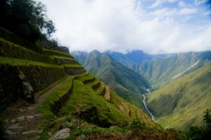
Huinay Huayna, Forever Young, hung above the Urubumba River (2011) Photo (c) Karen Abrahamson

Let’s face it, with GPS, Onboard computers in our cars, and smart phones, all of which will give you the best route to take from point A to point B courtesy of MapQuest, the art of map reading is certainly on the wane. Which makes me wonder what the loss of that art will mean to our world.

Sure it might mean less coffee-stained maps, probably fewer traffic accidents and certainly fewer arguments between couples lost on a Sunday drive, but what will it mean to how we see the world?

My fascination with maps has always existed. Travelling as I do, one of my first purchases for any destination is a map that is large enough that I can understand the relationship between places, and that I can see enough details so that I can also get off the beaten path. When I go travelling, I like to trace my route on the map as an indelible reminder of the places I’ve gone and the things I’ve seen. It also reminds of the immensity of experiences I haven’t had, and all the other corners and mountain tops and valleys and towns and people I haven’t seen or met. The map reminds me of the world out there that I’ve, ever so briefly, stepped into.

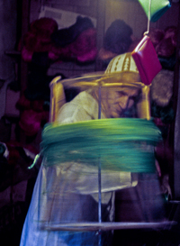
Thread seller - Marrakesh, Morocco

With the advent of GPS and TomTom etc. I wonder how that affects our relationship with the world around us. With a map we get context. We get how small we are in a much larger world, whereas the GPS and OnBoard Computers I’ve used reduce the world to one small computer screen that points us in one direction and that doesn’t foster those exciting tingles a map gives when you realize there’s an alternative route to the one you’d chosen—one that might be richer for the fact it isn’t the most direct route or the path that most people travel.

Maps have fostered my imagination since the first time one fell out of my parents’ National Geographic Magazine and since the first time I traveled with my parents from British Columbia to Quebec and my mom showed me a map of the continent. I was seven and the vastness of the landscape excited me with all the half-glimpsed things along our route. Maps gave me a sense of where we were in relation to where we’d been. Today they give me a sense of the greater world. Old maps show what the landscape once was and how it has changed. Maps even give a sense of how other cultures view the world differently than most North Americans do today

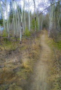
Path along the Yukon River, following the routes of explorers.

The French Author, Andre Gide wrote that “One does not discover new lands without consenting to lose sight of the shore for a long time.” That’s what maps are all about, a guide to discovery and exploring something vaster , whereas GPS seems to make a journey all about yourself moving from point A to point B.

So for me, though GPS and MapQuest are great for short trips, I’ll muddle through with a paper map and my own sense of adventure. I’ll live by Gide’s philosophy and take a chance on getting lost or perhaps, like Joey, finding myself in the map.

So how do you prefer to travel? Are you map challenged or a fan? Do you depend on GPS when you’re travelling? Why?

Recent Fantasy

Available HERE,

$1.99

Available HERE,
$3.99

Available HERE $1.99


Recent Mystery


Available HERE
$4.99


Available HERE,

$4.99


Available HERE,

$4.99


Available HERE,
$4.99


Recent Romance

Available HERE, $2.99