Tag: Culture

Bhutan: How Gross National Happiness Made Me Cry

Bhutan: How Gross National Happiness Made Me Cry

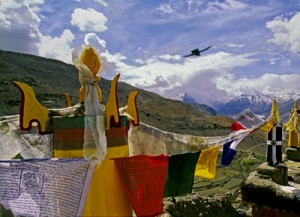
Prayer flags at Gangtey. Photo copyright Karen Abrahamson.

Sometimes… sometimes this world can be so darned hard to be in—like reading about the death of the last male northern white rhino, or that 18 of the Tigers ‘rescued’ from a Thai temple ended up dying. And then there’s the whole darn political situation where nobody seems to speak the whole truth.

But other times the world can be such a giving place that it overwhelms. That was my experience in Bhutan.

As I mentioned in a prior post, Bhutan is a Buddhist country. It isn’t a big country. It isn’t particularly modern in the way places like London, New York, or even Bangkok might be, but it’s a country that seems to understand the concept of ‘enough’. It might not be a wealthy country (up until this year it’s biggest source of revenue was tourism), but the government has decided not to rate the well-being of the country not on gross domestic product (in other words, how much does the country produce or earn each year), but instead they assess the country on Gross Domestic Happiness.
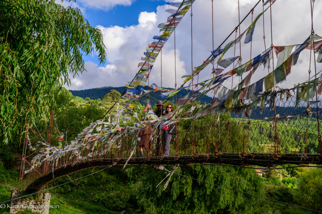
A local suspension bridge adorned with flags and a couple of photographers in the Tang Valley. Photo copyright Karen Abrahamson.

I’m not quite sure how they measure this apparently quite ‘ephemeral’ concept, but I have to say that the country seems to be doing quite well. Some of it seems to be the personal realizations of the citizens that they can have ‘enough’—maybe not from driving for the ‘high life’, but from something else. For instance, the country has put a lot of energy into education and has a well-educated middle class. This has lead to many young people leaving their traditional country villages for the city leading to pressure on Thimpu and Paro (the two main cities) and some concern for the farming tradition of the country. What did the country do? It offered sizeable subsidies for the well-educated young people to return to farming—and its working!
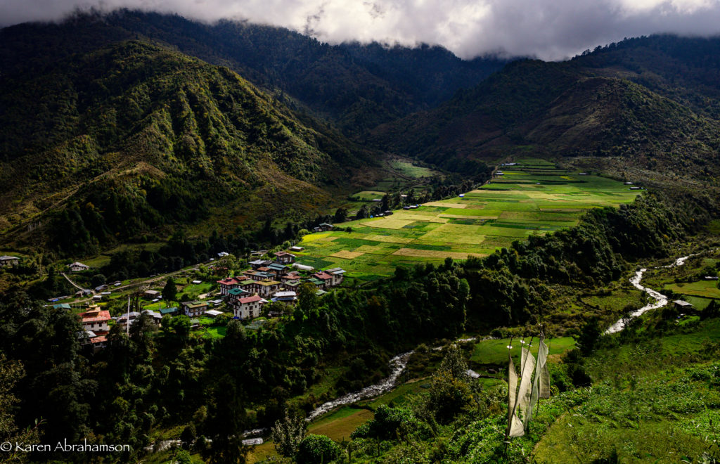
Prayer flags above one of the many mountain towns. Photo copyright Karen Abrahamson.

Bhutan is also a country that is trying hard to balance growth with protection of the environment. Compared to most countries around the world, Bhutan has actually seen an increase in the its national forest cover and it does things like set aside an entire fertile valley floor in order to preserve the habitat of the rare black-necked crane. Pretty progressive.

At the same time, tradition is everywhere. Come to a bridge, a river confluence, or mountain pass, and you find yourself amongst the fluttering host of red, yellow, green, blue or white prayer flags. Tradition says that with every gust of wind, the prayers connected to the flags are sent skyward to the benefit of the prayer flag’s patron. You become a patron by deciding to put up the flags but you’ll also see clusters of white prayer flags on poles that are raised in remembrance of the newly dead.

While I was in Thimpu, the capital, I had the chance to visit a Bhutanese astrologer who informed me that:

  1. I was a Fire Monkey (they use the Chinese astrological calendar)
  2. That I was going through a couple of bad years, and
  3. That there were flags that I could hang to help me get through this tough patch.

Given the astrologer was exactly right about the couple of bad years, I took the prayer flags he recommended and thought that I would hang some in Bhutan and some when I returned home. My kind and oh-so-knowledgeable guide, Kuenzang Norbu, researched dates that were bad to hang flags, and our wonderful driver, Tenzin Norbu (no relation) actually asked his father to research my best and worst days of the week.
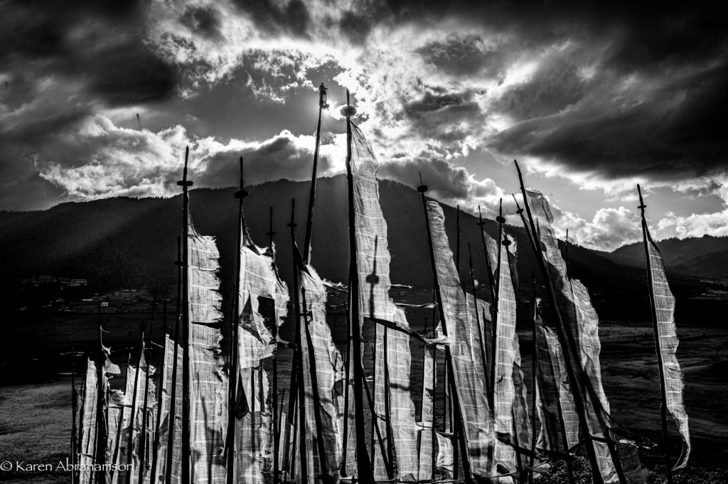
Prayer flags against the sun. Photo copyright Karen Abrahamson.

Not long afterward, we were traveling over one of Bhutan’s many high passes where the wind rarely ceases. The peaks of the pass were a mass of poles bearing crowds of fluttering flags and I knew immediately that this was where I had to hang my flags. Wonderful Tenzin helped me sort through them and then our entire group climbed the hill with me and helped hang my flags.

Whether it was for my benefit or whether it was because we all received the benefit of hanging those flags in the wind, the giving nature of everyone involved (foreign photographers and Bhutanese hosts alike) left me quite astounded.

So, I stood in amongst all those windswept prayers and cried.
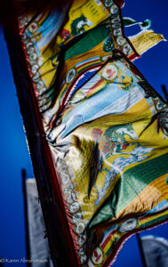
Colourful flags on a mountain pass. Photo copyright Karen Abrahamson.
I’m Off on a Research Adventure!

I’m Off on a Research Adventure!

Starting in January, I’ll be off on a research adventure in Southern India, Bali and Hong Kong. You might recall that Phoebe Clay, my character in my mystery novel, Through Dark Water, ended book one with an interest in global travel. This is my chance to scope out interesting locales for her next adventures. I’m planning to get back to Phoebe and co. and their mysteries on my return from Asia.

During my travels I’ll be posting regular photos and mini stories like those in the travel section of my website so keep an eye open for these on my website and on Facebook.

Winter is Coming

Winter is Coming

Okay, I know that line has been taken, but it seems that winter is a theme running through my writing these days. I recently finished a new alternative history mystery novel, (as yet unpublished—still at first reader stage) that arose out of a writing workshop I attended on the Oregon Coast. It is set in what is Kyrgyzstan in our world. Okay, okay. I can hear you now. KYRGYZSTAN? Where the heck is Kyrgyzstan?

Think north of Afghanistan in and around the Tian Shan and Allay mountains.

It’s a small, ex-Soviet Union country—one of the ‘stans’.

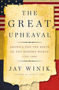
My story grew out of an exercise at a Historical, Time Travel, and Alternate History workshop presided over by Kristine Kathryn Rusch, author of such wonderful time travel novels as Snipers. She asked us to take an event out of the wonderful non-fiction book The Great Upheaval, and use that as a jumping off point for an alternate history story. The short story that arose presumes that history diverged way back in the late-1700s at the time of Catherine the Great, or Yekaterina as I call her. It was around the same time as the American and French revolutions when Catherine was the great Tsarina of the Russian people. She was an interesting lady who wasn’t even Russian by birth, but she married the Tsar and then usurped his throne. Like I said, interesting lady.

In her younger years Catherine was tempted by the influence of the great statesmen and philosophers of her day to consider democracy for her people, but eventually decided that it wouldn’t work—for Russian peasants. Instead she went to war against the Ottoman Empire. In our world she won her battles because the Ottoman Empire was waning.

But what if Catherine’s depredations (and they were vicious) woke the Ottomans up? What if the Ottomans found their strength again and took the battle to Catherine and the Russians? The Russians were stretched by conflicts on their northern and southern borders and with Poland.

Because the Ottomans won (in my version of history), it led to a world very unlike this one. It led much sooner to the end of the French Revolution so that Napoleon never became emperor and never ruled. As a result, the French government never supported the fledgling United States in their great democratic experiment, and that led to Great Britain taking over most of North America.

At least in my made-up world.

In the novel that grew out of the short story, a rag-tag group of Russian refugees escaped the Ottoman juggernaut and now live in a small country called Fergana. Fergana lies caught like the gristle in a joint between the two behemoths of the Chinese and Ottoman Empires. In the late fall of a modern day New Moscow a young girl is found dead in a city park. Thus begins my new novel, After Yekaterina. It’s late October and the first snow is threatening as Detektiv Alexander Kazakov stands over her body.

That is how I came up with my latest mystery series. And now, as I start the second novel in the series, the autumn ocean storms are settling in over my home, but in Fergana it is deepest January and the long winter has arrived.

My goodness I like this writing thing.

Clothing Might Make the Man, but Maps Make the Country

Clothing Might Make the Man, but Maps Make the Country

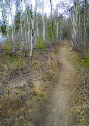
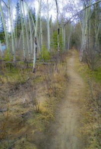
Path along the Yukon River. The quiet places like this are the ones lost in rampant development. (2010) Photo (c) Karen Abrahamson

I thought I’d throw a little light on my home and native land in honor of Canada’s 145th birthday on July 1st.

Maps give shape to countries, both real and imagined. I’ve written previously of the long search for St. Brendan’s Island in the Atlantic and how the need to establish Prestor John’s country influenced the maps of Asia and Africa. But beyond creating imaginary countries and geography, there are three real ways that maps can help build a nation and all of these have been used to build Canada. Maps can:

1. Help the populace visualize the their nation and understand their borders;

2. Take a geographic area and turn it into a political abstraction such as the Canadian state, and

3. Mediate relationships between states and their population and can act as a means of ‘erasing’ certain populations from the national and political psyche.

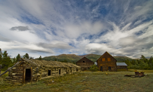
Old Ranch, Yukon River (2009) Photo (c) Karen Abrahamson

Maps have performed these roles for Canada since before the country was actually born. An example of the first comes from the period when the French and the English were still making their claims on North America. In the early 18th century, between 1713 and 1756, the French and English were engaged in a continuing dispute over what was English and what was French territory. This led to what might be called a war of maps, or at least a war of propaganda perpetuated through maps, with English maps having the audacity to present the French territory as a small area confined between the Ottawa and Saguenay Rivers in present-day Quebec, while the rest of North America – areas that had largely been mapped by French explorers – was claimed to be English. Oddly enough in the fight over what was French and what was English some of the battles, such as the argument over what was ‘Acadia’ (French) and what was ‘Nova Scotia’ (English) both sides presented maps prepared by their opponent. The trouble was, so much erroneous information was included in so many maps, you could pretty much support either argument.

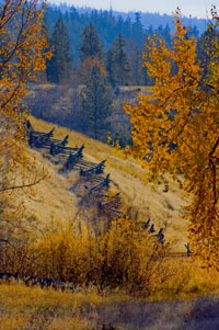
Snake fence along the Kane Lake Road, British Columbia, (2006) Photo(c) Karen Abrahamson

Maps also played a role in defining the border between Canada and United States. Dr. John Mitchell created A Map of the British and French Dominions in North America in 1755 and this was a pivotal map used by both of the fledgling countries in determining their borders. A Virginian, Mitchell became interested in maps as a result of concern over the French encroachment on territories the English had ambitions on. He began to collect information from travelers and publicly available maps, and compiled one of the first maps of North America. He wanted to expose the scale of the French Threat (they had been all the way down the Mississippi and far into the west by this point) to the British public and the colonies. Although his first map was crude, it showed enough promise he was commissioned to create something better by the Lords Commission on Trade and Plantations and was given access to the growing store of maps and charts coming from the new world.

The resulting maps showed a credible presentation of the boundaries of Upper Canada and, when the 1783 boundary negotiations between the United States and Britain began, the map helped to settle that the boundary would bisect the Great Lakes and then continue west. But that didn’t set the boundaries at the 49th parallel. It was another map, created by Jean Palairet, that erroneously showed the 49th parallel as the ‘agreed upon’ boundaries between French America and the Hudson’s Bay company. Although the French had never agreed to the boundary, the strength of a map presenting that fiction led the two countries to accept the 49th as their boundary in reality.

Two years after confederation, the fledgling Canada’s mapmaking had its first brush with making a culture disappear. In 1869, when the government sent surveyors into the prairies to prepare them for settlers, they were charged with measuring off the land, just as their American counterparts had done south of the border. They sought to mark off the land in one mile blocks, but when they came to the “hay privilege” lands of one Andre Nault, they were stopped by a group of Metis led by Louis Riel. You see, these descendents of marriages between native women and French explorers had established their own culture and place on the prairies. They had found that, in the arid landscape, the best way to divide the lands was using long strip land claims that flowed naturally back from each river or stream and thus allowed everyone access to irrigation. They viewed the government surveyors’ placement of each square mile on a map, as effectively wiping out their way of life. We know what happened—the Metis rebelled and Louis Riel was hanged and went down in history as an enemy of Canada. The Metis, like many First Nations people, were left as disenfranchised members of our country.

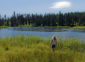
Small fishing lake in the B.C. Interior. (2011) Photo (c) Karen Abrahamson.

All of which shows how maps can be used to create or subdue a country—in this case mine. Happy Birthday, Canada. Let’s hope our maps of the future are a little more kind.


Andean Civilizations: A Map of a Different Color

Andean Civilizations: A Map of a Different Color

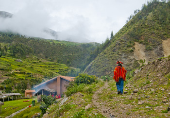
Off to the fields, Pumamarka (2011) Photo (c) Karen Abrahamson

When I think of maps I imagine back to when the first human made their first finger marks in mud to share a game trail, or a watering hole or an especially good berry bush. Surely that must have been the earliest form of map. Of course none of those primeval drawings exist, and so I’ve found myself writing a about the western development of maps over the ages and have tried to give a sense of the European tradition and the contributions of Arab and Chinese explorers and cartographers. This is the easy stuff to research and write about because the maps these cultures used were set down in a manner we are trained to see. Maps, to most of us, are a visual representation, usually on a flat medium like paper, that presents the relationship of one place to another. But other cultures have had other ways of presenting their landscapes, case in point are the great civilizations of the South American Andes.

What most of us think of as the Inca are actually a series of overlapping civilizations that rose and fell in the various livable areas of Peru, Bolivia, Ecuador, Columbia and Chile. After the very effective conquest of South American by the Spanish, not much remains of any Inca records and to date no maps (as we define them) have ever been found. But did these cultures simply not have maps or did they represent their landscapes in a different way?

Anthropologists and Cartographers say that formal mapmaking tends to occur within highly organized, bureaucratic societies as a form of discourse. The conditions necessary for mapmaking include: demands for agriculture, private property, long distance trade, militarism, and tribute relationships, amongst others, all of which are attributes of the various Andean societies.

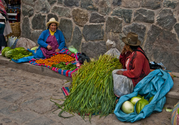
Women at Ollantaytambo market (2011) Photo (c) Karen Abrahamson

Anthropologists studying the various ancient cultures have begun to realize that westerners probably won’t recognize Andean maps until we start to see them through Andean eyes. The structure of maps aren’t only determined by geography, but also by social organization, cultural conventions and human perception. In the Inca worldview, the cosmos was built on a quartered circle, based on the way they viewed the Milky Way divide the heavens. They viewed their world that way as well, with the lands they ruled broken into four distinct quarters.

The Inca also had to map unusual terrain, from the coastal deserts and river oasis, up through the highlands to the alte-plano and Andes mountains and down again into the Amazon basin. Trade and tribute came those long distances, and north and south from Ecuador to Chile. Over those distict terrains there were distinctions of crop and animals at each of the different elevations. So, for an ancient Andean, among the things they needed to represent, were the different elevations, the different foods, and the waters that made life possible across these sometimes inhospitable terrains, as well as capturing the four quarters of the world and social relations.

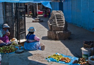
Market Scene, Chivay. Note the Inca rock that shows terracing and irrigation techniques. (2011) Photo (c) Karen Abrahamson

The resulting landscape representations convey things like ownership and elevation. Ancient weavings show the long narrow fields of produce separated by clan-assigned canals. Pottery shows spatial designs that encode critical social structures, and still other sculptures, such as Chieftain Vessels correspond to Andean landscapes with the head of the figure as the summit, the shoulders as central mountain slopes, the lower hips as the coastal plains where mountain rivers diverge on fields. Still other sculptures show realistic representations of the terraced fields and irrigation systems that make up areas of central highland valleys.

So while we might say the Inca made no maps, it doesn’t mean that they didn’t represent their landscape. The difference is that the Inca ‘maps’ were often three dimensional and layered with meaning, both in terms of the landscape, ownership and familial relationships, and the relationship of the landscape to their ancestors, the spirits and the cosmos.


What’s in a Map? Aboriginal Maps and Writer’s Dreams

What’s in a Map? Aboriginal Maps and Writer’s Dreams

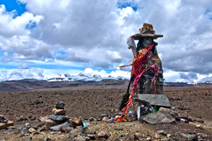
A Huaca, or sacred stone, in the landscape of the Peruvian Altiplano (2011) Photo (c) Karen Abrahamson

Last night I received an article from my local Romance Writers of America chapter about world building for writers and how making a map of a location can help to create your story and your plot. I got thinking about this and how it relates to human history. In particular I got to thinking about how some anthropologists and historians have drawn a line in the sand (the 15th Century) about when true maps came into existence. (See my last post here.) But it got me wondering whether they were short-sighted in their definition.

The authors of this theory have said that prior to the 15th century while people might have made maps, they largely weren’t made for the same purpose of orienting the landscape like maps are used for today. They talked about how maps of older civilizations presented a cosmology, not a spatial map, or were used to show relationships, which could as easily be represented in text or the spoken word. This, they posited, means that earlier map-like creations are not true maps. Whether they are wrong or right is a matter of some debate.

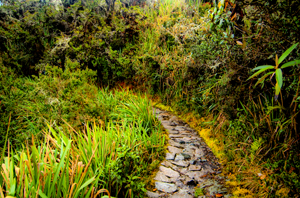
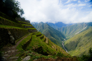
Trail along the Camino Inca, the path to Machu Picchu (2011) Photo (c) Karen Abrahamson

A case in point is Native American cartography. The literature about Native American maps is challenged by the fact that not only is it hard to find maps from pre-European contact (birch bark and leather just don’t stand up to five hundred years of colonization), but most of the records of native maps are colored by the perspectives of those who collected the map. The few maps that do exist require the reader to think of maps in more than one way. For example, records of a Virginian Algonquin map collected by John Smith in 1624 (while he was a prisoner), show a cosmological view of the world, but also a spatial linking of places. The map shows three concentric circles around a fire, with the first circle being a circle of meal representing the Algonquin Territory, the second being an inner circle of corn representing North America, and the third circle of corn representing the edge of the supposedly circular world. To try to understand John Smith’s origins from beyond North America, the Algonquin created a thatched stick island between circle two and three. Clearly this shows a sense of spatial distribution, even if it is not based on any scale a western European would use.

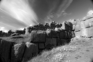
The ruins of Saqcsaywaman, Cusco, once part of the center of the Inca world. (2011) Photo (c) Karen Abrahamson

Another interesting ‘map’ was a gesture used by a Native American Elder to describe the location of his town. The elder held his forefinger and thumb like a not-quite-closed-looped ‘okay’ symbol. The location of his town was between the unclosed tips of the finger and thumb, with Quebec, Montreal, New York, Boston and Halifax all located along the knuckles and joints of the rest of that looped finger set. This again clearly places the Native American town in relation to the major cities. So the question may not be whether Native American’s had maps, but whether they recorded their map information in a different way. Native American communities and living accommodations like the Navajo Hogan, the Pawnee earth lodge and even some longhouses could be said to be map-like in their structural symbolism of the concept of the sky dome or celestial vault providing shelter for a two dimensional geography with the four directions spreading out from a pivotal centre of the house. It might not be written on a piece of paper, but clearly there is a sense of direction and relationship to place within their sacred geography.

Finally, Petroglyphs, a primary source of pre-contact information about Native American culture, have also yielded examples of what could be maps, though there continues to be some debate. Some appear to show river routes and tributaries along with trails. Still other stone paintings appear to represent drive fences (fences used to drive prey animals into capture areas) complete with pictures of the animals that resided in the area.

Across the world we look for the sublime meaning of everything. Prayer flags, Tibetan area of Northern India, (2000) Photo (c) Karen Abrahamson

Which brings me back to the RWA article. It spoke about how, for a writer, a map can help you to give a greater sense of place to your writing. The writer will know where the towns and roads and lakes and mountains are in relationship to where the character is. But drawing a map can help the writer to also learn something beyond thethe lay of the land. A writer’s map can help you to understand what monsters live in what areas, what territory belongs to the enemy and what resources there are to harvest, along with your character’s place in the world. This leaves me to think the Native Americans understood modern (writerly) mapping better than the anthropologists and historians think they did, and that the modern writer’s map is based in something much deeper and perhaps more linked to the notion of a sacred human landscape. Both look for something more than just scaled lines on a page to find our way through either our imagination or the world.


Mapping Dark Matter – Walking Like an Inca

Mapping Dark Matter – Walking Like an Inca

A recent Facebook posting referred me to an article about dark matter and how astronomers are mapping dark matter through space by identifying how light distorts as it travels through the invisible web of the dark. Scientists hope that, by mapping dark matter’s distribution through the sky, they can gain a better understanding of this substance and the underlying physics of the universe.

Reading this article reminded me of my recent trip to Peru and the unique Incan astronomy. Most of us are taught that the Incan’s worshiped the sun, and indeed the sun was a deity to the nobles. But beyond that worship, the Inca used their astronomical studies to not only follow the sun, moon and stars, but also to map the dark parts of the sky. They even had a special word for those places: ‘Yana Phuyu’, or dark clouds – the vacant places in the sky.

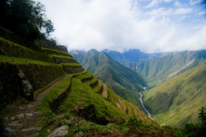
Huinay Huayna, Forever Young, hung above the Urubumba River (2011) Photo (c) Karen Abrahamson
Huinay Huayna, Forever Young, hung above the Urubamba River (2011) Photo (c) Karen Abrahamson

The Inca believed the Milky Way was a great river and the Yana Phuyu were animals called Pachatira that came from mother earth to drink at its side. These dark clouds were known and tracked across the sky and watched with interest. There was the fox, the black llama with her child, the serpent, the toad, the partridge. Each had their place in the sky and each was watched for signs of what would happen on earth. As the black llama descended from the sky she would lower her head and drink from the oceans to stop flooding. The toad, Hanaptu, rose in the sky, when the toads came out of hibernation, and Azoq, the fox rose during the summer solstice when foxes gave birth. For that was the strength of Inca astronomy, they truly believed ‘as above so below’. They watched the heavens and foretold the seasons and the rains by when certain animals appeared over the horizon or climbed the sky and, according to legends, major ecological events like devastating earthquakes and floods, along with the ages of the world.

But the Inca did more than that. They saw the heavens as a map of their world, with the great river of the Andes, the Rio Vilconota (aka the Urubamba) as the terrestrial version of the Milky Way. They recognized hundreds of holy sites (Huacas) around their empire that often were related to special days of the year and the places where the rising and falling sun was observed.

Today, stories of the skies are still taught to children in Inca villages. In Quechua they teach how the llamas in the fields watch the heavenly llama for news of the rains. They tell tales of the moon and his wife and how the ‘fall’ of the Moon’s wife led to the pumpkin-color of the soil in the Amazon. So though we will never know the true depths of Inca astronomical knowledge – too much was lost to the Spanish conquest – we do know that the Inca were much like the scientists of today: They mapped the heavens as a means to understand the connections of the universe around them.

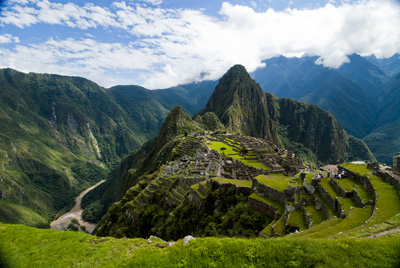
Machu Picchu caught in the coil of the coil of the Urubamba River (2011) Photo (c) Karen Abrahamson


Powell’s Books: A glimpse inside the cartographer’s mind

Powell’s Books: A glimpse inside the cartographer’s mind

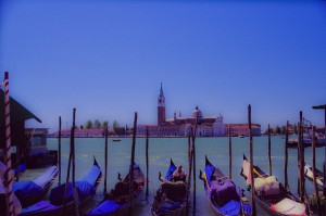
Gondolas, Venice (2004) Photo (c) Karen Abrahamson

The other day at Powell’s Books (Portland), I came across a wonderful little book called “The Mapmaker’s Dream” by James Cowan. The book is the translation of the diary of Fra Mauro, a sixteenth century Venetian monk and cartographer who set out to make a perfect mappamundi (map of the world) though he had never stepped outside the confines of his cloisters. Instead he gathered travelers’ tales through exchanges of letters or interviews of missionaries, merchants and soldiers travelling through Venice. His task became well known and he received envoys from as far afield as the court of the Chinese Emperor. Not only was this book astounding for the fact that word of his venture travelled so far in the 16th century, but the information he collected and the workings of his mind fascinated me.

Yes, his travelers brought stories of the Cyclopedes, beings in the southern hemisphere with only one huge foot that they used for hopping and also for shade when the sun in the antipodes became too fierce, but envoys also brought other tales that caused good Fra Mauro much reflection. This was what captured my attention for they showed a keenness of mind and a shifting view of the world much like new age philosophers. This seemed strange for his time; given Fra Mauro was a devout Catholic.

His encounters left him pondering whether the soul could possibly transmigrate into another person upon the death of the body and whether we are ‘all drifting towards a more complete life in someone else’. The visit of an old Jewish merchant from Rhodes left him contemplating how the loss of place (in the holy land) ‘condemned the man to inhabit his loss forever’ and how the rootless person came to inhabit a region of his own mind instead.

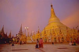
Schwedigon pagoda
Holy Schwedigon pagoda at sunset, Yangon, Myanmar (Photo (C) Karen Abrahamson)

Visits from others left him considering how venerated holy relics become something more because of that veneration, and how those objects take on their own life because they unite an idea that men aspire to. They left him wondering at cultures that worshiped Satan and yet were not evil, and others that determined their actions and their future through the calls of seven forest birds.

But most of all he wrote of the minds of travelers. He was struck by the notion that travelers not only travelled with their bodies, but also that they travelled in their minds and were transformed by that travel or, alternatively, transformed the place they had been. He wrote of the journeys of envoys sent to find the mythic kingdom of Prestor John and looked at the evidence of such a kingdom – the long letter still held in the Vatican archives that describes a kingdom so perfect it could not possibly exist. Fra Mauro concluded that the reason the search for Prestor John’s kingdom became all consuming, was not just the desire for aid against the Moslem hordes, but the desire to know that it was possible for paradise to exist on earth. Travelers longed to become ‘slaves’ to Prestor John’s perfection and bounty. But the country of Prestor John would never be found because it was only built on dreams.

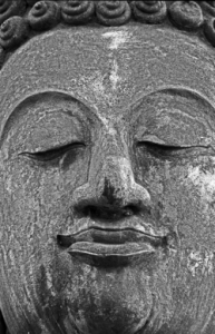
Buddha face, Sukhothai
Buddha face, ruins of the ancient capital of Sukhothai (1997) Photo (c) Karen Abrahamson

Ultimately, Fra Mauro realized the challenge of creating a perfect map arose because each man’s perceptions of place were different and any ‘perfect’ map must capture not only the land forms, but also the forms of the world created by men’s minds.

The lowly monk of Venice completed his life’s work, but today no trace of his perfect mappamundi exists, except in references in the pages of his journal. Perhaps, like the worlds he described, it faded away to become the world as we know it today, but more importantly what his journal shows is a man of deep thought who’s Sixteenth Century perspectives still resonate with readers today.

Thank you, Powell’s, for this gift.

On Maps, GPS and Andre Gide

On Maps, GPS and Andre Gide

I never get lost, or only rarely. Few places turn me around, Portland Oregon being one of them. (I’m blaming the rivers and the volcanoes on creating a weird magnetic field that disturbs my sense of true north.) All my life I’ve arrived in a new place and managed to orient myself quickly, so that I’ve been able to get around with only my sense of direction and, when necessary, a map. These days, however, I’m beginning to feel like an anachronism every time I unfold my trusty, old fashioned paper map. In fact, I’m reminded of an episode of FRIENDS, when, in London, Joey had to place his map on the ground and step into it, in order to find himself.

Huinay Huayna, Forever Young, hung above the Urubumba River (2011) Photo (c) Karen Abrahamson

Let’s face it, with GPS, Onboard computers in our cars, and smart phones, all of which will give you the best route to take from point A to point B courtesy of MapQuest, the art of map reading is certainly on the wane. Which makes me wonder what the loss of that art will mean to our world.

Sure it might mean less coffee-stained maps, probably fewer traffic accidents and certainly fewer arguments between couples lost on a Sunday drive, but what will it mean to how we see the world?

My fascination with maps has always existed. Travelling as I do, one of my first purchases for any destination is a map that is large enough that I can understand the relationship between places, and that I can see enough details so that I can also get off the beaten path. When I go travelling, I like to trace my route on the map as an indelible reminder of the places I’ve gone and the things I’ve seen. It also reminds of the immensity of experiences I haven’t had, and all the other corners and mountain tops and valleys and towns and people I haven’t seen or met. The map reminds me of the world out there that I’ve, ever so briefly, stepped into.

Thread seller - Marrakesh, Morocco

With the advent of GPS and TomTom etc. I wonder how that affects our relationship with the world around us. With a map we get context. We get how small we are in a much larger world, whereas the GPS and OnBoard Computers I’ve used reduce the world to one small computer screen that points us in one direction and that doesn’t foster those exciting tingles a map gives when you realize there’s an alternative route to the one you’d chosen—one that might be richer for the fact it isn’t the most direct route or the path that most people travel.

Maps have fostered my imagination since the first time one fell out of my parents’ National Geographic Magazine and since the first time I traveled with my parents from British Columbia to Quebec and my mom showed me a map of the continent. I was seven and the vastness of the landscape excited me with all the half-glimpsed things along our route. Maps gave me a sense of where we were in relation to where we’d been. Today they give me a sense of the greater world. Old maps show what the landscape once was and how it has changed. Maps even give a sense of how other cultures view the world differently than most North Americans do today

Path along the Yukon River, following the routes of explorers.

The French Author, Andre Gide wrote that “One does not discover new lands without consenting to lose sight of the shore for a long time.” That’s what maps are all about, a guide to discovery and exploring something vaster , whereas GPS seems to make a journey all about yourself moving from point A to point B.

So for me, though GPS and MapQuest are great for short trips, I’ll muddle through with a paper map and my own sense of adventure. I’ll live by Gide’s philosophy and take a chance on getting lost or perhaps, like Joey, finding myself in the map.

So how do you prefer to travel? Are you map challenged or a fan? Do you depend on GPS when you’re travelling? Why?

Laid back in Ollantaytambo

Laid back in Ollantaytambo

Ollantaytambo sits in the Sacred Valley, northwest of Cuzco and is known for its ruins and its train station. You see this is the place most travelers to Machu Picchu go through, climbing on the train that will take them to Aguas Calientes and the bus to the famous ruins. It’s the place that the Camino Inca treks often stop for breakfast before hitting the trails into the mountains. I came here because it was (supposed to be) a quiet little town and because I am determined to go back to Machu Picchu and see the place as I didn’t see it before.

The town of Ollanta (as it is known to the locals) is apparently the best surviving example of Inca town planning available today.

Women at Ollantaytambo market (2011) Photo (c) Karen Abrahamson

Leave the Plaza de Armas and turn towards the ruins on the mountain, and the streets are narrow, cobbled and have irrigation channels running down the sides. Stone walls are crowned with cactus in a traditional alternative to barbed wire and broken glass and each house sports twin bulls on their ridgepole – the result of the Spanish saying a bull was more appropriate than the Inca symbol of the ‘puma’.

You can tell this town wasn’t built in this century by the way the traffic congests every time more than two cars get on the road together. Now picture a town converged on by tour busses, taxis, moto-taxis and the occasional semi, all trying to squeeze across a single-lane bridge and I swear entertainment in Ollanta is sitting under the lone tree in the Plaza and watching the mess reconfigure itself again and again in a kaleidoscope of vehicles.

Unfortunately I didn’t get to see as much of the town as I would have liked, because both my ankles are still crippled from the Machu Picchu hike, but I did try to get out daily and finagled my way along (between naps – hey, recovering here) as the lone tourist with a local association devoted to preserving the weaving arts in small villages up in the mountains.

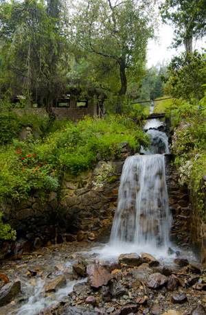
Irrigation waterfall along the mountain road, Ollantatambo, (2011) Photo (c) Karen Abrahamson

We drove out in the morning, heading up a dirt road that stretched back into the mountains. The road rose, switching back and forth across the mountain sides following a small rushing river, the Patacancha, that was joined by innumerable glacier-fed torrents that foamed down the mountainsides. Green Inca terraces, some the longest in Peru, an old stucco church with thatch roof that I was told is one of the oldest in South America. There were donkeys and pigs and sheep and trains of pack horses headed up the mountain and views of people harvesting their papa (potatoes) laboriously by hand.

Off to the fields, Pumamarka (2011) Photo (c) Karen Abrahamson

But best of all are the people. Not only are the people of Ollanta and environs friendly (they always have a smile, especially if you have one first), but this is a town where tradition has not yet been erased by globalization. Men and women both proudly wear their traditional clothing.

Nowhere was this more clear than in the small weaving town of Patacancha and the towns around it. As we drove in we could see the men in the school yard, bright orange and red clothing against the green.

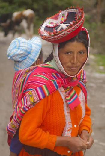
Woman near Pumamarka (2011) Photo (c) Karen Abrahamson

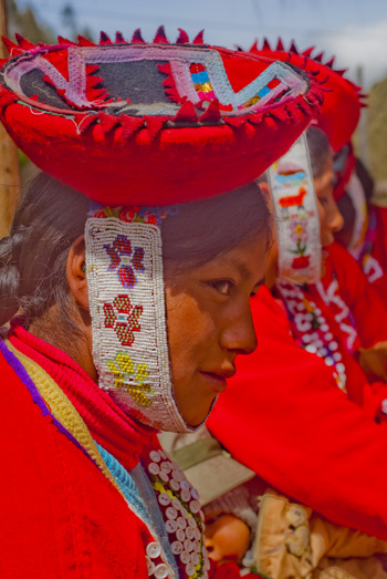
At the weaver’s cooperative, there were 36 women dressed proudly in their heavy skirts, hand-woven button-embellished jackets, and small hats held on by beaded chin straps. According to my informant, these villagers are not seeing their young men and women leave the village and that seemed the case looking at the ages of the women in the group.

So the coop bought the women’s weavings and I took photos while we sat on a hill side under thatched huts and blue skies with the sound of the wind in the eucalyptus and the river running. Taking it all in, I didn’t feel bad that I couldn’t walk much.

At the Weaving Coop (2011) Photo (c) Karen Abrahamson

Here in Ollanta, the culture and the past still lives and breathes and, if you sit quietly in the Plaza de Armas, both will pass you by – along with the traffic.

One of my new friends, waving goodbye (2011) Photo (c) Karen Abrahamson

Recent Fantasy

Available HERE,

$1.99

Available HERE,
$3.99

Available HERE $1.99


Recent Mystery


Available HERE
$4.99


Available HERE,

$4.99


Available HERE,

$4.99


Available HERE,
$4.99


Recent Romance

Available HERE, $2.99