Tag: Age of Exploration

They Came From the Rising Sun
They Came From the Rising Sun

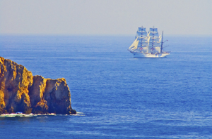
A Portuguese ship off the Algarve. Photo (c) Karen Abrahamson

I’ve spent much of this blog writing about the great European mapmaking tradition and the exploration that went with it, but long before European Kings considered funding a certain wild venture to reach India and China by sailing west across the Atlantic, and long before Vasco de Gama sailed round the Cape of Africa and into the Indian Ocean, the Chinese were venturing westward, too. They sailed from Canton and through the Malay straight and into the Indian Ocean. They mapped it, too.

Chinese records indicate that trade between China and Africa began as early as the Han Dynasty (202 BC to AD 220). Two of Africa’s most powerful nations of the time, Kush and Axum had trade relationships through intermediaries. In Kush the remains of ancient pottery and bronze utensils indicate that they may have been copying the styles of the Chinese goods being brought to its ports by Arab traders. Axum may have been the source of the rhinoceros horn, ivory and tortoise shell that Roman traders took to China in AD166.

But this was trade by intermediary, not face to face trade. The first trade by Chinese with African is thought to have occurred not much later, but it probably didn’t occur on African shores. Accounts of ancient travelers indicate that in places like Ceylon merchants and sailors from as far afield as China, Persia, Homerite countries and Adulis (an African port city) came together to trade. One Chinese trader, Fa Xian, stayed in Ceylon for two years before returning home to write his accounts of the people he met.
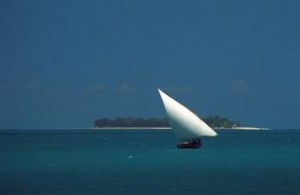
Dhow off Zanzibar Island (1994) Photo (c) Karen Abrahamson

During the time of the Tang Dynasty (618-907) records show that a Chinese did set foot on African soil. Du Huan, was a Chinese military officer who was captured by the Arabs during conflicts near Samarkand. After spending twelve years in the Abbasid Empire, he reappeared and wrote a record of his travels. Of the bits of that memoir that have been preserved over the ages, he speaks of travelling south over a great desert to the land of the black people, where there was little grain and no vegetation and malaria was endemic. Researchers today think this was probably modern-day Eritrea.

A Chinese junk from the 1270s was discovered in Guangzhou harbor in 1974 with cargo such as tortoiseshell, frankincense and ambergris that strongly suggest trade with Africa. Between 800 and 1400 Chinese goods were also making their way to Africa so that Chinese porcelain became common as decorations on houses and mosques and broken porcelain still apparently litters East African beaches. Chinese coins from the Tang Dynasty (the kind with the square hole in the middle) have been found along the coast and on islands like the Bajun and Zanzibar.
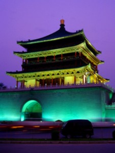
Chinese tower, Xi'an, China (1998) Photo (c) Karen Abrahamson

Of course, the Chinese travelers to these distant shores in these early days weren’t representatives of the Chinese dynasties. No they were merchants and traders. Most of these went as far as India and no farther and were content to trade with the middlemen who brought goods from Africa. But a few travelled further and the routes were known in the Kingdom of Heaven. In the ninth century the Tang Prime Minister and geographer, Jia Dan, knew of the sailing routes that gave 90 days from Canton to Arabia and 20 days for a further voyage southwest to a country called Sanlan.
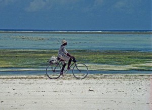
Cyclist on the western Zanzibar beach. (1994) Photo (c) Karen Abrahamson

Of course, if the Chinese were anything like the later Portuguese, this information could have come from Arab sailors as a result of the government confiscating all maps from visiting sailors, but a map compiled between 1311 and 1320 by the Chinese cartographer Zhu Siben clearly shows the triangular southwest pointing African continent at a time when the western world thought that Africa didn’t end, but instead the landmass continued on eastward before joining the mainland again and enclosing the Indian Ocean as a great inland sea.

Just think of what this map suggests: The Chinese were there first. If they had kept going, they could have discovered Europe long before the Europeans ‘discovered’ the route to China.


A Prince, a Prophecy and a Legend

A Prince, a Prophecy and a Legend

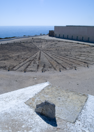
In southern Portugal, at a place called Sagre, I stood on red cliffs, high above an azure ocean and inhaled ocean wind and dust that had blown all the way from Africa. There, in an ancient fortress, laid out amid the scrub grass and rocky ground and seabird guano, laid a thirty foot, circular, roped off area that contained an old wind rose – a collection of ray lines that spread out to all points of a compass. This was the legendary home of Prince Henry the Navigator.

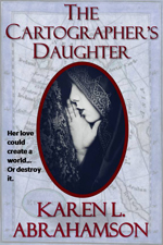
This was a few years back, when I had the good fortune to spend a month traveling around Portugal researching a prince for a book I was writing (The Cartographer’s Daughter). The prince I researched was none other than Prince Henry about whom the entire Portuguese psyche seems to revolve – or else he’s just a key tourist draw. You see everywhere you go in Portugal there are memorials to the old boy’s doings. In Porto there’s a museum that celebrates his birthplace. In Lisbon grand statues stand over the harbor and paintings of him fill the maritime museum. In Lagos another museum waits and elsewhere there are plaques and other statues. Why, you might ask? What did this man very few North Americans have heard of, do to deserve this kind of canonization?

I suppose the answer can be found in the wind rose.

Sagre windrose
The Sagre windrose has led to legends of a cartographer's school at Sagre. (2005) Photo (c) Karen Abrahamson

No, Henry didn’t invent the wind rose. Simply put, this foppish, spendthrift prince could be called the father of the Age of Exploration. Yes, there were many people that contributed to the dawn of new age of Europe, but good Prince Henry had something to prove and the full might of the Knights of Christ, the inheritors of the Knights Templar after they were disbanded, to help him do it. But I run ahead of myself. So who was Prince Henry?

The middle son of the Portuguese king, Henry was born under stars that astrologers proclaimed would devote Henry to ‘great and noble conquests and to uncovering secrets previously unknown to men’. Imbued with this sense of destiny, how could he help but be more than a middle son?

Henry grew up to be an ardent Christian and to become the head of the Knights of Christ. Along with that, came a driving hatred of the Moors and a determination to rid the European continent of them (they still held Granada). It also led to a dream of taking the Crusades across Gibraltar to Tangiers. His drive and his influence over his father led to one of the last European crusades—this one against the Moroccan trade city of Ceuta. The Portuguese won and held the city, but later, when they tried to advance they ended up routed from Tangiers and having to trade Henry’s younger brother for their freedom. This horrible blow some historians lay at Henry’s doorstep, but the loss of his brother was fuel to Henry’s fervor and he spent much of his life trying to revive the crusading fever amongst his cronies. It never came to be, but in the meantime Henry influenced a nation because he began to focus on maritime issues.

As a patron he began sending men on exploration along the African coast. Yes, he may have also been seeking a road to Christian Kings who could help him against the Moors, but his push and his financing, led to Gil Eannes becoming the first man to round Cape Bojador, which previously had been described as the end of the earth due to its difficult currents. With that passage, and with the improved sails and hull structures Henry’s money fostered, he ripped down a psychological barrier and the length and breadth of Africa beckoned. This led to a series of explorations sponsored by Prince Henry. He also fostered the collection of maps and sailors’portolan charts so that navigational information was shared and developed, before they became guarded national secrets.

The old Church at Sagre, (2005) Photograph (c) Karen L. Abrahamson

The interesting thing about Henry is that though we know so much about him, he still remains a man of mystery and legend. Records seem to show that he was an austere man who was deeply religious and sometimes given to mysticism at the same time as he liked to dress in foppish clothes and lavishly over spend the wealth of his estate holdings. He was also a man of learning who funded universities and financed astrologers and physicists and cartographers. But as I stood in Sagre by that wind rose I was struck by the rugged beauty that must have inspired him – that is until I went into the site’s visitor’s centre and they advised me that this fortress in Sagre was never a cartography school, though he did make his home here.

And the wind rose?

Henry’s involvement is just the stuff of legend.

Shaping the World – the power of belief.

Shaping the World – the power of belief.

In my last blog I mentioned how in the middle ages religion turned back cartographic knowledge, so that people started to think the world was flat. Heck, maybe it was flat then, given the prevalence of the belief in Europe. Or maybe the Europeans lived on a flat earth while the rest of the world didn’t, but during that time religious maps placed a new world view in the forefront of European’s minds.

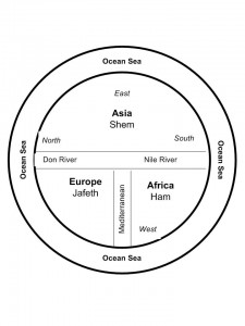
Some of the earliest maps, the ‘T-O maps’, from between 500 and 600 A.D. show a very different world than what we consider reality today. They were circular, disk-shaped maps (the O in T-O) that showed a circle of ocean around three continents that also made up a disk within the circle. At the top of the map was Asia that took up most of the top half of the circle. The bottom half was divided into Europe on the left and Africa on the right. Separating these three continents were the Mediterranean Sea (separating Europe and Africa), which was directly connected to the Don River and Nile River, which formed a horizontal margin across the middle of the map separating Asia from Europe and Africa. The confluence of the Mediterranean and the two rivers created the ‘T’ in the T-O map. The three continents were also each labeled and apportioned to the three sons of Noah, namely Shem, Japeth and Ham. The only further detail was the presence of Jerusalem at the heart of the world.

Not a particularly helpful map if you needed to find your way from point A to point B, but what it did was point the way to a different way of viewing the world. Asia was paramount and so was the east, which was also placed at the top. The north sat on the left. Why and what did this mean?

It reflected the belief that paradise lay somewhere off to the east and thus Asia was important.

Other maps of that time period, placed a square of land floating in an Ocean Sea that was filled by the four great rivers of paradise. So, for a while at least, these often beautiful maps were of no help to anyone travelling or exploring. But that wasn’t their intention. These maps were created to shape minds and belief systems, rather than to reflect reality.

Of course people still went on voyages from point A to point B, and  stories from adventures like the ‘mythical’ voyage of Saint Brendan of Ireland, fueled additions to maps for many years. Saint Brendan believed (contrary to the T-O maps), that paradise was an island somewhere in the Atlantic and so he sailed away and returned with tales of great adventures and the discovering of an island of great beauty and fertility that came to be known as Saint Brendan’s Island. Given the way the island changed its placement on maps over the next 1200 years, clearly this was an island with an outboard motor, but as late as 1721, long after the Age of Exploration  and the Renaissance had dawned, the Portuguese were still sending out expeditions to find Saint Brendan’s Island. They never did, and the paradise promised by Saint Brendan faded from the map.

But in my imagination, I wonder if the island really did exist — until someone decided to erase it from the map, sort of like an adult deciding a child is too old to beleive in Santa Claus. Maybe the island’s erasure was the point when Euopean’s grew up in the world. Or not…

Which, I suppose, points to the fact that the human spirit might hold to faith, but it also cannot be contained by the simple boundaries of  a T-O map.

Recent Fantasy

Available HERE,

$1.99

Available HERE,
$3.99

Available HERE $1.99


Recent Mystery


Available HERE
$4.99


Available HERE,

$4.99


Available HERE,

$4.99


Available HERE,
$4.99


Recent Romance

Available HERE, $2.99