Category: Writing

What’s in a Map? Aboriginal Maps and Writer’s Dreams
What’s in a Map? Aboriginal Maps and Writer’s Dreams

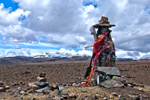
A Huaca, or sacred stone, in the landscape of the Peruvian Altiplano (2011) Photo (c) Karen Abrahamson

Last night I received an article from my local Romance Writers of America chapter about world building for writers and how making a map of a location can help to create your story and your plot. I got thinking about this and how it relates to human history. In particular I got to thinking about how some anthropologists and historians have drawn a line in the sand (the 15th Century) about when true maps came into existence. (See my last post here.) But it got me wondering whether they were short-sighted in their definition.

The authors of this theory have said that prior to the 15th century while people might have made maps, they largely weren’t made for the same purpose of orienting the landscape like maps are used for today. They talked about how maps of older civilizations presented a cosmology, not a spatial map, or were used to show relationships, which could as easily be represented in text or the spoken word. This, they posited, means that earlier map-like creations are not true maps. Whether they are wrong or right is a matter of some debate.
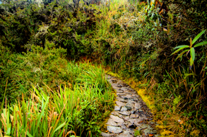
Trail along the Camino Inca, the path to Machu Picchu (2011) Photo (c) Karen Abrahamson

A case in point is Native American cartography. The literature about Native American maps is challenged by the fact that not only is it hard to find maps from pre-European contact (birch bark and leather just don’t stand up to five hundred years of colonization), but most of the records of native maps are colored by the perspectives of those who collected the map. The few maps that do exist require the reader to think of maps in more than one way. For example, records of a Virginian Algonquin map collected by John Smith in 1624 (while he was a prisoner), show a cosmological view of the world, but also a spatial linking of places. The map shows three concentric circles around a fire, with the first circle being a circle of meal representing the Algonquin Territory, the second being an inner circle of corn representing North America, and the third circle of corn representing the edge of the supposedly circular world. To try to understand John Smith’s origins from beyond North America, the Algonquin created a thatched stick island between circle two and three. Clearly this shows a sense of spatial distribution, even if it is not based on any scale a western European would use.
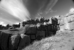
The ruins of Saqcsaywaman, Cusco, once part of the center of the Inca world. (2011) Photo (c) Karen Abrahamson

Another interesting ‘map’ was a gesture used by a Native American Elder to describe the location of his town. The elder held his forefinger and thumb like a not-quite-closed-looped ‘okay’ symbol. The location of his town was between the unclosed tips of the finger and thumb, with Quebec, Montreal, New York, Boston and Halifax all located along the knuckles and joints of the rest of that looped finger set. This again clearly places the Native American town in relation to the major cities. So the question may not be whether Native American’s had maps, but whether they recorded their map information in a different way. Native American communities and living accommodations like the Navajo Hogan, the Pawnee earth lodge and even some longhouses could be said to be map-like in their structural symbolism of the concept of the sky dome or celestial vault providing shelter for a two dimensional geography with the four directions spreading out from a pivotal centre of the house. It might not be written on a piece of paper, but clearly there is a sense of direction and relationship to place within their sacred geography.

Finally, Petroglyphs, a primary source of pre-contact information about Native American culture, have also yielded examples of what could be maps, though there continues to be some debate. Some appear to show river routes and tributaries along with trails. Still other stone paintings appear to represent drive fences (fences used to drive prey animals into capture areas) complete with pictures of the animals that resided in the area.
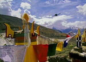
Across the world we look for the sublime meaning of everything. Prayer flags, Tibetan area of Northern India, (2000) Photo (c) Karen Abrahamson

Which brings me back to the RWA article. It spoke about how, for a writer, a map can help you to give a greater sense of place to your writing. The writer will know where the towns and roads and lakes and mountains are in relationship to where the character is. But drawing a map can help the writer to also learn something beyond thethe lay of the land. A writer’s map can help you to understand what monsters live in what areas, what territory belongs to the enemy and what resources there are to harvest, along with your character’s place in the world. This leaves me to think the Native Americans understood modern (writerly) mapping better than the anthropologists and historians think they did, and that the modern writer’s map is based in something much deeper and perhaps more linked to the notion of a sacred human landscape. Both look for something more than just scaled lines on a page to find our way through either our imagination or the world.



Free Fiction

Free Fiction

Free Fiction this week is part one of Pretense for Murder.

A dead girl, an empty phone booth where one shouldn’t be and a school full of suspects with too many unusual powers.

When student, Vallon Drake discovers the dead body of a girl and a British phone booth standing outside the American Geological Survey Preparatory Academy, she knows someone with special power committed the murder. Heck, her school exists to teach students with the talent to rewrite the landscape as future special agents. But while Vallon wants to solve the crime, everyone else wants to cover it up. Trust Vallon to break the rules to take the investigation on—even when the cost of doing so might be her life.

To read Part one, click here.


Free Fiction

Free Fiction

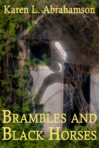
Brambles and Black Horses

By Karen L. Abrahamson

Gayle lost everything in the long ago accident that killed her family’s champion race horse and left her a ruined wreck of flesh and broken bones. Now, as bulldozers destroy the old farm where her love of racing was born, the appearance of a strange barefoot boy threatens to bring ruin upon her again.


To read the story, click here.

In Search of a World Map

In Search of a World Map

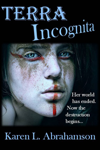
This week I finished the second draft of book two in my post apocalyptic fantasy, Terra Incognita, series. It wasn’t easy because it required a fairly major rewrite of much of my major character’s attitudes and motivations because I hadn’t mapped my character out from book one to book three. As I get started on Book Three, I’m thinking about how the importance of a consistent road map across a series of books is just as important as a consistent map of the world.

My last post spoke of the work done to standardize measures in mapmaking that led to the creation of the scientific metric measuring system. But the creation of the metric system was only the start in a venture to create of a consistent set of maps of the world. This might not seem sexy, but think about traveling to a different locale and finding the maps you are using don’t use consistent measurements and contradict each other. You end doing a mass of translations to make the maps work or you might end up throwing the maps out because they are so inconsistent it’s easier to simply start from scratch. That was the situation for many explorers because the maps they had might have used a consistent measurement scale (but not always), but were also based on measurements started from different starting points. In other words the Prime Meridian had never been agreed upon.

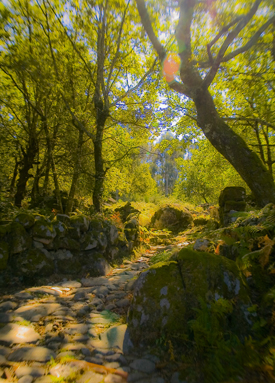
The trail turns upwards (2011) Photo (c) Karen Abrahamson

After the agreement about the metric system, there were still disagreements in the cartographic world. One of the major ones was the position on the earth from which meridians (the imaginary lines drawn on the earth from pole to pole that connect all spots along the longitude) should be referenced – in other words where was the zero point on the globe from which all other distances would be measured. To this point in time, where measurements began depended upon the nationality of the scientist conducting the measurement.

The need for a Prime Meridian had existed for all Cartographers. Ptolemy had chosen the Fortunate Islands – at his time the westernmost extent of the world. But the age of politics had national sentiment taking precedent with the French recommending the zero point’s location in Paris, the Spanish recommending either Toledo or Cadiz, the Italian Pisa or Rome, and Americans wanting Washington or Philadelphia etc. It took the International Meridian Conference in 1884 to settle on Greenwich as the Prime Meridian which gave us our zero longitude, and also set our clocks and time zones with Greenwich Mean Time.

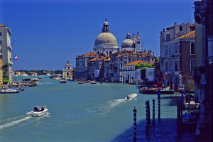
Venice's Grand Canal (2004) Photo (c) Karen Abrahamson

A later conference of the International Geographic Congress realized the mapping issues I mentioned above meant that there was a need to revise the world’s maps to create a consistent map of the world. It led to a proposal for an International Map of the World that would all be drawn to a single scale – 1:1,000,000 (1 centimeter =10 kilometers or 1 inch equals 15.78 miles) – leading to the name of the project being the Millionth Map. It would also be drawn using standardized symbols and colors. The project was debated for a period, but after examples of the maps were produced, in 1913 an agreement was reached. Maps were to be created for each 4 degrees of latitude and 6 degrees of longitude, not paying attention to national boundaries. All place names had to use the Roman alphabet.

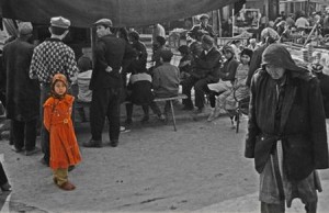
Little Uigher girl, Sunday Market, Kashgar, Western China (1997) Photo (c) Karen Abrahamson

It was a slow process. Between 1913 and the start of the First World War only eight maps were produced out of a total of 2,500 required to map the world. Between 1921 and 1946, the American Geological Survey produced the 107 maps that comprised the map of Hispanic American (North and South America). By the 1930s 405 maps had been produced in total, but the central repository of the maps (in Paris) was largely destroyed during the Second World War. In 1953, the United Nations assumed responsibility for oversight of the project, but by the 1980s only 800-1000 maps had been completed and many were not completed using exactly the same standards. Since then the U.N. has stopped even reporting on the project, so after all this work the Millionth Map languishes and who knows when you’ll fall right off its edges when you visit another country and have to work with maps that don’t mesh.

This suggests that I had better get busy and piece together the latitudes and longitudes of book three in my series, so that all of the books provide a complete and consistent picture of Terra’s world.


New Short Fiction

New Short Fiction

Ice Dragon

By Karen L. Abrahamson

Only the brave and the lucky can survive the walking dead, the frozen winter and the perilous ice dragon.

When seventeen-year-old Jazella of Gruenheld faces a forced marriage to the ancient Venerable Heed, she makes the decision to leave the safety of Gruenheld’s stockade walls in hopes of obtaining the treasure that will buy her freedom. Faced with the dead and the dragon, will her luck hold?

Available on Smashwords and Amazon


New Short Fiction

New Short Fiction

Two new short stories are now available on Amazon.com and Smashwords.

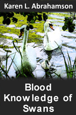
A small child, a string of pearls and a colony of swans converge in this short story of family life gone wrong. In Bella’s world of beautiful swans, her mother is the most beautiful creature of all. But swans abandon Bella every year and now her mother may abandon her, too. In a world filled with magic, what’s a child to do?

Amazon

Smashwords


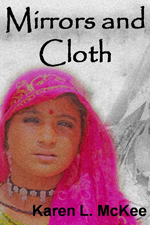
Lost in Rajasthan, the home of camels, hevalis, ornate men’s turbans and women draped in mirror-embossed saris, freelance journalist, Lena, must deal with strange customs and two men who profess to love her. Choosing the right path can be as convoluted as the twists on a Rajasthani turban.

Amazon

Smashwords

Boundaries and Goals: The straight edge of the map

Boundaries and Goals: The straight edge of the map

Old Roman Road, Portugal (2005) Photo (c) Karen Abrahamson

I just read a great post by my friend and fellow writer, Matthew Buchman. Matt wrote about goal setting and why he always sets hugely high goals, and how he (usually) berates himself for not reaching those goals instead of celebrating the numerous accomplishments his goals have helped him achieve. He also wrote about how he intends to continue set superhuman goals, because it keeps him going, pursuing the dreams he has for his writing. This got me thinking about goals and maps, because what is a goal, anyway, but a map of where you are trying to go? You set your goals farther and you’ll probably go farther. You set easy to accomplish goals and you might not reach the brass ring you really wanted to achieve.

This made me think about the boundaries we place around our lives and how the mapmakers of North America have perhaps influenced how we think. I’m talking about the surveyors who first set boundaries across the landscape. At first, North American surveyors took a metes and bounds approach to surveying, much the same as is used in England. A metes and bounds description might be something like, Beginning at the cherry tree growing where Hazy Creek joins the Swift River, north along Swift River 200 rods to the stone wall next to Cascade bridge bordering the road, then West along the road to a lightning-struck maple at the corner of Christopher Hopper’s place, thence, south toward Hazy Creek where a cairn has been set next to the ford, and thence eastward along Hazy Creek to the beginning place.

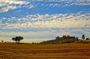
HIlltop Fortress, Alentejo, Portugal (2005) Photo Karen Abrahamson

This approach to placing boundaries relative to the landscape, shifted with the survey of the Mason-Dixon line, to an approach dependent upon accurate readings of latitude, and on a process of taking horizontal measure with a chain and surveyors level and frequent (every 10 degrees or 17.5 kilometers) astronomical observations. They even made careful adjustments for the earth’s curvature.

Surveyors subsequent to Mason and Dixon used similar methods as they moved forward to comply with the Land Ordinance Act of 1785, which modified a proposal originally made by Thomas Jefferson, to use the principle of rectangular surveys, instead of the irregular metes and bounds, to partition the landscape. Congress envisioned a series of townships along the Ohio River and up to the great lakes and so on westward. As a result, teams of surveyors headed west with axemen chopping a line through the forest. Of course the Indians had other thoughts about the measuring of the land which they thought of theirs. But the surveyors kept coming and the trees fell as the surveys were made and the lands of America became something new: a checkerboard landscape of straight lines and right angles as exemplified by the four corner meeting if Utah, Colorado, New Mexico and Arizona and as seen on any map of America.

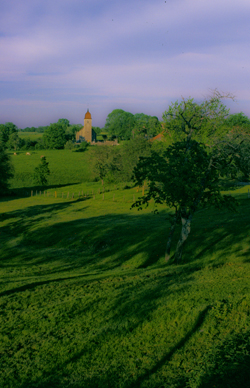
French village spire (2004) Photo Karen Abrahamson

How does this relate to goals? Well all these straight lines got me wondering if setting too-clear boundaries might also set boundaries in our minds. It got me wondering if Matt’s ideas of setting goals that almost surely surpass our abilities (read boundaries) might actually make us reach farther.

With that in mind, I’ve modified my annual writing goals as follows:


Original:

  • Write 30 pages a week
  • Write four novels (or three if one is a fat fantasy)
  • Post one blog a week
  • Publish at least one new short story and three novels
  • Work on craft of openings and voice

Revised writing goals:

  • Write 30 pages a week
  • Write four novels (or three if one is a fat fantasy)
  • Post one blog a week
  • Publish 25 items (Novels and short stories) in 2012
  • Work on craft of openings and voice.
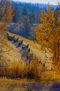
Snake fence along the Kane Lake Road, British Columbia, (2006) Photo(c) Karen Abrahamson

The thought of publishing 25 items fills me with fear because it means I have to write those stories or novels. I knew I could accomplish the 3-4 novels, but I don’t know if I can accomplish this. So I’ve stretched beyond those neat little borders I set for myself. I’m back into the wild spaces marked by metes and bounds. And you know what? If you fly over all those neatly surveyed spaces, you’ll find that fence lines and roads and buildings generally follow more natural paths anyway. So here’s to breaking boundaries and going to those new places nature takes us.


Free Fiction

Free Fiction

I’m pleased to provide to a new short fantasy, Bees in the Morning, to celebrate the new year.

What happens when an aging apiarist’s best hive is destroyed?

Bees in the Morning can be found here.

Recent Fantasy

Available HERE,

$1.99

Available HERE,
$3.99

Available HERE $1.99


Recent Mystery


Available HERE
$4.99


Available HERE,

$4.99


Available HERE,

$4.99


Available HERE,
$4.99


Recent Romance

Available HERE, $2.99