Category: Writing

Great Expectations: Cats and Readers
Great Expectations: Cats and Readers

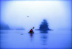
Kayaking the west coast. (1996) Photo (c) Karen Abrahamson

This past week I was supposed to be on the coast of Oregon with a group of writers learning about marketing books to bookstores. I was really looking forward to the trip and being with a group of great friends. I had everything packed and ready to be loaded into my car. My cats were primed and ready to for the trip. (They always travel with me, and the hotel where I stay at has known these boys since they were babies—it’s like a second home).

Then Ben, the larger of the two boys got sick and not just throwing up, but a total shut down. He quit eating (a VERY big thing for this guy) and drinking and became very quiet and cooperative. Now you have to know Ben. This is a cat that pulls paintings off walls and statues off shelves just to get your attention. When he took a downturn I ended up taking him to the emergency veterinarian. The next day more vets and more bills and at that point the I was still holding up hope that he might recover and I might still head to my course a day late.

Not to be.

Ben.

More tests, more bills and by this point I was administering subcutaneous fluids twice a day, force feeding three times and day and wrestling pills down his throat twice a day. It’s a wonder he’s still speaking to me. How do you spell stress?

The point I’m making here is that all my expectations were dashed and so I had to totally regroup and refocus myself from a week that I had booked off from work to a week working and caring for sick cats (yes, Ben’s brother got the same bug). It was jarring. It was unpleasant not least because I had a sick cat, but also because I wasn’t doing what my mind had expected. I raise this because it brought home something important writers need to think about, which is reader expectation.

Reader expectation is what the reader is expecting to experience in a book. For instance, if J.R.R. Tolkien had written a shoot-‘em-up Science Fiction book as a follow-up to the Lord of the Rings, think about how disappointed the Lord of the Rings fan would have been when they bought the book. Same goes for the reader who picks up a book that has a cover and blurb that looks like a suspense story, but when they get reading they find it’s women’s fiction. Or the reader whose book spends an immense amount of time early on lovingly describing the gun the hero owns, but by the end of the book the gun has never been used or even appeared in the story again. Each of these authors has violated reader expectations.
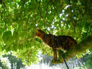
Shiva trying to catch a fly in Oregon.

A few days ago I was talking with a writer friend of mine. He was bummed out because his editor at a New York publisher had turned down book two of his two book contract and my friend couldn’t understand what that had happened. In discussion with the writer he advised that book one was a lavish fantasy involving the Jewish kabala. Book two was a comedic superhero novel. Anyone see a problem here? Apparently his editor did, because the publishing house had ‘bought’ my friend as an author of lavish Jewish fantasies, but his second novel failed to deliver this in every respect. The publishing house likely turned the book down out of concern for reader expectations. Basically my writer friend was asking to his readers to give up the expectations he had created through his first book and start all over again. I suggest that readers don’t like to do this anymore than I wanted to give up my week in Oregon.

In all of these cases the author failed to meet reader expectations and as a result the reader would have as dissatisfying an experience as I have had this week. Yes, the book(s) may still have been well written. My writer friends second book was undoubtedly wonderful (he’s a great writer), but it wasn’t what the publisher was banking on the reader wanting. He should have written another Jewish fantasy. He should have written under a different name for the superhero novel. Not that all our books have to be the same, but if we want to establish a career as a writer, we need to establish a brand. We might have several brands for different kinds of books written under different  names. For instance my romance novels are under Karen L. McKee, while my fantasy/SF is written under Karen L. Abrahamson. It helps reader know what they are getting and this helps meet reader expectation.

So as writers we need to make sure that we don’t put our readers through the experience I’ve had this week. With two sick cats, I definitely didn’t get what I’d thought I bought when I booked the week off.

(and in case you were interested, the boys are both on the mend.

The boys.
“A Good Traveler (or writer) has no Fixed Plans…”

“A Good Traveler (or writer) has no Fixed Plans…”

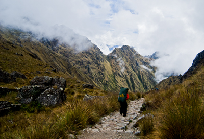
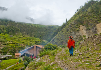
Porter on the Camino Inca. (2011) Photo (c) Karen Abrahamson

I purchased a lovely journal the other day. Though it’s not specifically a travel journal it certainly could be, because all of the quotes in the book relate to travelling, but when I read the complete quote by Lao-Tzu, all I could think of was its applicability to writing. The quote goes thus:

‘A good traveler has no fixed plans and is not intent on arriving.’

As someone who loves to travel, this quote provides a cautionary tale, because it warns that if you focus always on the destination you miss a lot along the way. Personally, I prefer to meander from place to place because you never know when you are going to find some better place to go than the place you intended. If you are always focused on heading somewhere, you have a much greater chance of missing where you are. As the Buddhists suggest, mindfulness of where we are, rather than worrying about the future  (or where we are going) brings much more happiness than the rush, rush, rush of hurried travel. It’s for that reason that I don’t take bus tours. The tours point out what they think you want to know, not what you can really learn just by being there.

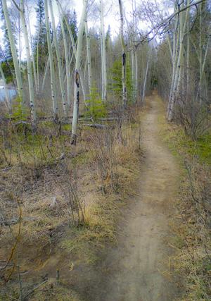
Yukon path, (2008) Photo (c) Karen Abrahamson

But Lao-Tzu’s quote applies equally to writing. The writer who spends all his/her time solely focused on completing a project isn’t really giving themselves the opportunity to enjoy the project. I’m not saying that you should fool around and never finish, I’m suggesting that you should enjoy the process, no matter how difficult it is, and—just like the traveler who takes the time to meander you don’t need to be so end-driven that you can’t enjoy the little sidepaths that your muse sends you down.

I guess what I’m talking about is allowing the story to carry you along, just like the road can. You don’t have to know where you are going exactly, though you may have a vague idea that you would like things to end in a certain way. Some of my best days of writing are when I have allowed the story to carry me away from the story I had intended—those are the mornings I get up and rush to get writing again because I want to know what happens next. The funny thing is that if you allow the little digressions and flashes of insight to lead you, often the ending will turn out to be some place better than what you envisioned. Believe me, if the ending surprises you, it’s going to surprise and charm your reader, too.

So as a recovering ‘plotter’ of novels I think all novelist should allow themselves the freedom to step off the path they are following to explore the new world they’ve created. They might just find it’s bigger and better than they ever imagined.

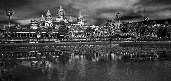
Angkor Wat reflections. (2009) Photo (c) Karen Abrahamson
Ray Bradbury and Rewriting the Map of Canada

Ray Bradbury and Rewriting the Map of Canada

Woodland trail, Yukon, Canada (2009) Photo (c) Karen Abrahamson

Ray Bradbury died this week and as a science fiction and fantasy writer, his was some of the writing that most inspired me. I will forever be haunted by his horrific short story “All Summer in a Day,” but some of Bradbury’s best work were his cautionary tales like Fahrenheit 451, a terrifying look at the death of freedom and the burning of books in a fictional future. You might wonder what this has to do with the map of Canada, but bear with me.

This post will probably be as close to getting political as I will ever get, but events here in Canada have pushed me to the place where I finally have been forced out of the silent majority. You see the map of Canada is about to change. Not the physical map, perhaps, but the environmental map and the map of our hearts and our place in the world, and our children’s future is under attack so badly that I have to speak out. It feels very strange for a business person and writer who has always focused on fiction. For those of you who don’t live in Canada, here’s what’s at issue.

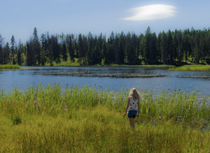
Small fishing lake in the B.C. Interior. (2011) Photo (c) Karen Abrahamson.

1. Our federal government is currently introducing legislation, Bill C 38, that will abolish most of our environmental protection legislation. They claim that they are trying to clean up the legislation in order to make it ‘make sense’ for municipalities and farmers, but in reality, while they might cut some red tape, they are getting rid of any legislation that might block the immediate implementation of major corporate initiatives, like the Enbridge Pipeline that will cross some of the most rugged and pristine landscape in Canada, from Alberta to the Pacific Ocean. This pipeline will cross hundreds of miles of wilderness and thousands of salmon-spawning streams to bring the dirtiest type of oil to the Pacific Ocean. Once there, this same legislation erases much of the laws in place to protect the pristine waters of British Columbia. It will allow oil tankers to ply the delicate environmental areas of the inland passage to take this dirty oil to China—one of the worst polluting countries in the world. Think Exxon Valdez. The legislation also removes the safeguards in place for many endangered species, because, the new legislation says, these species aren’t really important.

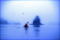
Kayaking the coast of British Columbia (1996) Photo (c) Karen Abrahamson

2. At the same time this government is systematically silencing any opposition. Along with this salvo against the environment which shortens any environmental assessments and limits who can even participate in the discussions, the government has also launched an attack against non-profit societies and charities, by imposing restrictions that stop these charities from any sort of advocacy against government actions. This attack has specifically been leveled at environmental organizations because they receive donations from other countries and this government is threatened by the groundswell of reaction from around the world about what they plan to do. They are changing the rules to hamstring any opposition against the huge oil corporations.

At the same time, they either stop funding scientific research, or they place gag orders on all remaining government scientists who might provide a voice of reason or evidence that government actions are wrong. But then I shouldn’t be surprised. This government doesn’t believe in science.

Even Members of Parliament who try to express what their constituents want are silenced. And when members of the United Nations commented recently on the impoverished state of our First Nations population, this government told them to go away and focus on third world countries. It seems Canada, in this government’s eyes, is beyond criticism.

All of this paints a picture that should terrify anyone concerned for our future. For someone who has always been a proud Canadian these actions are only the tip of a blood-chilling iceberg. It leaves me to think that, instead of the great white north that has stood proudly for freedom, integrity and honour both here and abroad for 145 years, we are being transformed into a country I only read about as in Ray Bradbury’s writing.

Welcome to totalitarian Canada – next comes the book burning.


Knowing Where We Are in the World – and in Story

Knowing Where We Are in the World – and in Story

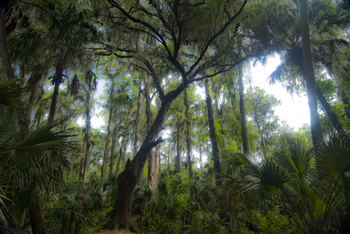
Cypress tree, Northern Everglades (2012) Photo (C) Karen Abrahamson

I’m currently working on two pieces of writing. One is the third novel in the Terra Trilogy and the other is the third installment of the Ice Dragon Series of short stories. Working on these two projects has made me question how I know where I’m going and how do I know where I am in relation to everything else in both these stories. It brings to mind the question of how we know, in our real life, where we are in relation to the rest of the world.

In this day of GPS and mapquest etc. this might seem like a very easy question to answer, but it wasn’t always this way, just like I wasn’t always able to have a sense of where I am in a story. Yes, surveyors took it upon themselves to survey the world. Countries (and scientists) agreed on the prime meridian that impacts all our time zones. But the 20th century has primarily been concerned with improving the precision of mapping and in particular with ensuring the pinpointing of places on the map in relationship to the rest of the world. The US Geological Survey was involved in this through most of the 20th century.

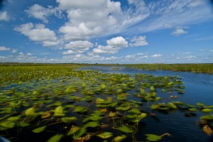
Waterlilies, Northern Everglades (2012) Photo (c) Karen Abrahamson

Why is this important? Well, think about it. Without standard understanding of how everything relates to everything else, weird things happen, like bridges getting built from each shore that don’t meet in the middle, or highways that have weird jogs in them because the measurements allowed the two ends to miss each other. It might not be important to you, but the cost overruns of such mistakes make having a common context for measuring everything important because it stops these types of things from happening.

In North America, the result of the surveying is those nice little brass discs (known as monuments) set in concrete or rock dotting the landscape . Each of these little brass discs serves as a known point for all subsequent surveying in the area. How did they know the individual location of these monuments? They took meticulous measures of distance through triangulation surveys and also measured the azimuth—the direction of Polaris—to set each monument’s position.

Throughout America, broad swaths of land were surveyed independently to create grids of known locations. They measured locations not only horizontally across the landscape, but also vertically, in relation to sea level, but the challenge was knowing that all these grids fit together. The result was the selection of a single monument at a ranch in central Kansas, Meades Ranch, as point zero for all grids across the country. Meades was chosen because it sat centrally in the US and it lay close to the crossing of two major survey lines across the US – one from Canada to Mexico and the other from the Atlantic to Pacific Ocean. Interestingly, today Meades Ranch has been superseded by global positioning that uses the center of the earth as the central point of reference.

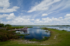
Airboat docked in the Northern Everglades. (2012) Photo (c) Karen Abrahamson

The use of that central point for mapping draws me back to my thoughts on plotting a novel or story. I once heard the wonderful writer, Nancy Kress, talk about plotting. Now I don’t know how you feel about plotting—some people are all for detailed plotting of everything in a novel, while others prefer to fly by the seat of their pants (Pansters) and write into the mist of their imagination. Nancy Kress seemed to offer a third alternative that didn’t hold a writer’s imagination down, but also gave some structure to writers so that all that lovely mist didn’t turn into a dense blinding fog. Ms. Kress suggested that writers need to write down what they think is going to happen in the novel. Just brainstorm them out. Ask yourself what is the beginning (the inciting event) and what is the midpoint (quiet often a reversal of some sort), and how do you think the story will end (the climax)? Once you have those key points identified, you can easily place them on a plot line and them locate all your other plot ideas on either side of the midpoint—a lot like being able to measure your location from Meades Ranch.


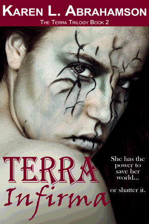
Book 2 of the Terra Trilogy is now available!

Book 2 of the Terra Trilogy is now available!

I’m thrilled to announce that book two of the Terra Trilogy is now available in e-book and the print publication will be available in May.

In the years after the ‘Big One’ destroyed most of human civilization, a lone city perches precariously on the Pacific Northwest coast of North America.

When nomadic marauders attack the Independent city of Couver, seventeen-year-old Terra Vargas must choose: use her Cartos powers to protect her city, or rescue her mother from the marauders’ camp. But as her control over the earth power erodes, so does her ability to choose wisely.

Stay or go?

Either way, there will be a horrible price to pay.

Available on Amazon and at Smashwords and other fine e-tailers.


Books and Geology: Mapping Beneath the Surface

Books and Geology: Mapping Beneath the Surface

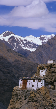
Cliff-side Monastery, Spiti Valley, India (2000)
Cliff-side Monastery, Spiti Valley, India (2000)(photo (c) Karen Abrahamson)

Recently I was reflecting on the difference between plot and story, with plot being the events that happen to keep the story moving, and ‘story’ being what the book is about and the changes that occur to the characters along the way. Frodo starts out as a happy young hobbit, and returns as someone who understands the price that must be paid for the safety of places like the Shire. Bella starts out as this infatuated, clumsy girl who constantly has to be rescued, and turns out to hold the secret abilities to save everyone.

This got me thinking about mapping beneath the surface. In a book, if you are a plotter, you map out where the actions occur, but also the impact the scene has on the character. I started out writing this way, and used wonderful planning sheets like these. This has allowed me to layer stories with the emotional changes that make a story much richer to read.

A similar process has occurred in mapping the world. Once the surface mapping was well under way, people began to wonder how to map the landscape under the layer of dirt and forests we see. Why? To gain a better sense of the layering of the landscape and the connections between places. For example, the discovery of similar strata layers in both France and England demonstrated that once they were a single land mass.

The process of mapping the underside of the earth began around 1750 when a Frenchman named Jean Etienne Guettard asked just such a question about England and France. Though he posed the question, the first person taken seriously for geological mapping was an Englishman named William Smith who spent a quarter of a century mapping England and Wales beneath the ground. Smith had been a surveyor’s helper and a keen observer who noticed and recorded things like strata exposed in hillsides and in mine shafts. Smith was the first person to have the insight that different strata held different fossils from different time periods, which provided a means to date the strata. He also noted that similar fossils were found in similar strata, even though they were separated by long distances. In 1815, the result of his study was a many-colored map of England and Wales that set out the different geological formations.

Off to the fields, Pumamarka (2011) Photo (c) Karen Abrahamson

Such a map can set out the distribution of various geological units such as glacial debris (if it was near the surface) or deeper formations like igneous, metamorphic or sedimentary rock that underlie the topsoil. Of course, having a general picture of the structure of the earth wasn’t enough for a civilization with an increasing thirst for oil and minerals, so processes were developed that measured gravitational attraction from which geologists could deduce the nature of the subsurface geology. Other processes drew on the ancient Nordic use of magnets to locate ore bodies. A more modern magnetometer was developed in the 1930s and mounted on aircraft to gather readings. The Seismic method was developed after 1875 when an English geologist in earthquake-prone Japan, thought to use a seisomograph to determine where the quakes arose from. A similar process was used in 1909 to discover the boundary between the Earth’s crust and its mantle.

Using sonic sounds or thumpers or vibrators to create sound, the sonic process then uses geophones (or hydrophones for underwater exploration) to read echoes from underground formations that tell the scientists what lies underneath.

This has led to the ability to measure the crust of the earth (which measures from about 6.5 kilometers thick under the ocean to 50-75 kilometers thick under high mountains), the mantle which extends from the crust to about half way to the centre, and the dense, partly molten core. Seismology has led to the ability to map oil deposits and layers of water and natural gas that wait in the earth’s crust. But they have also allowed scientists to reach much deeper.

Main Ghat, Varanasi
Main Ghat, Varanasi (2000) Photo (c) Karen Abrahamson

Geologists are now able to measure and map the underside of the earth’s crust (I alluded to this here). Which is a lot like understanding the underside of a novel, because, like the geothermal power of the earth that may save us from global warming,  it’s really the hot emotional underbelly of a novel that brings out the best of any novelist’s writing.


Rhumb Lines, Novel Writing and How to get from point A to Point B

Rhumb Lines, Novel Writing and How to get from point A to Point B

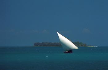
Dhow in coastal waters off Zanzibar Island (1994) Photo (c) Karen Abrahamson

As I mentioned in a previous post, I’m in the midst of a year of writing sequels. Actually it may take two or three years to get through all the sequels needed for my current novels. As I have already mentioned on this blog I’ve found writing my first sequel a bit of a challenge even though I knew where I was going. It seemed that I kept straying off course.

This puts me in mind of the challenges mariners had back before Gerard Mercator created his famous projection in 1569. A projection is a way of taking three dimensional landforms off of a globe and placing them onto a flat surface (a map) while retaining relative conformity of shape and relation between the landforms. What Mercator did was take meridians of latitude and longitude and make them all aim straight north-south or east-west creating 90 degree angles at each intersection. Sure it expanded the landforms closer to the poles, but it also gave mariners a means of plotting courses over long distances.

Picture this overlaid on top of a typical world map with latitude and longitude laid out.

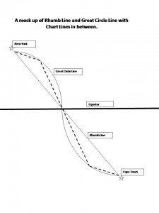
You see, prior to Mercator, mariners shared two fears – bad weather and getting lost. (Actually I share their fears, the latter most particularly when I’m writing.) In the years before Mercator’s projection, mariners had generally confined their sailing to the Mediterranean and coastal waters. The transatlantic voyages to America were done by the stars, but there were no helpful portolano (mariners maps using compass roses to show sailing routes) of the great oceans. Mercator’s grid made sailing the open ocean as easy as sailing the coasts because it gave sailors a means to chart a straight line (a rhumb line) from Point A to Point B across the ocean. From this they could plan their headings and make their voyages.

Of course sailing the distance from Cape Town to New York is about as huge an endeavor as writing a novel (or a sequel) from page one to the end and neither route actually takes a straight line. Sailors travelling that distance recognized that they didn’t travel a flat earth, they travelled a globe and so they added to their calculations, the curve of a great circle that was the largest circle they could draw through a sphere and this route showed the actual shortest distance between two points. Sailors then chose their routes by drawing straight chart lines between the great circle and rhumb line that allowed them to approximate the great circle along the route.

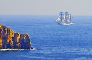
Tall ship off Portuguese coast (2006) Photo (c) Karen Abrahamson

This seems a lot like the process I use when I’m writing. I know where I start and I know where I want to finish (most of the time). The writing process then becomes one of deciding how far to travel from the rhumb line (the plot or the backbone) of the story, for it seems to me that novels have great circles, too. These are the themes you are writing about and you don’t want to allow your plots to take over, so that your story is nothing but plot, but neither do you want your subplots to take you so far out of your way that the story no longer fits within its themes. And that’s where sailing and writing diverge in their process. Sailors use the great circles and rhumb lines to plot their course and they follow it from Point A to Point B. A writer, on the other hand, will use them to plan their novel or their series of novels, but also to look behind and check whether they have wandered too far off course to get to their final destination. This is the challenge in sequels: viewing the second or third book as just one of the charted lines between the rhumb and the great circle, building its way to the ultimate end of the voyage.


Do We Need Maps in Fantasy Books?

Do We Need Maps in Fantasy Books?

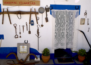
Alentejo house wall, Portugal (2005) Photo (c) KarenAbrahamson

Yesterday I spent part of the afternoon mapping the layout for a community event I’m planning. I found myself confounded (for a bit) about the need for scale, because I needed to be able to estimate the amount of security fencing I needed. What struck me was that I didn’t actually need to make a map. Others could have determined the fencing needs through simple math. But for me, the answer to my fencing needs lay in graphic representation so that I could measure the length of fencing from visualizing the exact boundaries of everything. It raised the question for me of whether maps of fantasy worlds were always necessary.

Controlling the reader’s experience of imaginary places seems to me to be the main purpose of maps in fantasy books – to set hard boundaries around the reader’s imagination. Whether a map is actually necessary has been a topic of discussion among writers. I wonder if the debate about the inclusion of maps couldn’t learn something of benefit from looking at dialogue within the cartographic world.

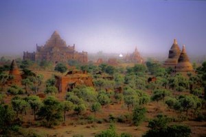
Dhamayagyi Phayto, Pagan, Burma (1997) Photo (c) Karen Abrahamson

You see, there are some pundits who suggest that professional and academic cartography is dying because it has become too cut off from the human experience and too insistent on rules and scales and design constraints, while the human need to map (or simply to talk about location) is under constant evolution. Think about some of the things mapped today. It’s not mountains and rivers and landscapes. In my non-writing life I’m dealing with maps of childhood vulnerability, community asset maps and maps of fast food restaurants placed near high schools.

Not exactly like the maps of the great explorers, which is why I question whether qualities like scale are necessary, or even possible or useful, for many types of maps including those in fantasies. The maps I’m dealing with in my non-writing life are helpful to because they help me express certain phenomena occurring in the community, but I didn’t have to do it with a map. I could have provided a chart or a list, just as the fantasy author can provide description. Was a map even necessary? Is it necessary in a fantasy?

In the past, most of my books have been without maps, instead painting the picture of place with my words. In my epic fantasy, however, (The Warden of Power) I felt that a map was necessary as I wrote the first volume of my epic so that I could ensure place names, etc., were used consistently in the manuscript and its sequels. Did I include the map in the book? Actually, no.

I think the reading experience should be one that transports the reader to a place that they and the writer create together, without a map setting boundaries around the reader’s experience. Let the reader read my words, their brain cells fire, and reinterpret the world in my fiction. It doesn’t matter that they might not imagine the world exactly like me. My words are code and the reader will interpret them from within the context of what matters to them. Isn’t that what

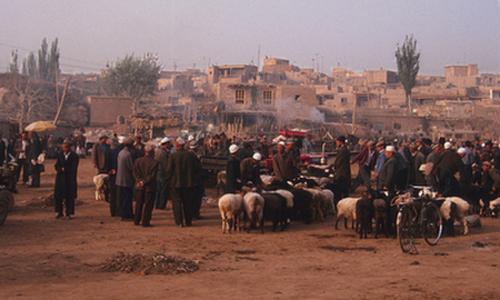
Morning shepards, the Sunday Market, Kashgar (1999) Photo (c) Karen Abrahamson

reading is all about? Creating a world in your head? Some of the most disappointing experiences I’ve ever had involved artists (or Hollywood) providing their interpretation of a book I love. Inevitably their attempt to place boundaries around a character or the landscape wasn’t consistent with what I had in my head.

Mapping, like other forms of communication, reflects a need to express, to create and to understand, but setting a map in a book – like setting rigid rules around mapping — it can stymie the imagination. This applies whether we’re creating new maps to express new ideas or situations, or creating a world in a reader’s mind. Mapping, like dreaming, is a human need. Must we, as writers, place boundaries on that need?


Free Fiction

Free Fiction

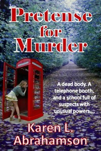
Pretense for Murder (part two)

By Karen L. Abrahamson

Vallon Drake continues her investigation into a dead girl where no girl should be. In a school with too many students with too much power, continuing the investigation might just lead to a second body: Vallon’s.

To read on, click here.

Recent Fantasy

Available HERE,

$1.99

Available HERE,
$3.99

Available HERE $1.99


Recent Mystery


Available HERE
$4.99


Available HERE,

$4.99


Available HERE,

$4.99


Available HERE,
$4.99


Recent Romance

Available HERE, $2.99