Category: Maps and Cartography

Spy Lands –Who really discovered the coasts of America
Spy Lands –Who really discovered the coasts of America

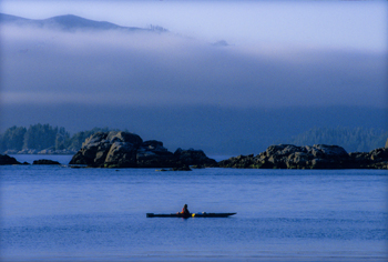
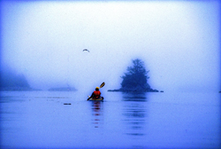
Kayaking the west coast of Vancouver Island, Photo (c) Karen Abrahamson

I mentioned last week about spies and maps and government subterfuge as aspects of maps that we rarely think about. Municipal governments still fool residents with streets on maps that are planned, but haven’t been built. Map makers take liberties with place names and add imaginary towns and streets that reflect their biases for and against university football teams. But in the past spies were frequently involved in cartographic subterfuge.

For instance, most of us were schooled that Captain Cook was the first European to lay eyes on the north western coast of North America. However there is mounting evidence that the English privateer (government sanctioned pirate) Sir Francis Drake, not Cook, first saw the coast of Oregon, Washington and British Columbia between 1577 and 1580 – 160 years before Cook’s journey.

Why isn’t this known?

First of all because some historians are hard pressed to let go of old ideas, but second of all because Drake’s journey was likely suppressed and evidence of it hidden, because of disputes with the Spanish that were, later, going to erupt into war. Drake is confirmed to have travelled as far north as Mendocino, California, the farthest north the Spanish had been, but a 412 year old map commemorating Drakes circumnavigation of the globe shows details of the coast of British Columbia that no one could have known unless they had been there. Additionally, archeological evidence – 1571 British coins and equipment – have been found in Oregon and Victoria, B.C. gardens, so that Drake is believed to have travelled as far north as Prince of Wales Island in Alaska. Finally, Drake’s cousin confessed under torture to the Spanish, that a fabled North Pacific island, Nova Albion, had been discovered by Drake and claimed for England 29 years before Samuel Champlain founded Quebec and before there was a Virginia on any map. This is believed to have been Vancouver Island, kept secret.
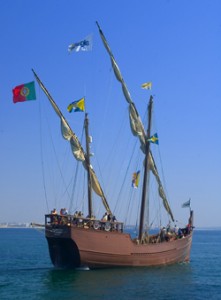
A further example of cartographic spies, deals with those icons, Christopher Columbus and John Cabot. Columbus, we’re taught, discovered the Americas while looking for China. Cabot’s fame is due to his first North American landfall by a European. Or at least that’s what we’re taught. But in a 1498 letter that was penned just months after Cabot’s historic return from Newfoundland, a spy in England wrote to Columbus and talked about earlier voyages by men from Bristol to the same place Cabot had been and that these earlier voyages had been to an “Island of Brasil” and that Cabot’s landfall “is believed to be the mainland that the men from Bristol found”. The spy’s letter also mentions that these voyages from Bristol were well known to Columbus – something that is further supported because Columbus had spent time in Bristol and Iceland in the 1470s – almost 20 years before he managed to convince the Spanish monarchy to fund his explorations. Did Columbus use this knowledge to convince Isabella? Did he use it to calm his crew on his long crossing?
We may never know, and even if we do, will it matter? For Columbus IS an icon that history won’t forget, but what this shows is how secrets and spies permeate the European history of maps, so that who really ‘discovered’ the coasts of America may never be known. Of course, just talk to a First Nations/Native American person and they’ll tell you we’ve got it all wrong anyway. North America had been ‘discovered’ long before any European left home.
The Place That Wasn’t There

The Place That Wasn’t There

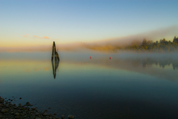
Mist on the Fraser River (2009) Photo (c) Karen Abrahamson

I fell off the map this week – at least that was what it felt like when I learned that I’d been removed from the intercom list at my townhouse complex. It doesn’t sound like much – a simple omission when they were doing the complex list – but think about it. To the outside world I no longer existed in this location. I inhabited an invisible place outside of the normal world that happened to be located between the house number below me and the one above – much like the safe house in Harry Potter but without the overt magic. I was gone, and so was my home and all the mementos I’ve collected from across the world. And of course my cats.

I’ve experienced something similar before, when I worked in the interior of British Columbia in a small town that was a long ways away from anywhere. When my agency’s reporting relationship shifted from one region to another, all the paperwork connections seemed to disappear and no one contacted us – it was actually quite a nice change. But it was also like we inhabited some huge fog bank that filled a space in the center of the province that no one knew existed. Our own personal twilight zone.

Kayaking the Broken Islands (1996) Photo (c) Karen Abrahamson

Such phenomena isn’t only in my imagination. Cartographers have been erasing or omitting bits of the landscape from their maps since before Prince Henry, when choice harbors and trade routes were secrets worth killing for. In order to gain a truer picture of the world, it became common practice for Kings to confiscate the log books and charts of each ship that came to harbor in order to copy them down before the sailors took ship again.

During the time of the early Portuguese spice trade, the location of, the Moluccas, the five tiny islands that were the sole source of nutmeg, mace and cloves, were closely guarded secrets. True maps of the eastern Indian Ocean were treated as highly classified documents (and few exist today) due to the possibility that the Portuguese were violating a Papal bull which gave the Spanish sovereignty over all lands west of a longitudinal line running 100 leagues west of the Cape Verde Islands (in the Atlantic).

During the age of exploration and when Spain, France and England were vying for the Americas and the Northwest Passage, maps were made that purposely misrepresented the landscape in case they fell into (and sometimes purposely intended for) the enemies’ hands. Such maps were intended to deter exploration by competitor nations because the harbor, the river, the inhabitable, productive land wasn’t there.

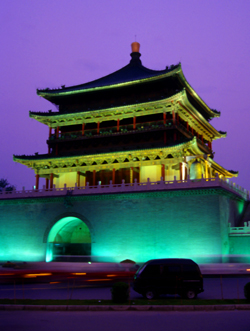
Xi'an tower (1998) Photo (c) Karen Abrahamson

Even today we see maps shift reality so that places exist differently than what you would find ‘if you were on the ground’. Road maps often include streets that are planned, but have never been built, or don’t describe that the street crossing that looks so direct on the map, can’t be made. A recent internet report showed that Chinese government maps of cities often change the position of major streets. Why? For military purposes. The government has apparently fallen back on the ancient practice of redrawing reality to stop potential invasion or intelligence gathering.

Happily, I’ve been replaced on the list of existing residents of my complex and so my home and I have been returned to reality. There is no longer a fog where my house once stood and my cats and I are all okay.

The Roots of the World

The Roots of the World

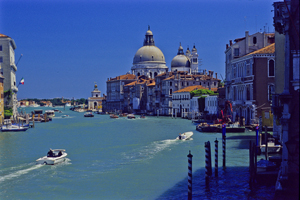
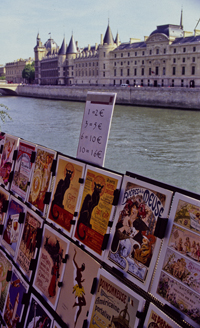
The Grand Canal, Venice (2005) Photo (c) Karen Abrahamson

For men like Fra Mauro (see last post), the exploration of the external world led to an understanding of the inner landscape of men. So too, from the triangulation of the world (see post here) came a greater understanding of the internal shape of the earth.

I mentioned previously that in order to determine the shape of the world, a French survey team went to Ecuador and Peru at the same time as a team went to Lapland. Unfortunately for the Peruvian team, the Lapland team discovered the answer to the scientific question long before the Peruvian team ever finished their survey. While in South America, however, the Peruvian team struggled over mountains and through jungles and noted different gravity readings as they took their survey measurements along their route. They surmised that the differences in the readings might reflect the varying landscape and theorized that mountains might be made of less dense material than the lowlands. A good theory, but it took over a hundred years for the matter to be more fully explored and the discovery was made far from South America. It took the British Raj’s need to survey India to bring understanding to what the mass of mountains might mean.

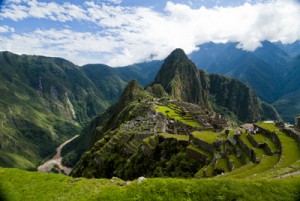
Machu Picchu caught in the coil of the coil of the Urubamba River (2011) Photo (c) Karen Abrahamson

In the mid nineteenth century, the horrendous task of surveying India through triangulation was almost undone by the discovery of an error of some 150 meters between the distance the triangulation measurements computed, and an actual direct surface measurement. To determine what had led to the error, the cartographers involved had to reexamine their assumptions – in this case they had assumed that the mass of the Himalayan Mountains would greatly influence the gravity measurements of their survey instruments. What they found was that they had overestimated the lower mass of the mountains.

This led to a theory of the earth’s crust that still exists today, namely that every (theoretical) column of the earth (from core to outer surface following a theoretical plum line) should have approximately the same mass. Given that tall mountains have a lower mass, they must have an equally large (but low mass) protuberance at the bottom of the earth’s crust to achieve the same mass as denser areas of the earth’s crust. Conversely, under the oceans where the ocean basins are very dense, the earth’s crust would be relatively thin. The theoretical result would be that inside the earth there would be a mirroring of the plains, mountains and ocean valleys we see on the surface, much like a tall iceberg has a large underwater presence to balance it out. Modern science has supported this, by obtaining crust measurements off the coast of South America that show the Andes have roots as deep as 75 kilometers.

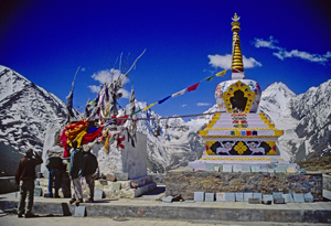
Stupa and Prayer flags at the Manali Summit (2000) Photo (c) Karen Abrahamson

Think of this the next time you are crossing the mountains, staring up at those tall, snow-covered peaks, for they are the frosting, the outer conceit of an iceberg of stone that conceals the deeper reality of the roots of the mountains.

Much like Fra Mauro saw the illusions of men obscure the truth of his map of the world.

Powell’s Books: A glimpse inside the cartographer’s mind

Powell’s Books: A glimpse inside the cartographer’s mind

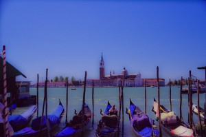
Gondolas, Venice (2004) Photo (c) Karen Abrahamson

The other day at Powell’s Books (Portland), I came across a wonderful little book called “The Mapmaker’s Dream” by James Cowan. The book is the translation of the diary of Fra Mauro, a sixteenth century Venetian monk and cartographer who set out to make a perfect mappamundi (map of the world) though he had never stepped outside the confines of his cloisters. Instead he gathered travelers’ tales through exchanges of letters or interviews of missionaries, merchants and soldiers travelling through Venice. His task became well known and he received envoys from as far afield as the court of the Chinese Emperor. Not only was this book astounding for the fact that word of his venture travelled so far in the 16th century, but the information he collected and the workings of his mind fascinated me.

Yes, his travelers brought stories of the Cyclopedes, beings in the southern hemisphere with only one huge foot that they used for hopping and also for shade when the sun in the antipodes became too fierce, but envoys also brought other tales that caused good Fra Mauro much reflection. This was what captured my attention for they showed a keenness of mind and a shifting view of the world much like new age philosophers. This seemed strange for his time; given Fra Mauro was a devout Catholic.

His encounters left him pondering whether the soul could possibly transmigrate into another person upon the death of the body and whether we are ‘all drifting towards a more complete life in someone else’. The visit of an old Jewish merchant from Rhodes left him contemplating how the loss of place (in the holy land) ‘condemned the man to inhabit his loss forever’ and how the rootless person came to inhabit a region of his own mind instead.

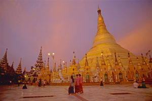
Schwedigon pagoda
Holy Schwedigon pagoda at sunset, Yangon, Myanmar (Photo (C) Karen Abrahamson)

Visits from others left him considering how venerated holy relics become something more because of that veneration, and how those objects take on their own life because they unite an idea that men aspire to. They left him wondering at cultures that worshiped Satan and yet were not evil, and others that determined their actions and their future through the calls of seven forest birds.

But most of all he wrote of the minds of travelers. He was struck by the notion that travelers not only travelled with their bodies, but also that they travelled in their minds and were transformed by that travel or, alternatively, transformed the place they had been. He wrote of the journeys of envoys sent to find the mythic kingdom of Prestor John and looked at the evidence of such a kingdom – the long letter still held in the Vatican archives that describes a kingdom so perfect it could not possibly exist. Fra Mauro concluded that the reason the search for Prestor John’s kingdom became all consuming, was not just the desire for aid against the Moslem hordes, but the desire to know that it was possible for paradise to exist on earth. Travelers longed to become ‘slaves’ to Prestor John’s perfection and bounty. But the country of Prestor John would never be found because it was only built on dreams.

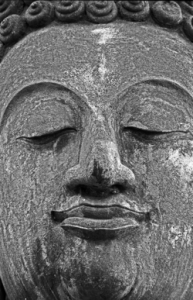
Buddha face, Sukhothai
Buddha face, ruins of the ancient capital of Sukhothai (1997) Photo (c) Karen Abrahamson

Ultimately, Fra Mauro realized the challenge of creating a perfect map arose because each man’s perceptions of place were different and any ‘perfect’ map must capture not only the land forms, but also the forms of the world created by men’s minds.

The lowly monk of Venice completed his life’s work, but today no trace of his perfect mappamundi exists, except in references in the pages of his journal. Perhaps, like the worlds he described, it faded away to become the world as we know it today, but more importantly what his journal shows is a man of deep thought who’s Sixteenth Century perspectives still resonate with readers today.

Thank you, Powell’s, for this gift.

A Question of Balance

A Question of Balance

We have a lot to thank the ancient Greeks for. They gave us Greek culture, mythology, the Odyssey and the Iliad. They developed drama and many of the arts and sciences and gave us some of the best early approaches to understanding the world – including its cartography. But the Greeks got some things downright wrong, too, like the circumference of the world. Unfortunately the rest of the European world held onto these errors as gospel simply because it WAS the Greeks who initiated the theories.

Case in point was the Greek philosophers’ belief in symmetry which, in cartography, surmised that because there was a large landmass in the northern hemisphere (Europe and Asia and North Africa), there must be a similar large land mass in the south. This led to world maps carrying the weight of a large continent south of the equator. In earlier maps this continent encircled the Indian Ocean, but when Vasco da Gama sailed the Cape ofGood Hope to circumnavigate Africa, the great continent receded a little, and simply reached out from the limits of Antarctica. It became known as Terra Australis.

The myth of the Antipodean continent caused cartographers to override the information brave explorers brought back from their ventures. When Magellan made the dangerous crossing from Atlantic to Pacific off the tip of South America, they spotted Tierra del Fuego and surmised it was an island. Cartographers, however, chose to override those who had been there, and drew Tierra del Fuego as an outcropping of the great continent. More mapmakers embellished their maps with prominent features like the land of Parrots, the Cape of Good Signal and the River of Islands, all lending credence to the existence on the continent. But exploration in the Pacific continued to chip away at the continent’s size, but it was only in the 1770s, when Captain James Cook was instructed to search for the southern continent, that he sailed farther south than 71 degrees to a land of fog and snow mists, that cartographer’s gave up on their belief in the super-sized southern continent.

So they turned their notion of symmetry northward.

If South America and Africa both had southern straights that gave passage from one ocean to another, then surely there must be something similar in the north. This led to the search for the Northwest Passage that scattered the names of many an explorer across Canada’s north. Think Frobisher Bay. Think Baffin Island and Hudson Bay, just to name a few.

Explorers from Spain, France and England sent explorers up and down the coast of North America and deep inland through the great lakes, seeking that passage. The English sent exploration teams one after another into Canada’s north, many never to be heard from again.

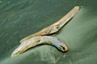
Driftwood at Longbeach, B.C. (2005) Photo (c) Karen Abrahamson

When the search from east to west brought no results, they sent famed Captain Cook, and then Captain Vancouver, exploring and mapping the Pacific coast of North America still seeking that elusive fjord that would spread out and become a fulsome channel all the way to England.

It was not to be, but such legends died hard. And today perhaps the ancient Greeks are laughing, as global warming opens up the northern passage they prophesized. Symmetry exists at last.


The World Has Three Points

The World Has Three Points

I mentioned last week how the ancient Egyptian, Eratosthrenes, used a column and a shadow as two sides of a triangle to estimate the size of the earth, which shows the importance of geometry to cartography. Nowhere was this more evident than in mapping the earth, where triangulation, (the process of determining the location of a point by measuring angles to an unknown point from known points at either end of a fixed baseline), was literally used to measure the location of everything in relation to everything else.

Geometry and triangulation had actually proven themselves previous to Eratosthrenes. They’d been used to measure the heights of the pyramids and had also had been highlighted by the ancient Chinese as an important principle of mapmaking. Unfortunately this wasn’t well known in Europe even though the Arabic influence brought such surveying methods into old Spain. Instead, Europe was still transcribing tourist tales and fanciful stories onto paper and selling these for parlor display based on their beautiful illuminations, rather than spending their time surveying the landscape.

Apparently the first European to get serious about the use of triangulation was a Dutchman named Gemma Frisius who suggested using triangulation as a means to pinpoint the location of places on maps. The technique gradually spread through the 1500s, but it wasn’t until the 1600s that Europe got serious. A Dutchman named Snell began the process of surveying the landscape with a chained line of triangles (much like the triangles the American flag is folded into)across the countryside for a distance of 70 miles. The use of Snell’s process led to a rise in the quality of the Dutch maps and, in comparison, the decline of French maps into dependence upon engraving and elegant color as their selling feature – all well and good as a parlor adornment, but not what you want if you actually want to do something with the map you made.

Enter Guillaume Deslisle: In the late 1600s this young Frenchman began to change maps from things of the arts to matters of science. At a time when the great rulers such as Louis XIV knew little about the countries they ruled, he began to use triangulation surveys to permanently shift and fix continents and islands on the map, and even settled the age-old argument about the length of the Mediterranean Sea (41 degrees). The work of Deslisle and his kin led to the first mapping of Russia, or Muscovia as it was known at the time, and eventually influenced the French Minister for Home Affairs and advisor to Louis the XIV, Jean Colbert, to push for the mapping of France.

In 1663, Colbert ordered that each French province’s maps be examined to see if they were of sufficient quality. If they were not, qualified surveys were to be undertaken. This eventually led to Abbe Jean Picard overseeing the first precisely measured chain of triangles and topographical surveys around Paris – the two preliminary foundations to accurate mapping. The extension of this process led to France being mapped and became the standard practice for scientific mapmakers. It was used in the cartographic expeditions used in Lapland and Peru discussed in my last cartographic blog, in mapping the Himalayas, the English countryside and, the Grand Canyon and everywhere else in the world.

But the work of Deslisle and Picard had unforeseen impacts. Like the magic in my books, the new maps seriously revised France’s boundaries and coastal outline. The world’s shape was changed again – all because of three points.

Myths, Latitude and the Financial Shape of the Earth

Myths, Latitude and the Financial Shape of the Earth

Despite the myths and rumors of a flat earth promulgated during the Middle Ages, most scientific minds over the centuries have known the world was a sphere. Clues to this came from the fact that boats sailing away disappeared gradually as if they sank from view, and did not simply diminish in size. The Greek philosopher and mathematician, Pythagoras, hypothesized that earth was a sphere based on the fact that the sphere is ‘the most perfect of forms’. If the sun and moon were such a shape, why not the earth? It was Pythagoras and other Greeks such as Plato and Aristotle who cemented the idea of a spherical earth in European culture.

So people knew the world was round, they just didn’t know the size of it, nor did fully understand its shape.

Estimating the size of the earth also harkens back to the Greeks. Both Aristotle and Archimedes had erroneous estimates of the earth’s circumference, but history hasn’t left any clues as to what those estimates were based on. The

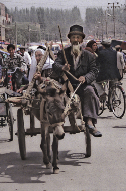
Going to market, Kashgar, China (1998) Photo (c) Karen Abrahamson

Chinese apparently sent two men to measure the earth and they walked it from north to south and east to west before coming up with the result of 134,000 kilometers (hopelessly in error).

The first (known) scientific measurement of the earth’s circumference came from an Egyptian named Eratosthenes during the time of the Ptolemy Kings. He knew of a water well in Southern Egypt where at noon on a certain day of the year the sun shone straight down to the bottom. He also had made observations that on the same day in Alexandria, at noon, there was still a shadow. He hypothesized that if he could measure the angle of the shadow on that day, he should be able to estimate the size of the earth. Using a vertical column he did just that, measuring the distance of the shadow from the base of the column. Then, with the length of the column, and the length of the shadow, he could calculate the third side of the triangle and determine the angel of the sun’s rays. Using basic geometry he was able to hypothesize that the earth was 46,000 kilometers in circumference – too large since we know today that the circumference is about 40,000 kilometers – but not too shabby for a man working with only a shadow and a column.

The debate about the actual size and shape of the earth continued over the centuries, with various other size estimates coming to prominence at different times. Contributing to the issue was the debate over the actual length of a degree, a debate that raged for centuries. This led to numerous ‘thinking men’ attempting to determine the length of a degree through methods ranging from counting the turns of a carriage wheel as it travelled between two points, to taking laborious chain measures of distance across the English countryside. It took debates of Newtonian and Cassini theories to help scientists realize that they were – in a word – wrong – about there being a definitive length of a degree.

You see, Newton formulated the theory of universal gravitation and that centrifugal force would mean that the earth could not be perfectly round. If he was right, due to the earth’s spin, the earth would be flattened at the poles and would bulge at the equator. Refuting this was the work of French scientist, Jacques Cassini, who had found that the length of a degree seemed to get slightly shorter at the poles compared to the equator. He theorized that this meant that the earth was shaped more like an egg, with poles drawn out and the equator flattened.

It took two expeditions in the 1700s, one to Peru and Ecuador, and other to Lapland, to settle the issue. While the trip to Peru dealt with altitude sickness, unfriendly Indians and disease, the expedition to Lapland had to race winters to take measurements. The team in Lapland completed their measurements after two years and found that the length of a degree was significantly longer in the north than a degree measured in France, thus proving that the earth was indeed compressed on the poles and bulging towards the equator. The poor Peruvian team spent nine years completing their mission, and confirming Newton’s theory, only to discover that their work was redundant.

But what they showed was that the length of a degree will depend on the latitude:

  • The east-west degree at the equator = 111.321 kilometers, however the circumference along a meridional circle is 67.2 kilometers shorter.
  • The north-south degree at the equator = 110.567 kilometers and the
  • The north south degree at the poles = 111.9 (or 1.4 km longer)

All of which may be where the phrase ‘giving someone some latitude’ comes from: What they do (and how far they go) will depend on where they’re standing.

Which could explain the disparity in approach the Germans and Greeks are espousing to deal with the Eurozone financial crisis. It’s all latitude.

A Prince, a Prophecy and a Legend

A Prince, a Prophecy and a Legend

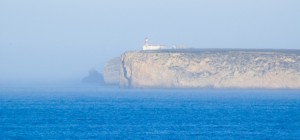
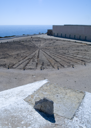
In southern Portugal, at a place called Sagre, I stood on red cliffs, high above an azure ocean and inhaled ocean wind and dust that had blown all the way from Africa. There, in an ancient fortress, laid out amid the scrub grass and rocky ground and seabird guano, laid a thirty foot, circular, roped off area that contained an old wind rose – a collection of ray lines that spread out to all points of a compass. This was the legendary home of Prince Henry the Navigator.

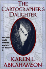
This was a few years back, when I had the good fortune to spend a month traveling around Portugal researching a prince for a book I was writing (The Cartographer’s Daughter). The prince I researched was none other than Prince Henry about whom the entire Portuguese psyche seems to revolve – or else he’s just a key tourist draw. You see everywhere you go in Portugal there are memorials to the old boy’s doings. In Porto there’s a museum that celebrates his birthplace. In Lisbon grand statues stand over the harbor and paintings of him fill the maritime museum. In Lagos another museum waits and elsewhere there are plaques and other statues. Why, you might ask? What did this man very few North Americans have heard of, do to deserve this kind of canonization?

I suppose the answer can be found in the wind rose.

Sagre windrose
The Sagre windrose has led to legends of a cartographer's school at Sagre. (2005) Photo (c) Karen Abrahamson

No, Henry didn’t invent the wind rose. Simply put, this foppish, spendthrift prince could be called the father of the Age of Exploration. Yes, there were many people that contributed to the dawn of new age of Europe, but good Prince Henry had something to prove and the full might of the Knights of Christ, the inheritors of the Knights Templar after they were disbanded, to help him do it. But I run ahead of myself. So who was Prince Henry?

The middle son of the Portuguese king, Henry was born under stars that astrologers proclaimed would devote Henry to ‘great and noble conquests and to uncovering secrets previously unknown to men’. Imbued with this sense of destiny, how could he help but be more than a middle son?

Henry grew up to be an ardent Christian and to become the head of the Knights of Christ. Along with that, came a driving hatred of the Moors and a determination to rid the European continent of them (they still held Granada). It also led to a dream of taking the Crusades across Gibraltar to Tangiers. His drive and his influence over his father led to one of the last European crusades—this one against the Moroccan trade city of Ceuta. The Portuguese won and held the city, but later, when they tried to advance they ended up routed from Tangiers and having to trade Henry’s younger brother for their freedom. This horrible blow some historians lay at Henry’s doorstep, but the loss of his brother was fuel to Henry’s fervor and he spent much of his life trying to revive the crusading fever amongst his cronies. It never came to be, but in the meantime Henry influenced a nation because he began to focus on maritime issues.

As a patron he began sending men on exploration along the African coast. Yes, he may have also been seeking a road to Christian Kings who could help him against the Moors, but his push and his financing, led to Gil Eannes becoming the first man to round Cape Bojador, which previously had been described as the end of the earth due to its difficult currents. With that passage, and with the improved sails and hull structures Henry’s money fostered, he ripped down a psychological barrier and the length and breadth of Africa beckoned. This led to a series of explorations sponsored by Prince Henry. He also fostered the collection of maps and sailors’portolan charts so that navigational information was shared and developed, before they became guarded national secrets.

The old Church at Sagre, (2005) Photograph (c) Karen L. Abrahamson

The interesting thing about Henry is that though we know so much about him, he still remains a man of mystery and legend. Records seem to show that he was an austere man who was deeply religious and sometimes given to mysticism at the same time as he liked to dress in foppish clothes and lavishly over spend the wealth of his estate holdings. He was also a man of learning who funded universities and financed astrologers and physicists and cartographers. But as I stood in Sagre by that wind rose I was struck by the rugged beauty that must have inspired him – that is until I went into the site’s visitor’s centre and they advised me that this fortress in Sagre was never a cartography school, though he did make his home here.

And the wind rose?

Henry’s involvement is just the stuff of legend.

Seeking Prestor John: We’re All Looking for Rescue

Seeking Prestor John: We’re All Looking for Rescue

Last week I talked about the legend of paradise contained in Saint Brendan’s Island and how that legend persisted through 1200 years of exploration. Explorers and Kings were looking for safety, and a way to return to the promised land. Perhaps, like a lot of us, they were looking for a return to a simpler time and hoped for someone to help in a time of dire need. This gave rise to another long-lasting legend – that of Prestor John.

Prestor (short for Presbyter) John was rumored to be a Christian King whose kingdom existed far to the east in Asia – or maybe it was Africa. That was sort of the trouble. The kingdom shifted and moved around the landscape, eluding the best explorers sent out by Popes and kings. But the myth of Prestor John held sway for many years with embellishments and details that included Prestor John’s Pedigree- right back to none other than King David.

Rumors of Prestor John’s kingdom began in 1150 – right about the middle of the Crusades and the Catholic Church’s intent to spread Christianity across the world. The legendary king was apparently a Christian King who had risen up and battled and beaten the Musselmen ( or the Moors, as the people of the Moslem east were then known) and become a powerful emperor. His presence became a symbol of hope in a time when the Christian west was at war with the ‘infidel’ in the holy land and the specter of infidel invasion disturbed the sleep of many western nobility and religious leaders.

The sudden hope and the belief in these rumors led to multiple dispatches of faithful retainers to find the mythic kingdom. Many never returned, but some traveled far to the east and actually met with the Mogul Khan, dispelling the myth that the Christian Kingdom existed in Asia.

But it also led to maps.

Yes, adventurers like Marco Polo gave detailed descriptions and maps of the places they had been (including the location of Prestor John’s Kingdom somewhere in China). More importantly, maps gained in value as European leaders sought to move people across the continent to the battles in the holy land. This led to the creation of pilgrim’s guidebooks, a type of map. The need to move such large numbers of men and equipment resulted in the enlisting of Venetian and Genoese merchants. The needs of such merchants for shipping ports, and the wealth of groups like the Knights Templar and the Knights Hospitaler led to the Holy Land becoming a mercantile centre for the movement of trade from Asia to Europe. The European hunger for spice and ‘things eastern’ involved Europeans in trade both in overland missions across the Asian continent and on coastal journeys along the southern Asian coast. Which led, by the 1300s to a renaissance of awareness of Asia and its wealth and the resulting creation of new maps.

But in the meantime it meant that Prestor John’s Kingdom shifted to the darkness of what was then called Abyssinia – a belief that still held sway as Europe began its shift towards the Age of Exploration. Figures central to the dawn of the exploration age still hoped that Africa might contain Prestor John’s Christians who could help against the Moors. Which makes me wonder if the enduring cold war of the 1950s, 60s and 70s might have influenced the rise of the SETI project. Perhaps we were looking for help ‘out there’ like the hope Prestor John provided to those long ago Christians.

Which begs the question: where are we going to be looking next?

Shaping the World – the power of belief.

Shaping the World – the power of belief.

In my last blog I mentioned how in the middle ages religion turned back cartographic knowledge, so that people started to think the world was flat. Heck, maybe it was flat then, given the prevalence of the belief in Europe. Or maybe the Europeans lived on a flat earth while the rest of the world didn’t, but during that time religious maps placed a new world view in the forefront of European’s minds.

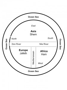
Some of the earliest maps, the ‘T-O maps’, from between 500 and 600 A.D. show a very different world than what we consider reality today. They were circular, disk-shaped maps (the O in T-O) that showed a circle of ocean around three continents that also made up a disk within the circle. At the top of the map was Asia that took up most of the top half of the circle. The bottom half was divided into Europe on the left and Africa on the right. Separating these three continents were the Mediterranean Sea (separating Europe and Africa), which was directly connected to the Don River and Nile River, which formed a horizontal margin across the middle of the map separating Asia from Europe and Africa. The confluence of the Mediterranean and the two rivers created the ‘T’ in the T-O map. The three continents were also each labeled and apportioned to the three sons of Noah, namely Shem, Japeth and Ham. The only further detail was the presence of Jerusalem at the heart of the world.

Not a particularly helpful map if you needed to find your way from point A to point B, but what it did was point the way to a different way of viewing the world. Asia was paramount and so was the east, which was also placed at the top. The north sat on the left. Why and what did this mean?

It reflected the belief that paradise lay somewhere off to the east and thus Asia was important.

Other maps of that time period, placed a square of land floating in an Ocean Sea that was filled by the four great rivers of paradise. So, for a while at least, these often beautiful maps were of no help to anyone travelling or exploring. But that wasn’t their intention. These maps were created to shape minds and belief systems, rather than to reflect reality.

Of course people still went on voyages from point A to point B, and  stories from adventures like the ‘mythical’ voyage of Saint Brendan of Ireland, fueled additions to maps for many years. Saint Brendan believed (contrary to the T-O maps), that paradise was an island somewhere in the Atlantic and so he sailed away and returned with tales of great adventures and the discovering of an island of great beauty and fertility that came to be known as Saint Brendan’s Island. Given the way the island changed its placement on maps over the next 1200 years, clearly this was an island with an outboard motor, but as late as 1721, long after the Age of Exploration  and the Renaissance had dawned, the Portuguese were still sending out expeditions to find Saint Brendan’s Island. They never did, and the paradise promised by Saint Brendan faded from the map.

But in my imagination, I wonder if the island really did exist — until someone decided to erase it from the map, sort of like an adult deciding a child is too old to beleive in Santa Claus. Maybe the island’s erasure was the point when Euopean’s grew up in the world. Or not…

Which, I suppose, points to the fact that the human spirit might hold to faith, but it also cannot be contained by the simple boundaries of  a T-O map.

Recent Fantasy

Available HERE,

$1.99

Available HERE,
$3.99

Available HERE $1.99


Recent Mystery


Available HERE
$4.99


Available HERE,

$4.99


Available HERE,

$4.99


Available HERE,
$4.99


Recent Romance

Available HERE, $2.99