Six Mysteries. Six Authors Read.
Meet six cool Canadian authors and hear about their new releases, replenish your TBR pile, be entertained!
Recently Sisters in Crime -Canada West showcased six authors and their new releases.
To view, click HERE.
Meet six cool Canadian authors and hear about their new releases, replenish your TBR pile, be entertained!
Recently Sisters in Crime -Canada West showcased six authors and their new releases.

To view, click HERE.
Two new releases came out in December. One is the short fantasy story of the first case of Vallon Drake, the heroine of Afterburn and the American Geological Survey series. The story is called All She Can Be.
The second new release is the first in a contemporary romance series with touches of magic and suspense. The novel, Unlocking Her Heart leads off a series of books in what will be the Unlocking Saga.
Karen L. Abrahamson
When someone moves the Canada/US border along the flooding Red River, the American Geological Survey assigns freshman agent Vallon Drake to find the culprit and repair the damage. If she doesn’t it could destroy the peace between the two nations.
But solving a crime in the shadow world of the AGS is never straightforward, especially when assigning blame can have serious career repercussions.
Karen L. Abrahamson once again transports us to the change-ridden world of the AGS, but this time she takes us back in time to Vallon Drake’s first dirty little case.
Available on:
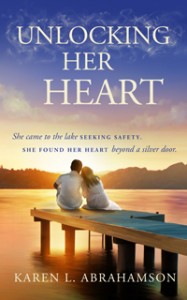 Unlocking Her Heart (The Unlocking Series, Book 1)
Karen L. Abrahamson writing as Karen L. McKee
When Kylee Jensen left Africa she left behind her fiancée and brought with her a badly broken heart. To heal, she seeks out her best friend in the idyllic lakeside town of Peachland where she meets bad boy vintner Brett Main. Kylee knows her barely mended heart can’t take a man like Brett, but meeting Kylee might just be the incentive Brett needs to change his ways. When a mysterious death disturbs the peace that Kylee sought, and she finds a puzzling bracelet that refused to be removed from her wrist, only Brett’s help can keep Kylee from being next on the killer’s hit list.
Karen L. Abrahamson creates a cast of wonderful characters in this, the first book of the Bracelet contemporary romance series. The book will take readers to the sun-soaked Okanagan Valley where orchards and vineyards cover the hills and sometimes magic raises its head, like the ancient Okanagan lake monster.
Available at:
 My book is being featured on Friday December 19th 2014 at www.ebooksoda.com. Check it out for free and bargain ebook deals!
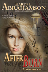
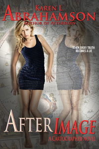 Afterimage – Karen L. Abrahamson
With the destruction of the American Geological Survey complete and the Gifted and their power no longer a secret, all Gifted must choose to fight or flee. The mortally wounded agent Vallon Drake and her friends run for the border, desperately hoping for the help of the ancient Cartographers who, so far, have considered the Gifted far beneath their notice.
But dealing with the Cartographers reveals a personal history that Vallong never wanted to know. When those responsible for the AGS’s destruction find a way to block the Gifted’s power, Vallon must overcome her past to face a threat that will destroy not just the Gifted, but all life on earth.
Karen L. Abrahamson delivers another breakneck adventure that leaves the reader gasping in this fourth book of the American Geological Survey. With its twists and turns and memorable characters, Abrahamson delivers an ending that begs for “just one more”.
Available in print, here.
Available as an e-book here:
Amazon
Barnes and Noble
Kobo
Smashwords
iBook
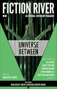 The latest issue of Fiction River came out on Tuesday, August 19th. Fiction River: Universe Between includes a whole plethora of stories about the time and space and emotions ‘between’, including my story, Between the Lines. It’s my first Landon Snow story, so of course he’s the hero!
You can find Universe Between at your favorite bookstore or here.
Well, it’s finally here and I’m thrilled about it. Now available in e-book form and they tell me print publication will be available early in March. I think this is the best one yet!
Happy reading,
Karen
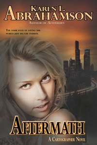 Aftermath – Karen L. Abrahamson
After surviving the attempted destruction of the American Midwest, Vallon and her allies face an even greater danger: Homeland Security’s decision to destroy all Gifted – those people who can rewrite the landscape using only their minds. In a breakneck race to save her kind, Vallon rushes back to Seattle, only to find that friends are not really friends and nothing is what it seems. Will circumstances force her to break every moral code to stop an imminent war between Gifted and unGifted?
Karen L. Abrahamson establishes the American Geological Survey series as a thriller roller coaster of a ride within the urban fantasy genre. A fantastic story of cartographic magic, danger and betrayal, Aftermath will grab readers by the throat and drag them through to the end. Unputdownable.
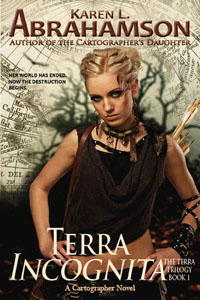 Terra Incognita is being promoted through BookBlast today (Here) and is available for $0.99 on Amazon through this weekend.
Here’s the blurb:
Terra Vargas lives on an Earth shattered by climate change in a city threatened by fierce marauders—the deepee—who destroyed her family. When a young man, Ravi Sanghera, arrives with a destiny of his own—to rid the earth of the “Destroyer of World”, Terra learns she inherited powers she neither understands nor wants—powers that might contain the secret to preserving or destroying the only home she knows.
Now Ravi faces a terrible choice, follow his vision and kill Terra… Or abandon the reason he traveled halfway around the shattered planet, and help her stop the deepee.
The answer lies in their future, but first they must survive.
Happy reading!
Exactly one year ago I wrote my first blog about maps and decided that I would write a series on that topic– maps, their history, the people who made them, and how maps have been used by people. I did this because maps are integral to the series of books I write in the Cartographer Universe and I wanted to understand more deeply what maps have meant to humankind.
What I’ve come to understand is that maps can be a truth, a lie and a metaphor. They can present the ‘reality’ of the physical world—the mountains and rivers and roads and cities and can inspire men to superhuman acts just to complete a map. Just as often, though they represent lies or half-truths—the imaginary island of Brasilia, the shifting landscape of Prestor John’s Kingdom or, more overtly, contorted landscapes intended to lure the unwary into towns, gold fields and department stores. And that’s a problem, because we tend to think of maps as representing the truth and we don’t approach maps with a ‘use at your own risk’ mentality or with the realization that any map may only represent the reality that the map’s maker wishes to represent. They’ve been used this way for centuries, so that the modern-day Chinese maps which change the location of major city thoroughfares to stymie the advance of any potential invasion are only an extension of the same tradition that caused British mapmakers to make erroneous maps of the West Coast of Canada (presumably to stymie the work of Spanish spies), and the Portuguese and Dutch Kings who kept secret their routes to the spice islands.
But maps are much more than simply tools to convey or obscure information. Maps are a part of our psyche so deeply engrained that the map metaphor has seeped deep into our culture. Cervantes wrote ‘Journey all over the universe in a map, without the expense and fatigue of travelling, without suffering the inconveniences of heat, cold, hunger, and thirst.’ Shakespeare wrote “In thy face I see the map of honor, truth and loyalty.”
But maps themselves are not truth, but metaphors. Once, in Fra Mauro’s time, they represented the mythical extent of man’s imagination and potential. Once, they represented the adventure, the spirit of mankind in the terra incognita of the empty sections of the map. Nowadays they represent the world as governments want it to be when they represent contested borders (think the current battle over islands between Japan and China, or the oil-rich islands in the South China Sea that three countries claim). Maps are used to represent presidential aspirations, shifts in battlefields, oil pipeline routes, and enemy and friendly countries—not that these presentations are the truth, but they are one truth—the truth that the mapmaker wants us to believe.
In this day and age when maps are no longer produced by a person hunched over vellum and ink, we must remember that many things influence the mapmaker’s pen. Everything from politics, funding sources and the publishing company’s allegiances represent what is filtered onto the page. Which brings me to my final conclusion about maps and the truth. They have always been creatures of the imagination and not of the truth, no matter that they grew out of scientific endeavors, but now that purpose of inciting the imagination is being used with more strategic purpose than ever before. Can we trust maps? No.
As Herman Melville stated so well:
It is not down on any map; true places never are.

Yes, it is all about the money.
Two weeks ago I wrote about the Klondike gold rush and how that led to cartographic oddities that misled gold seekers into taking ill-advised routes to the gold rush. But other maps are also intended to ‘sell’ to their users—including the ubiquitous road map.
Americans often claim that they invented the road map, and indeed Americans certainly created the most extensive collection of roadmaps just as they advanced their road systems. But there are earlier versions of roadmaps. In the third century the Romans produced a six meter-long map of roads and distances between certain points called the Peutinger Table (now stored in a Viennese museum) and during the time of the crusades crude journal/maps of routes to the Holy Land were produced. But the modern road map is largely an American invention.
These maps didn’t originate with cars in mind, but as a result of bicycle clubs in the late 1800s when cyclists were searching for maps of paved roads to enjoy their activity. Cars soon took over and road maps developed as promotional tools to encourage people to travel to, and live in, new places. Of course, as new locations opened up, land sales increased, and as the car culture grew and people travelled more, road maps did wonders for the bottom line of the oil companies.
But maps were used for promotion by other companies, too. In Canada, department stores developed road maps that showed that ‘all roads started or ended’ on Yonge Street, Toronto, the location of their store. Maps produced by oil companies specifically marked the location of oil refineries and invited people to visit these new ultramodern facilities. Maps produced by exhibitions/fairs included images of vehicles speeding to that location. Road maps were not just a means to open up a person’s eyes to the many places in the landscape, they were a means to direct that person’s attention to a specific location in an overt attempt to separate that person from their money.
City maps were more of the same only concentrated in a microcosm of what was going on all over the United States. John Jacob Ast0r became the veritable poster child for land speculation through his exploits in Manhattan. Astor bought his first lot on the Lower East Side in 1800 and gobbled up numerous lots afterwards to make a fortune in property values. What was bought for$50 an acre in 1800, was worth $1,500 in 1920 and as the City’s grid system was planned well before the city finally took shape, Astor was able to parlay his wealth into $25 million—the wealthiest man in America when he died in 1848. How did he do that? By looking at the street map of the city. Then he could sell properties—always at a profit—to take the cash and purchase more property in as-yet undeveloped areas that would be worth even more in the future. For example, a sale at $12,000 allowed him to purchase lots that would be worth $80,000 in a few short years. All because the road maps, like the maps to the Klondike, told him where to go.
Which brings me to the latest development debacle in Greater Vancouver: a developer not only leveled all the trees on the property that was soon to hold four mega houses, he also leveled the trees in a local park, on private property and along a salmon spawning stream. I’m not holding my breath given the history of cutting down trees in these parts, but here’s hoping a large part of his profits go into reparation.
