Free Fiction
 This week’s Free Fiction is a fantasy/horror when a loving eldest child is consumed by jealousy. In a Fold of Green Leaf Shadows can be read Here.
 This week’s Free Fiction is a fantasy/horror when a loving eldest child is consumed by jealousy. In a Fold of Green Leaf Shadows can be read Here.
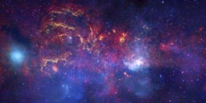 A recent Facebook posting referred me to an article about dark matter and how astronomers are mapping dark matter through space by identifying how light distorts as it travels through the invisible web of the dark. Scientists hope that, by mapping dark matter’s distribution through the sky, they can gain a better understanding of this substance and the underlying physics of the universe.
Reading this article reminded me of my recent trip to Peru and the unique Incan astronomy. Most of us are taught that the Incan’s worshiped the sun, and indeed the sun was a deity to the nobles. But beyond that worship, the Inca used their astronomical studies to not only follow the sun, moon and stars, but also to map the dark parts of the sky. They even had a special word for those places: ‘Yana Phuyu’, or dark clouds – the vacant places in the sky.
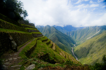
The Inca believed the Milky Way was a great river and the Yana Phuyu were animals called Pachatira that came from mother earth to drink at its side. These dark clouds were known and tracked across the sky and watched with interest. There was the fox, the black llama with her child, the serpent, the toad, the partridge. Each had their place in the sky and each was watched for signs of what would happen on earth. As the black llama descended from the sky she would lower her head and drink from the oceans to stop flooding. The toad, Hanaptu, rose in the sky, when the toads came out of hibernation, and Azoq, the fox rose during the summer solstice when foxes gave birth. For that was the strength of Inca astronomy, they truly believed ‘as above so below’. They watched the heavens and foretold the seasons and the rains by when certain animals appeared over the horizon or climbed the sky and, according to legends, major ecological events like devastating earthquakes and floods, along with the ages of the world.
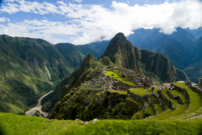
But the Inca did more than that. They saw the heavens as a map of their world, with the great river of the Andes, the Rio Vilconota (aka the Urubamba) as the terrestrial version of the Milky Way. They recognized hundreds of holy sites (Huacas) around their empire that often were related to special days of the year and the places where the rising and falling sun was observed.
Today, stories of the skies are still taught to children in Inca villages. In Quechua they teach how the llamas in the fields watch the heavenly llama for news of the rains. They tell tales of the moon and his wife and how the ‘fall’ of the Moon’s wife led to the pumpkin-color of the soil in the Amazon. So though we will never know the true depths of Inca astronomical knowledge – too much was lost to the Spanish conquest – we do know that the Inca were much like the scientists of today: They mapped the heavens as a means to understand the connections of the universe around them.
 I’m pleased to provide to a new short fantasy, Bees in the Morning, to celebrate the new year.
What happens when an aging apiarist’s best hive is destroyed?
Bees in the Morning can be found here.
In one of my last posts (here) I wrote about how Sir Francis Drake may have been the real first discoverer of the Pacific Northwest coast, and how this fact was likely kept under wraps by the British government because of the potential for Spanish spies. Maps and spies have gone hand-in-hand for years and are still important in modern battles. I recently picked up the book Swan Song and the opening scene is the President looking at spy satellite images (maps) of Russian Territory. Spies and maps. That’s what this post is about.
Of course spy satellites weren’t always around, but spies were, and they have played an important role in the Great Game of Asia (the name given to the period between 1813 and 1907 when the Brits and Russians duked it out over influence and ownership over Central Asia). Being able to map an area and to gain control over important vantage points, rivers, towns and countries was all part of ‘the game’. The Survey of India I mentioned here, was all part of the British Raj’s need to know about and control their holdings.
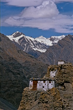
But they ran up against a barrier – the physical boundary of the Himalayan Mountains and the geopolitical border with Tibet that had been closed by order of the Chinese Emperor. Although Europeans had sighted the heights of K2 and had scaled peaks only slightly less tall than Mount Everest, they hadn’t been able to map Tibet because of the Chinese border that specifically excluded Europeans. As a result, a captain of the Indian Survey, Thomas G. Montgomerie, decided to train and send disguised native agents into the mountains. Only two men passed the rigorous training: cousins Nain and Mani Singh.
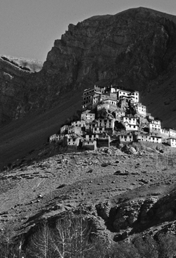
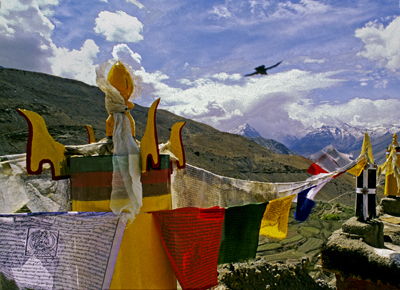
In 1865 they went on their first mission through Nepal and into Tibet to try to reach Lhasa. The two became separated on their journey. Mani made it into western Tibet and returned with some mapping information, but it was Nain who managed to make it to Lhasa. Along the way he was robbed, but managed to retain his survey instruments. Trained to take even paces as his means of measuring distance and using a 100-bead rosary to keep track of his pace-count, he eventually entered the fabled city disguised as devout pilgrim. There he chanced public beheading by taking night-time measurements of altitude and latitude using mercury he poured into his begging bowl.
When he thought people were becoming suspicious of him, he left the city with a Ladakh caravan and headed west along the great Tibetan river, the Tsangpo. Along the way he mapped the river’s course and kept up his careful measures before finally escaping one night to make his way back across the Nepali border. He’d travelled 2,000 miles and mapped it all and returned with descriptions of Lhasa and the first reasonable placement of it on the map.
Nain’s accomplishment was followed by similar mapping parties, not all of which ended well. One agent travelled into northern Afghanistan and was murdered in his sleep. Another returned to Lhasa and back to India with data on almost 48,000 square kilometers of previously unmapped territory. A nephew of Nain’s continued the work and travelled for nearly six years in the mountains. He’d mapped a caravan route to China as well as the headwaters of the Mekon, the Salween and Irrawaddy rivers.
More impressive still, is the adventure of Kinthup, another native trained to survey the mountains. In 1880, he and another man were sent into the mountains to answer the question of whether the Tsangpo River became the Brahamputra. He braved the mountains and escaped after being sold as a slave by his ‘partner’ on the venture, but still managed to complete his mission in a feat that became legendary to Survey of India.
But it was only in 1911, after the Great Game was over, that the mapping of the Himalayas was completed, when the British joined their surveys with those of the Russians they had so long fought against. But it was brave native spies like Nain Singh and Kinthup who did the work for us and brought Lhasa and the Himalayas into the known world.
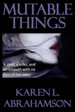 The second to last installment of Mutable Things is up today. Chapter 25 and 26 are Here.
 I put up the Christmas tree the other day, uncovering each tissue-wrapped ornament before putting it on the tree. My mother commented on how each one was so unique and that made me reflect on how each ornament was a memory that solidified and evoked a place that I had visited, or a certain place and time in my life.
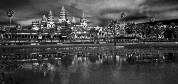
On the tree were ornaments purchased in Peru, and others from Tanzania, Cambodia, St.Thomas, and India. The tiny painted gourd Peruvian cuy (guinea pig), hung side by side with the wee silk elephant I found in Thailand. A German bauble my mother-in-law gave me hung next to a globe found at a French clock-maker’s shop at a town next to the Swiss border and a Pueblo Indian Virgin Mary sent by my parents from Arizona. All of these brought back memories of Christmas eve feasts, times in the Angkor heat or the chill of the Himalayas, and standing on the Serengeti plains.
Two of the dearest decorations were a handmade snowman and a tiny wooden cuckoo clock. The cuckoo reminds me of times with my stepsons and ex-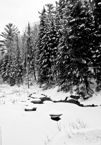 husband out riding the wilds of Central British Columbia. You see, that area is ranching country complete with wolves and bears and miles of undeveloped forest. In the winter it was covered with snow-laden pine and spruce. At Christmas, there was no better way to start the season than to saddle up our horses and head out into that pristine winter land.
We’d take an axe and an old horse blanket with us and head out into the forest, the horses blowing steam through their nostrils as they bounded through hock-deep snow, my sons rosy-cheeked as they raced their horses ahead until they came whooping back to announce that had found the PERFECT tree. That was what the ride was all about. We’d follow them – usually out to some clearing where a smaller tree would stand. My husband would dismount and shake the snow off, getting it all over himself and then, as a family, we’d critique the tree they’d found. If it passed muster, we’d chop the tree down, wrap it in the blanket and tether the blanketed tree to the horn of one saddle before starting our (much slower) ride home dragging the tree behind us. That would bring the official tree into our home and the small cuckoo clock was one of the first ornaments we bought as a family.
The snowman ornament was made by my youngest stepson. We didn’t have a lot of money in those days – at least not for ornaments for the tree – so he and I set out to make some. I still have the small green felt tree I made, but his is special: a stuffed white snowman complete with scarf, and broom and a black top hat all carefully sewn by ten-year-old hands. I smile and think of him, long grown to a man, whenever I find it each year.
 And so my Christmas tree today is a guardian of riches worth more than the presents under it. Those glittering branches hold not only my memories, but also a map of the treasures of my life.
 Chapters 23 and 24 of Mutable Things are now available here.
 To celebrate the new year I’m giving away five print copies of my Fantasy YA, Terra Incognita. To put your name in for the draw, go to Goodreads here.
I mentioned last week about spies and maps and government subterfuge as aspects of maps that we rarely think about. Municipal governments still fool residents with streets on maps that are planned, but haven’t been built. Map makers take liberties with place names and add imaginary towns and streets that reflect their biases for and against university football teams. But in the past spies were frequently involved in cartographic subterfuge.
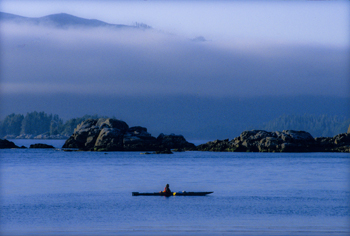
For instance, most of us were schooled that Captain Cook was the first European to lay eyes on the north western coast of North America. However there is mounting evidence that the English privateer (government sanctioned pirate) Sir Francis Drake, not Cook, first saw the coast of Oregon, Washington and British Columbia between 1577 and 1580 – 160 years before Cook’s journey.
Why isn’t this known?
First of all because some historians are hard pressed to let go of old ideas, but second of all because Drake’s journey was likely suppressed and evidence of it hidden, because of disputes with the Spanish that were, later, going to erupt into war. Drake is confirmed to have travelled as far north as Mendocino, California, the farthest north the Spanish had been, but a 412 year old map commemorating Drakes circumnavigation of the globe shows details of the coast of British Columbia that no one could have known unless they had been there. Additionally, archeological evidence – 1571 British coins and equipment – have been found in Oregon and Victoria, B.C. gardens, so that Drake is believed to have travelled as far north as Prince of Wales Island in Alaska. Finally, Drake’s cousin confessed under torture to the Spanish, that a fabled North Pacific island, Nova Albion, had been discovered by Drake and claimed for England 29 years before Samuel Champlain founded Quebec and before there was a Virginia on any map. This is believed to have been Vancouver Island, kept secret.
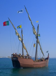 A further example of cartographic spies, deals with those icons, Christopher Columbus and John Cabot. Columbus, we’re taught, discovered the Americas while looking for China. Cabot’s fame is due to his first North American landfall by a European. Or at least that’s what we’re taught. But in a 1498 letter that was penned just months after Cabot’s historic return from Newfoundland, a spy in England wrote to Columbus and talked about earlier voyages by men from Bristol to the same place Cabot had been and that these earlier voyages had been to an “Island of Brasil” and that Cabot’s landfall “is believed to be the mainland that the men from Bristol found”. The spy’s letter also mentions that these voyages from Bristol were well known to Columbus – something that is further supported because Columbus had spent time in Bristol and Iceland in the 1470s – almost 20 years before he managed to convince the Spanish monarchy to fund his explorations. Did Columbus use this knowledge to convince Isabella? Did he use it to calm his crew on his long crossing?
 We may never know, and even if we do, will it matter? For Columbus IS an icon that history won’t forget, but what this shows is how secrets and spies permeate the European history of maps, so that who really ‘discovered’ the coasts of America may never be known. Of course, just talk to a First Nations/Native American person and they’ll tell you we’ve got it all wrong anyway. North America had been ‘discovered’ long before any European left home.