Month: August 2012

Maps, Dreams and a Road Trip to Port Townsend
Maps, Dreams and a Road Trip to Port Townsend

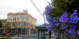
One of the lovely old buildings along Water Street, Port Townsend. (2012) Photo (c) Karen Abrahamson

This past week a good friend and I embarked on one of those memorable institutions of Americana (or Canadiana—we are both Canucks)—the road trip. Not that it was one of those great ventures across the continent like so many novelists have captured. No this was a small road trip—actually more of a mini or micro-mini road trip all the way from Vancouver, Canada, to Port Townsend, Washington. Why did we go? Just like any other road trip, we went because it was there and because it was a point on a map that we hadn’t visited before.

Road trips seem like an important part of our North American culture. Maybe it’s our love of the automobile or maybe it’s the distances, but I know people who think nothing of hopping in their car and driving for days on end just to visit a friend, or to be able to stand on a point of land and look out at the Pacific Ocean. Yes, they might have been able to fly to the location quicker and more conveniently, but the road trip makes the process of getting there just as important as the arrival.
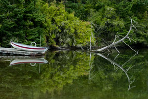
Boat pulled onto dock at Coupeville, Whidbey Island. (2012) Photo (c) Karen Abrahamson

My first road trips were in the back of my parents’ black Ford sedan, travelling across the continent not once, not twice, but at least five or six times because my dad was posted at a military base on one side of the continent and ‘home’ was always on the other side. Dad would drive and mom would ride shot gun and play navigator with the road map. For summer holidays we took road trips from the Pacific Northwest to Utah and California or Montana. Those were memorable trips and brought home at a young age, just how huge the continent was and the diversity of all the places there were to visit and all the different people you could meet along the way. We’d play games of spotting license plates from other places, and I’d count the horses I saw in the fields.

My first independent road trip was right out of high school when, with two friends, we drove to Mexico and back in a Ford van affectionately known as the Dorf. At eighteen it was adventure and an announcement of independence to the world. It took all three of us to places we’d never been before, following the map down the coast and back up I5. We got lost travelling at night playing leapfrog with the long haul truckers and then turning off when exhaustion made us look for a place to sleep in the Van. We got chased off by locals and scared by someone prowling around us and ended up taking turns and travelling right straight through from central California to home in one sitting following the long straight road laid out on the map for us.
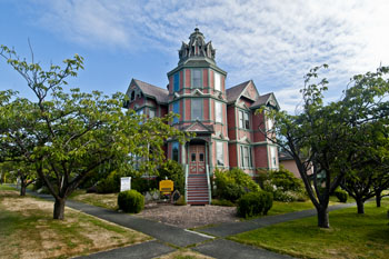
Lovely old Heritage house, cum B and B, Port Townsend. (2012) Photo (c) Karen Abrahamson

What is it about the road trip that draws most of us to such a trip at some point in our lives? Is it simply the love for the automobile and the feel of power that wheels us away from the moorings of our life, or is the call to adventure that dreamers dream of and writers write about? Or is it the vestigial need to explore that remains like a tailbone in our psyche?
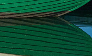
Wooden boat hull reflections. Port Townsend has a long history of wooden boat building. (2012) Photo (c) Karen Abrahamson

Either way, my friend and I explored the heritage byways and backwaters of Whidbey Island before climbing on a ferry and crossing to Port Townsend. We followed the city map of heritage houses and explored the town before heading on our way again looking for opportunities to fall of the map before climbing back on again to eventually find our way home. At one point our trusty map failed us and it took a kind trucker and his GPS to put us straight again, but that’s the nice thing about road trips: you meet nice people most of the time. When we got home my friend and I were both ready for another, longer trip. We’re already scanning the maps for new places we haven’t seen. Any recommendations?

A Port Townsend cat makes us welcome by licking the window. (2012) Photo (C0 Karen Abrahamson
Mystical Dunvegan and the Northern Gateway Pipeline

Mystical Dunvegan and the Northern Gateway Pipeline

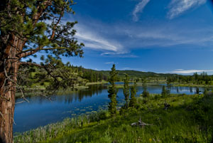
Along Kane Lake Road, British Columbia (2012) Photo (c) Karen Abrahamson

The furor in British Columbia about the proposed Northern Gateway Pipeline got a little bit more interesting this past week. First of all we had Enbridge providing the public with maps of the coastal route to be used by oil tankers. Those maps conveniently left out all the islands and difficult narrow ocean channels those same tankers would have to navigate. Then we had the announcement by a B.C. newspaper mogul that he was exploring the potential for building an oil refinery on the Northwest coast of BC. His rationale was that with so many people concerned about oil tankers travelling the treacherous and pristine British Columbia waterways, why not process the oil in BC, create new jobs, and only ship processed gas and diesel. This would alleviate some of the concerns over a potential oil spill as both gasoline and diesel are easier to clean up and don’t pollute like oil does. Of course the reaction has been mixed. Even the oil companies aren’t sure they like his alternative, but Enbridge’s maps and the newspaper mogul’s vision put me in mind of the ‘town’ of Dunvegan.

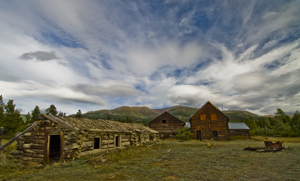
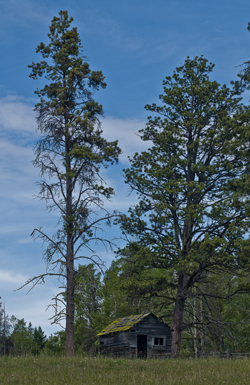
Abandoned Yukon Homestead (2009) Photo (c) Karen Abrahamson

I say ‘town’ with parentheses because Dunvegan was never actually built, but in the saga of Canadian maps it has a place of ignominy. You see, as the Dominion of Canada was busily surveying and dividing the country to encourage development it led to a boom in land speculation. These high stakes games were trying to anticipate where the next great land boom was going to take place. Dunvegan seemed like a likely place.

Located six hundred and fifty kilometers north of Edmonton, Alberta, Dunvegan was a convergence point for a number of native trails and a regular route for explorers and map makers. Indians camped there. Two creeks met there. A fort was built at the location and provided a jumping off point and point of safety for missionaries, explorers and homesteaders. Dunvegan became one of those mystical places on the map like Finisterre was to the pilgrims on the Camino de Santiago in Spain and France.

So much did Dunvegan enter the public consciousness of the day that it was included in the name of the first railroad to the Peace River in British Columbia, the Edmonton-Dunvegan and British Columbia Railroad. The trouble was, the railway never actually ran to Dunvegan. This was never mentioned in all the real estate material selling land to Englishmen and Easterners. Nope, the material and the maps showed the rail running to the town. Along with the railway the maps showed wharves along the waterways and development. But that wasn’t the only problem with Dunvegan. The many maps of the town being used to sell the land to the unwary, showed quarter sections of land without bothering to mention the topography. Think vertical cliffs and steep drops. Though the land was sold to many, not one lot was built upon because of the many difficulties.

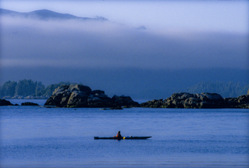
Kayaking Clayoquot Sound, British Columbia (1996) Photo Karen Abrahamson

Which brings me back to the proposal for a pipeline and a world class oil refinery on the north coast of British Columbia. Sure, you could build the refinery, or you can talk about it, but such a refinery is dependent upon a pipeline across the same type of terrain that turned back the land investors in Dunvegan. I like to think that unlike the unsuspecting purchasers of land in Dunvegan, the British Columbia public won’t be taken in by maps and rhetoric that enhance non-existent amenities and that minimize the dangers that do.


The Past, the Future and Map Wars

The Past, the Future and Map Wars

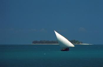
Dhow off Zanzibar Island (1994) Photo (c) Karen Abrahamson

I’ve written about how maps created belief systems in the people of old. In ancient days, stories and maps of Prestor John led people to Asia and Africa in search of his kingdom. Mariners believed that the Indian Ocean was a huge inland sea surrounded by Africa that swept down and around to join with Asia. When North America was discovered, maps of the mythical Northwest Passage, led explorers to seek the real passage. But maps do more than that. Maps are sources of propaganda and maps are sources of conflict. You see maps, their systems, omissions and scale (as examples) are often used to take forward propaganda or a dominant world view. They have been used this way close to home in Canada.

For example, for many years maps of Lake Superior were left largely blank, because people believed the lake was very deep. But the truth was that fishermen didn’t want their secret ‘fishing shoals’ mapped for others to find. It was only after military vessels went missing (not to mention the Edmund Fitzgerald) that in 1930 that the Canadian Hydrological survey confirmed that there is a mountain rising in the middle of Lake Superior creating a large shoal. This shoal had been known to American fishermen, but no one had ‘told’ because the area was a magnet for fish.

Recent visitors. (2012) Photo (c) Karen Abrahamson

Maps as propaganda were used extensively in the settling of Canada. The Dominion of Canada turned surveyors maps of soil and rivers into grid maps that were then artistically enhanced with pastoral images of farms and young golden-haired women clad in white dresses. Atlases of Canada were created and sent to Europe and America in hopes of encouraging immigration. The art was focused on meeting the pastoral desires of the Europeans and in particular the British. Slightly different art work was used for maps sent to America. It didn’t matter that the images didn’t reflect the prairie landscape (The images were more of Ontario). It was the dream of the pastoral lifestyle that drew the immigrants that Canada needed.

These same maps with their grid lines were sources of conflict because they established expectations about how people would inhabit the landscape. The grids were set out in sections six miles by six miles, based on latitude and longitude, regardless of the lakes or waterways they crossed. As I mentioned in a previous blog (here) the Metis found the grid pattern foreign because they settled land based on long strips of land that swept back from water courses and that allowed everyone access to water. But immigrant groups from Eastern Europe also had challenges with the grid pattern. They were familiar with more communal, village styles of land allotment, where the land was marked off from the village in a manner more appropriate to communal living. As a result these groups (the Mennonite, Doukhobors, and Hutterites) subverted the grid style by purchasing the land, but then subdividing it according to what worked for them.

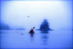
Kayaking the coast of British Columbia (1996) Photo (c) Karen Abrahamson

Maps were also used as propaganda by commercial entities such as the railroads. Canada’s two railways, Canadian Northern (CN) and Canadian Pacific Railway (CPR) battled for ridership through their maps. Maps were developed that left out or diminished the competitor’s railway. For example, CN created a triangle route map between Edmonton, Jasper National Park and Vancouver that played with scale. In this map CN’s journey through scenic Jasper was presented in large scale so that the route through Jasper leaves little room for any other details, while the rest of British Columbia was presented in small scale that didn’t allow CPR’s rail lines to even exist—according to the map. The interesting thing about this map is that no one then, or even today, notices the scale issues with the map—we accept what the map presents as reality.

So while maps are supposed to be presentations of reality, the big question the map reader has to ask themselves is whose reality (or wishful thinking) are they reading. Sometimes it is helpful to step back from the map and ask what does this map tell up about the people who developed (or paid for) it? Or what was going on at the time it was made? Or Why was this map even made? I think of my local community developers who, like the Dominion of Canada with their maps, are presenting the paved-over reality they would like to have made. The question is whether this is the map of the future we want, or whether, like the Mennonites, Hutterites and Doukhobors, we can  subvert it to a better reality.

Mapmakers, Spies and the Alaska Highway

Mapmakers, Spies and the Alaska Highway

Cabin on the Kane Lake Road, B.C. (2011) Photo (c) Karen Abrahamson

Last week I wrote about characters in the Canadian Cartographic past. I thought I’d continue that theme this week with an illustration of how mapping is not the objective scientific pursuit we all think it to be. Instead, mapping is an exercise influenced by politics, exploitation of resources, culture and religion. Hubris comes into play in there somewhere, too. Mapmakers influence perception through their use of scale, their level of detail and even just by what they choose to put on the map. Determining which maps are actually made is perhaps the penultimate influence on public perception.

One of the most memorable Canadian mapping ‘junkets’ involved an American millionaire by the name of Charles C. Bedaux.

In 1934 Beadaux, then living in France, initiated the Bedaux Sub-Arctic Expedition, that planned to use specially built tractors and horses to traverse, map and cut a road from Edmonton, Alberta, through northern British Columbia to the Pacific Ocean. The 1,800 kilometer route was to go through Fort St. John, Redfern Lake, Sifton Pass and Telegraph Creek. While the media reported that Bedaux claimed the expedition was purely scientific, there were other rumors abounding.

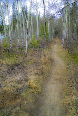
Woodland trail, Yukon, Canada (2009) Photo (c) Karen Abrahamson

In any event, this strange expedition left Edmonton with a crew of 43 people including Bedaux’s wife, her Spanish maid, and an Italian Countess to tend to Bedaux, along with the usual accoutrements of pate de fois gras, champagne and a gamekeeper. Oh yes, and a movie cameraman to record the adventure. This was not your usual surveying venture, but along with this cavalcade of oddities, were a topnotch group of scientists and surveyors. Poor sods.

Immediately after leaving Edmonton they were caught in rainstorms that slowed their progress and caught them in muskeg, even though Bedaux’s vehicles had extra wheels that were to lift them over the worst obstacles. Bedaux had brought everything with him from French cook pans, lock and tackle to lift the tractors over vertical terrain, and claw-foot bathtubs. All the equipment literally weighed  ton.

As the expedition progressed, the situation worsened. The tractors’s problems didn’t get any better and had they to be pulled out by some of the expedition’s 100 pack horses. When even this didn’t help them make better progress, he determined to start divesting himself of equipment. Not the bathtubs and champagne of course, but scientific equipment like the surveyor’s theodolite. The situation became more bizarre as Bedaux railroaded the surveyor’s assistant into becoming his houseboy, and demanded the other scientists become actors in staged moviemaking involving forest fires and staged stampedes of the horses.

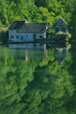
Old water mill in the countryside near Besoncon, France (2004) Photo (c) Karen Abrahamson

Finally, after 14,00 kilometers, Bedaux abandoned the expedition over 400 kilometers from Telegraph Creek. Bedaux returned to France, but the meticulous maps and drawings prepared by the surveyor of the venture, one Frank Swannell, went on eight years later, to lead to the building of the Alaska Highway which followed Bedaux’s route north from Fort St. John.

And Bedaux, well his fate wasn’t quite so memorable. You see one of the rumors about Bedaux was that his venture was really a testing ground for German military transport trucks in alpine conditions. During World War II Bedaux hitched his star to the Third Reich and acted as go-between between the Germans and the Vichy French. It is suggested that he passed information to the Germans, and in 1943 he was captured in North Africa by the Americans. He was brought back to America and charged with trading with the enemy, but in 1944 he overdosed on barbiturates and died.

Thus ended another bit of Canadian cartographic history. But one wonders. Maybe we have the Germans to thank for the Alaska Highway.


Recent Fantasy

Available HERE,

$1.99

Available HERE,
$3.99

Available HERE $1.99


Recent Mystery


Available HERE
$4.99


Available HERE,

$4.99


Available HERE,

$4.99


Available HERE,
$4.99


Recent Romance

Available HERE, $2.99